Traveling To Oregon - More Lessons In Weather
Completed 8/19/09 - Hobbs 539.8 EndThis trip provided many more weather experiences, and tons of fun to go along with it. When we departed for this trip, we still had not had a complete idea of exactly where we would go, or what we would do. That's a huge beauty of flying your own aircraft...you can choose where and when to go, and you can flex the destinations as you need, to fit either a schedule, or a desire. We often don't know exactly where we're heading until the night before or even the morning we depart, because if the weather looks bad in one direction, we just change our direction. In this particular case, I was fighting two completely different goals...one was to backpack on one of my favorite islands....Isle Royale National Park up on Lake Superior (If you haven't ever been there it's a huge "must do" experience if you like hiking, boating, and camping), and the other goal was to get out to either Oregon (to visit friends), California (for a one-day trip to San Francisco), Idaho (To do some backcountry flying/camping), and along the way swing by Salt Lake City to stop and see some great flying pals, the Schmidts. So our goals had nothing to do with going East, but had huge implications due to the weather. Before the trip we purchased a pile of Kelty Red Cloud Backpacks, and a bunch of backpacking supplies, with the idea that we could use them at Isle Royale as you have to pack in all your clothes and for the most part be self-sufficient for 3 or 4 days, and then pack everything back out again. That kind of fit with our travel goals for flying West, too, in that we could use the same gear (although we'd not hike far) if we traveled to Idaho and other areas. With the kids being 8 and 10, it's time to get them out on some more survival type trips, and get them used to a little bit more rugged travel conditions...Yeah yeah yeah, I admit it...part of it is that I want to finally live out some of the things I never got to do when I was a kid. So for the 2 days before the trip, we purchased and organized gear and planned the equpiment side of things. Unfortunately, to keep things complicated, the weather turned bad the night before our trip and knocked the power out for 12 hours, making departure day filled with more things to deal with. The result was that other than some pre-preparation of the gear, the clothes packing and organization would have to be done within about 30-60 minutes of time just before we were to leave. One girl had a birthday party to go to, so we couldn't leave until after 2pm CST, which also makes travel time a little bit tighter. Can you say "Threw it all together at the last minute"? But that's OK....as long as you get your weather and route briefing, you are good to go just about anywhere, on a moments notice.
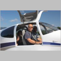
And so we boarded the plane at about 3pm CST for our adventure...
Day 1 - Wisconsin to Utah
 |
 |
 |
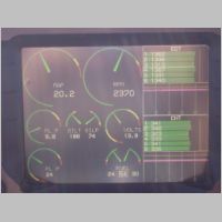 |
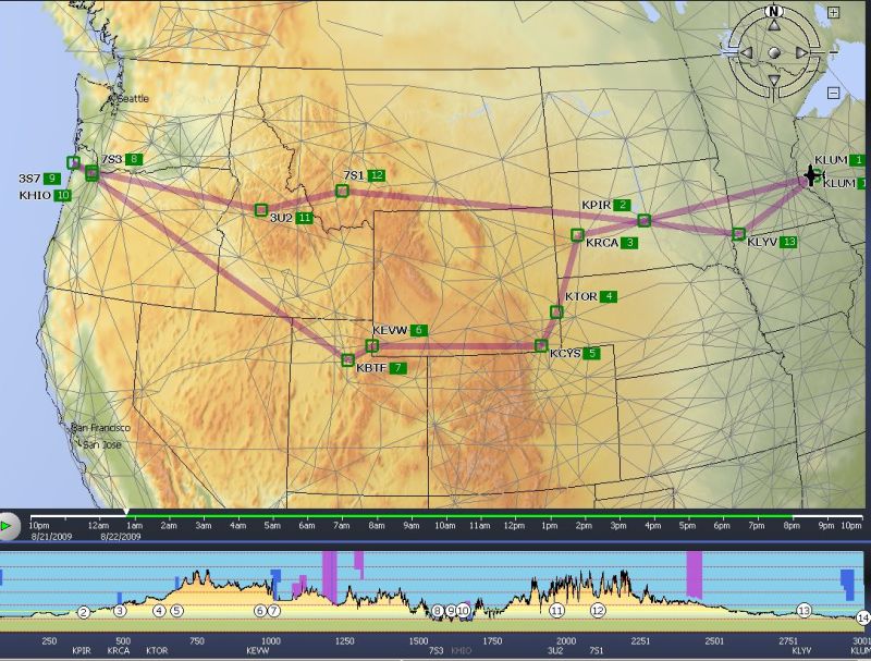
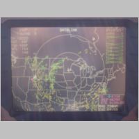
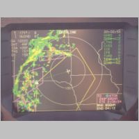
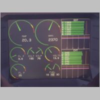
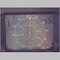
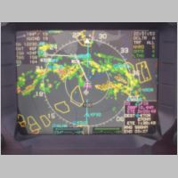
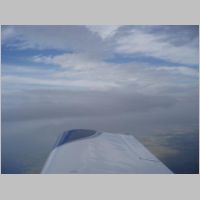
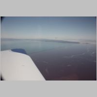
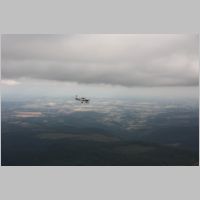
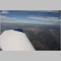
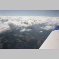
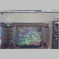
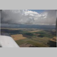
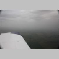
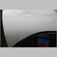
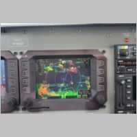
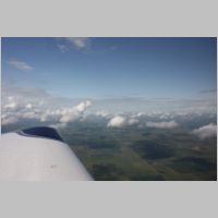
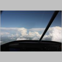
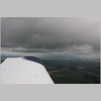
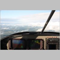
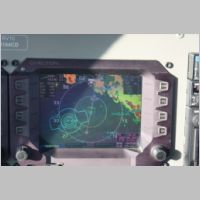
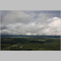
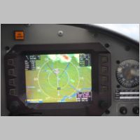
| We took off and climbed right up to 10,500' and called MSP center to get some flight following in hopes of getting MSP Bravo transit...but after reaching 10,500' there wasn't much they could do to stop us. We had CRJ traffic pass right below us which was very close but since we had visual they didn't get too worried. That airspace is pretty busy, but with the fishfinder working we could see all the traffic well ahead of when it was a factor. You can see from the above pics that at 10,500 we were doing a leisurely cruise but the long range weather looked like it just wasn't the ideal day to be going West. The shot of the Datalink page above makes the entire range from Canada to Southern New Mexico look pretty impassable with rain, and storms. The Lightning symbols tell me that although this is all patchy stuff, it's pretty thick out there and where there's lightning the weather is significant. But, at the same time, it isn't all solid like in a line of red, so I pushed forward knowing I could stop at any time if I coudln't get around something. We were packed with freeze dried food, and tents and sleeping bags, so we could stop just about anywhere if we needed to park ourselves for the night. My hope was that it would be scattered enough for easy passage. | |||
 |
 |
 |
 |
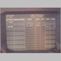 |
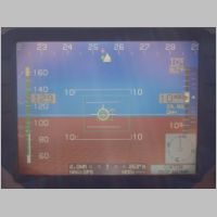
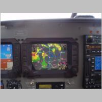
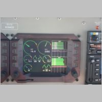
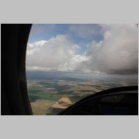
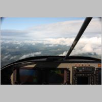
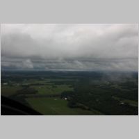
| Continuing on in the above photos, you can see that we've made it through Minnesota, and are still a ways from the weather. About 200 miles before we'd hit anything too wild on our present heading. With the TAS reading about 1.8kts low, we were averaging about 158-160kts, pushing along at somewhere near 9.5gph. Our original destination was KTOR (Torrington, WY) where we could top off with some cheaper gas. As we got further along though, it became apparent that "Direct KTOR" wasn't going to cut it for us. You can see that the WSI weather was showing a fairly solid line of rain and it had reds and lightning mixed in some of it. I've come to realize that having my WSI in the plane, especially integrated into the MFD that I navigate by, is one of the biggest safety features of the airplane...even beyond an autopilot sometimes. It simply is indispensable. Ever since going with the new Sirius system's AV300 receiver, it's been flawless service. That Datalink screen above may look pretty worrysome, yet you need to realize that the inner ring is 100 miles, so the gaps in the storms may not be huge, but they are definitely gaps. The key is in a few things...knowing which gaps to hit, judging the changes in the weather around where you want to fly, staying out of cells with any lightning, or anything but greens and yellows, and...this is the important part...correlate the picture you get from WSI with the view out the window. You simply DON'T fly through Thunderstorms, and you don't fly where you get yourself into sever weather. But, by staying VFR, you can get closer and navigate around some pretty substantial systems. | ||||
 |
 |
 |
 |
 |
 |
 |
|
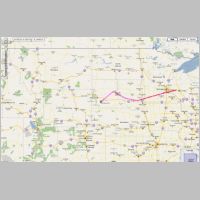
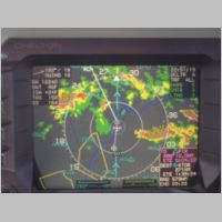
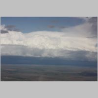
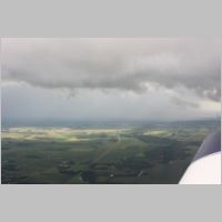
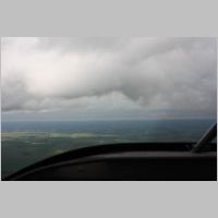
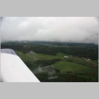
| We
ended up changing our route because the weather looked
passable if we stayed a little North. We picked some routing that took
us up over KPIR, and then towards KRCA and then planned to turn back
South to KTOR. Looking at the first screen above, zoomed in, you
might think we should head South and go around that big cell. But
in that 3rd shot you can see that South has no real gaps in the storm.
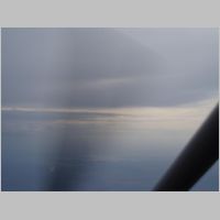
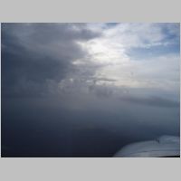
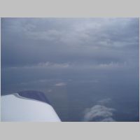
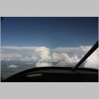
Keeping our eyes out the window, and staying VFR, we just pushed on,
heading for the gap where there was no color. It tightened up a little
but we stayed totally visual the whole time. I shot the above photos
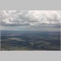
out the window to give an idea of what the visibility was. We
could probably easily see 30 miles, and you could see exactly where the
rain and storm cells were. So as long as it looked reasonable we
could keep going. And, at any minute we were prepared to turn and head
to any airport we needed. In the end, I was able to stay at 10,500 the
whole time except for about 5 minutes where I dropped to 8,500 as a
drizzling cloud started to come down above our path. Our forward viz
dropped to about 10 miles, so we lowered down to 8,500 and got our
30-50 mile viz back. That was on the back side of the storm, and within
a couple more minutes we were in full clear, past all the weather
between us and the mountains. One of the things that makes
circumnavigating the weather in an RV-10 so easy is the speed you
travel. You can find a line you want to fly, and navigate through an
area in such short order that the weather doesn't have time to change
much...you can be miles away in a real hurry, and almost any conditions
you are in will be over within 10 minutes. We got a bit of a surprise when we got to KTOR. I didn't check to see if it was 24 hour self-serve fuel, only that they had good priced fuel. As it turned out, nobody was around to open the pumps, so topping off was not an option. While we landed with plenty of fuel to continue, (maybe 15-18 gallons), I don't like to cut fuel reserves close, so I saw a couple working on some cropdusters across the ramp and went to say hi. They were absolutely wonderful people to meet. They said it was about 100 miles to the nearest guaranteed fuel, and seemed very concerned for fellow pilots, and were happy to help. They had their own fuel tanks, but I spied 3 jugs of 2.5 gallons each, and they gladly let me buy that fuel from them just to add to my reserves so I could continue to where I could get 24 hour fuel. It was only about 60-90 minutes from dark, and we were coming toward Cheyenne, WY...so I wanted to get topped completely off if I were to continue. So with that little boost of fuel, we were off to Cheyenne. At Cheyenne we paid a bit more for the fuel but the people were very nice at Sky Harbor, so we filled up quickly, bought a few candy bars (no supper or even a good lunch for us!), and jumped back in the plane. There was a little weather on the screen JUST as we had to cross the first mountain range that leads into the semi-flatlands where I-80 passes through to Salt Lake City. Again, seeing it on the WSI made the choice easy...we could push on and pass that initial spot of rain in the daylight, and have plenty of opportunities to land if conditions changed as things went to the black of night. I knew the terrain wouldn't rise to meet us on that flight if I stayed over I-80, so we flew high above the interstate and kept moving along. At Cheyenne we arranged with Scott that he'd fly up to Evanston that was just outside of KSLC and meet us in the air so that we could follow him in to the busy KSLC airspace through his favorite entry down Parley's Canyon over I-80. Everything went real well until we got about 3 miles from the city...coming down through the canyon there was a little spot of weather off to the South that caused some downdrafts, and I smacked my head (so did most of us) into the ceiling in one good bump where the bottom dropped out from under us. Other than that, it was a very uneventful flight ending after 10pm Mountain time. But, we made it all the way to the point where we could decide what the adventure would turn into...and, we were now close enough to go to CA, ID, OR, or wherever we wanted out West. |
|||
Day 2 - Utah to Oregon
 |
 |
 |
 |
 |
 |
 |
 |
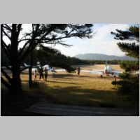
| With
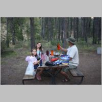
a night of sleep behind us, we took a lazy morning of breakfast and
hanging out with the Schmidts and then planned our next move.
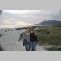
Scott had stopped in at Nehalem Bay State Park on the ocean shore of
Oregon way back when he did his transition training, and that sounded
like a great place to go to us! We had brought all that camping and
backpacking gear anyway, so lets go use it. A quick flight planning
session showed we could do the trip in about 3.75 hours. One minor
issue....if you're running ROP, you would need to either very carefully
monitor your fuel useage, or at least be real diligent about planning
your fuel burn or fuel stops. Problem easily fixed though by my
favorite method....just run LOP (Lean of Peak)! Check out THIS WRITE-UP I did
around this same flight timeframe, for more info on LOP flying. Using
Lean of Peak cruise, we were easily able to do the trip with
plenty...and I mean plenty of fuel to spare. I think we had nearly 2
hours of extra fuel left upon landing....so we had something like a
5.75 hour fuel range at our LOP burn rate. We flew the trip
largely at 10,500' and averaged 9.5 approximate gph for Scott, and 9.7
for us....Scott having a bit less weight on board so he throttled back
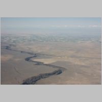
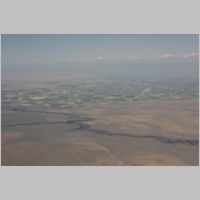
slightly for me. We departed directly over the Great Salt Lake, which really has a terrible look to it in color. I imagine if we had to ditch there that not only would we not sink, but the plane would corrode from around our bodies and make it easy to make an evacuation. We flew along to Oregon, passing over the Snake River, and seeing some great sights along the way. Surprisingly, the empty area between Salt Lake City and Portland seemed to have some pretty good ADS-B coverage at times, as I picked up some various traffic targets nearby, from my NavWorx/Chelton system. |
|||
 |
 |
 |
 |
 |
 |
 |
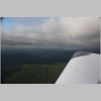 |
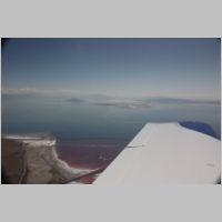
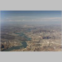
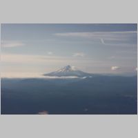
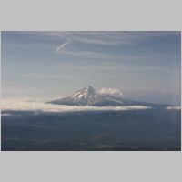
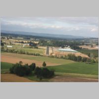
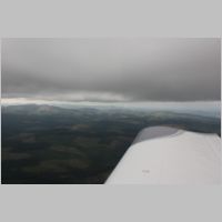
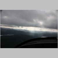
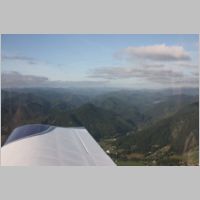
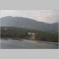
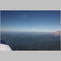
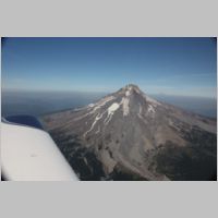
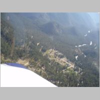
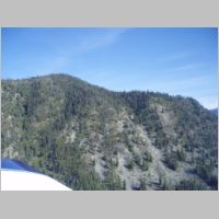
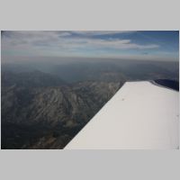
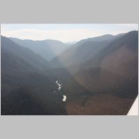
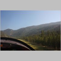
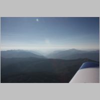
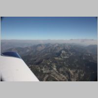
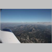
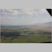
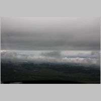
| As
we approached the Portland area, we could see Mount Hood off to our
Right side, and Mt. Jefferson off to our Left side. The next time I'm
out that way (which I hope won't be too awful long from now), I plan to
fly up and down the Cascades and see all of these beautiful
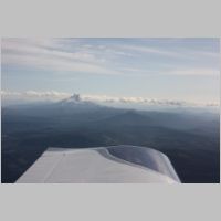
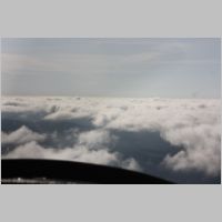
mountains. Ahead out the front windshield we could see one thing
that was going to get us thinking for a couple minutes....there was a
layer of clouds that started just on the ocean side of the cascade
mountains. You can see from the pictures above that as we got
closer you can easily make out the valleys under the cloud deck, and
the peaks come up to near the cloud layer. As it turned out, we were
easily able to fly down to the lower cloud level, bringing us closer to
the mountain tops, but then head down in the descending valleys of the
mountains and be well under the cloud deck, but remain plenty clear of
terrain. The visibility was great, so it was just a matter of getting
under the deck, and knowing that the terrain drops from many thousands
of feet down to 200' msl at KHIO, it doesn't take much distance to have
the terrain fall away from under your wheels. |
|||
 |
 |
 |
 |
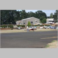
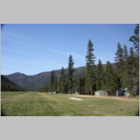
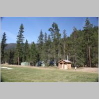
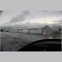
| We
stopped over at Twin Oaks airport, 7S3, for some economical fuel and to
meet Ed and say Hi, on our way to 3S7 (Nehalem Bay). Yes, Oregon
does indeed have a 7S3 only a few miles away from a 3S7.....talk about
a recipe for confusion. We quickly topped off and loaded back up
for another very short flight of maybe 15 minutes or so, to get out to
the Oregon Coast. |
|||
 |
 |
 |
 |
 |
 |
 |
 |
 |
 |
 |
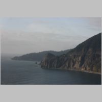 |
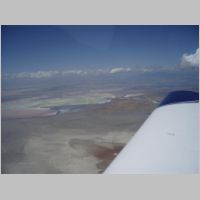
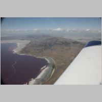
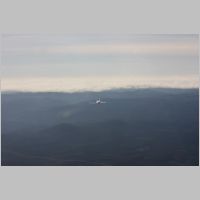
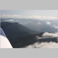
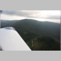
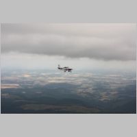
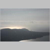
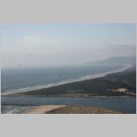
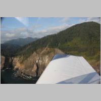
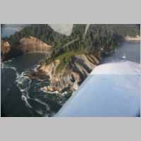
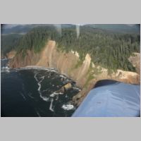
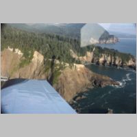
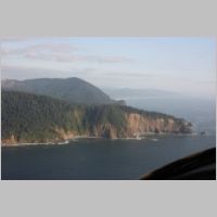
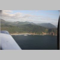
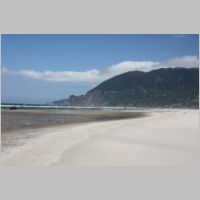
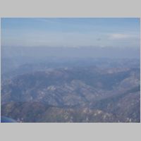
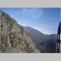
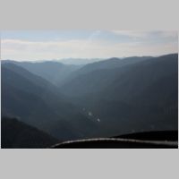
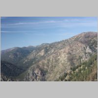
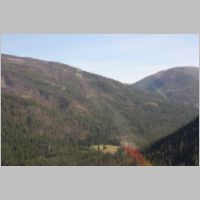
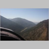
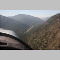
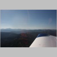
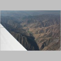
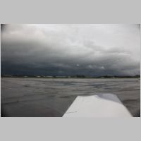
| Enroute
to the coast we had to reach another coastal mountain chain, that was
not too far below that same cloud deck. You can see from the photos
that again you have to ride that narrow gap on the way out to the
ocean. Over the water there were no clouds at all. It's a
good thing that regs allow for 1200' AGL or less, clear of clouds
operations, because there are times when the visibility is wonderful,
but you just need to get closer to the terrain and clouds to easily
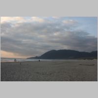
pass to your destination, or to better conditions. So we zipped
over the hills popped out over the coast into some beautiful skies and
over an awesome shoreline. We aimed for Tillamook airport to get
to the shoreline, to see the large blimp hangar there, and then turned
North over the shore to go to Nehalem Bay. As we flew along
though, we decided to go see more shoreline so kept going North for a
while first to do some sightseeing, and then came back south to land. |
|||
 |
 |
 |
 |
 |
 |
 |
 |
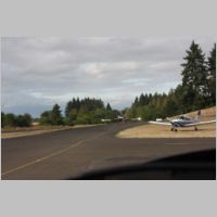
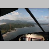
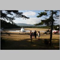
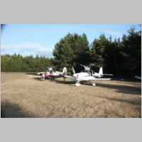
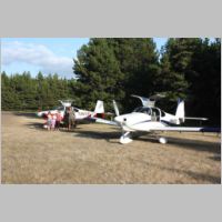
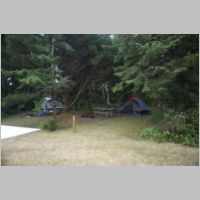
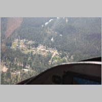
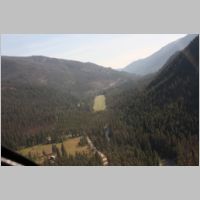
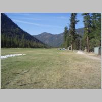
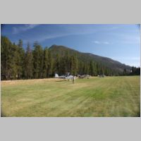
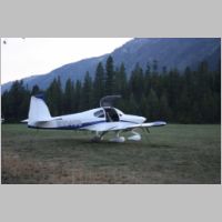
| As
you can see from above, Nehalem's runway is approached over the water
of the bay. It's a real scenic approach and a very nice little strip.
Once down, we turned around and taxiied back and picked out 2 nice
little campsites, #1 and #2, and there were only a couple other planes
there. We set up our tents, and enjoyed how awesome it was to be
camping by air, right next to the Ocean, on the Left side of the United
States. |
|||
 |
 |
 |
 |
 |
 |
 |
 |
 |
 |
 |
 |
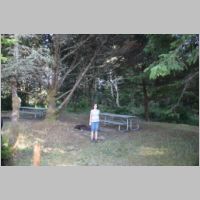
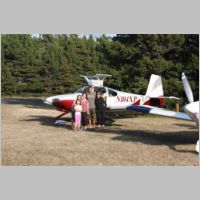
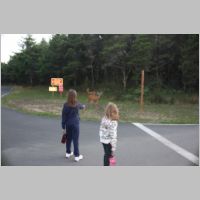
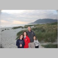
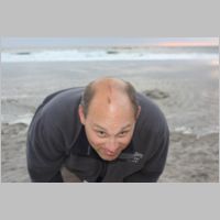
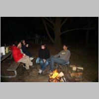
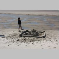
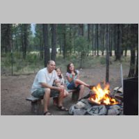
| After
we were set up for the night, we decided to walk out to the beach and
see the ocean. We ran into 3 deer on the way, and then walked on the
sand for a while. I had to shoot a photo of my turbulence scrape, for
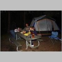
posterity. We headed back to camp and got a campfire going.
NeHalem bay has firewood available for sale, and they delivered it for
us. It's also just a short walk to town and there are plenty of
restaurants there too. For dinner though, we had packed a bunch of
Mountain Home dehydrated meals, and so we boiled up some water and
enjoyed some Lasagna, Spaghetti and meatballs, and some Chicken
Stew...all of which were very good tasting. |
|||
 |
 |
 |
 |
Day 3 - Back to KHIO
 |
 |
 |
 |
 |
 |
 |
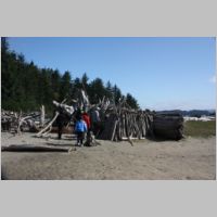 |
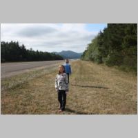
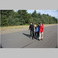
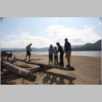
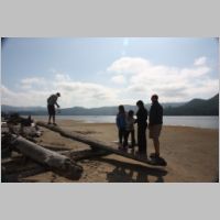
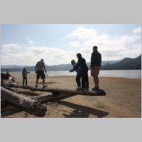
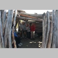
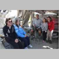
| In
the morning we got up and got a campfire going again to have breakfast,
and then took a walk down the runway to the bay. Once out on the
shoreline, we found many places to have fun. A flat bottomed log
laying over another log provided entertainment for an unbelieveable
amount of time as we took turns balancing people against the rest of
the group on a giant lever. Further down the beach we could see a
log shelter someone had put together, and we found some crabs that had
washed up on the beech. |
|||
 |
 |
 |
 |
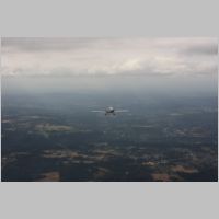
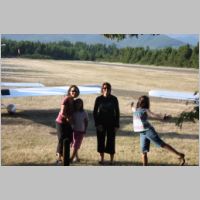
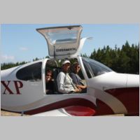
| After
a little break, we went up for a couple quick flights so Scott and I
could finally see firsthand how eachothers airplanes flew. It was a
great experience. I always enjoy flying in someone else's plane and
seeing how they laid out the panel or how they operate the plane...and
how their plane runs. After that it was time to walk to
town for lunch, and back along the beech. There were many people
who were out there sail-surfing with big parachute looking things that
towed them around on surfboards. It was very cool to watch. |
|||
 |
 |
 |
 |
 |
|||
Day 5 - Mc Minnville's Evergreen Museum and flying to Idaho's "Johnson Creek"
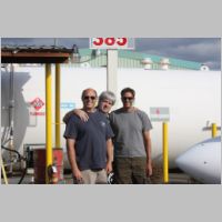
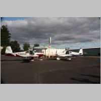
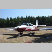
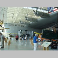
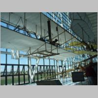
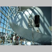
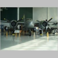
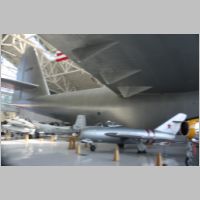
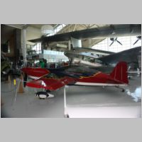
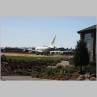
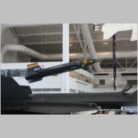
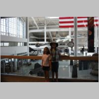
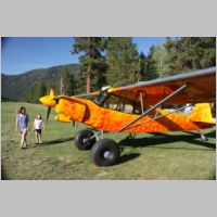
| I've
always wanted to see the incredibly huge "Spruce Goose", and being so
close to the Evergreen museum in Mc Minnville I couldn't pass it up on
this trip. They've got an awesome selection of airplanes there,
including one of my favorites...Wayne Handley's Turbo Raven. Lots
of neat stuff to see. They recently obtained a 747 that is parked out
front right now, and they're busy constructing a new waterpark that
will have the 747 sitting on top of it. It's a great stop when you're
in the area. If you see the photo of my plane on the ramp, you
can see the 747 in the background, so you park very close to the
museum...but they have a shuttle that picks you up to get across the
busy highway. Any time I can go see an X-15 and an SR-71, it's a good
time. |
|||
 |
 |
 |
 |
 |
 |
 |
 |
 |
 |
 |
 |
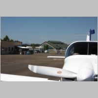
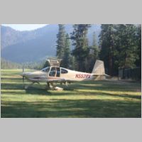
| Loading
back up, we flew back past Mount Hood, and took the short jaunt (hey,
in an RV-10, everything is short) over to Johnson Creek Airport at
Yellow Pine, Idaho. We came in at 9,500' over the mountains, and
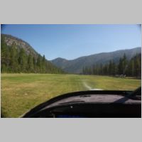
overflew the airport to get a bird's eye view of the strip. From
there we forumulated our descent plan. I amed for just above the
peak in front of me, and planned to descend just over the next
mountain, down into the valley, turning Left over the city of Yellow
pine. The common approach is to fly South down the valley from
Yellow Pine, and then as you turn the bend to the Right, you will see
the airport in front of you. If you fly down to about 500 AGL as
you get past Yellow Pine, you're all set up for coming in to land at
Johnson Creek. It's a very awesome and beautiful approach. |
|||
 |
 |
 |
 |
 |
 |
 |
 |
 |
 |
 |
 |
 |
 |
 |
 |
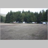
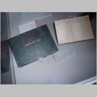
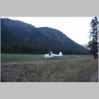
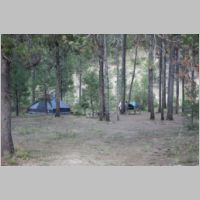
| Once
on the ground, we parked by a spot with an open campsite and I went
down to register in the book. The people there are all very nice. You
get the feeling that everyone there is a regular...like once you've
been there, you will come back again and again. I've heard that
as many as 150 airplanes have been lined up along the grass runway
(that lies at an elevation of over 4,900') for a fly-in. It
really is a perfect airplane camping location, with good sites, a river
nearby that provides an awesome "white noise" for sleeping, and hot
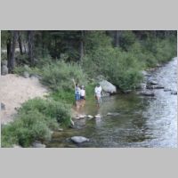
showers. Again, we set up camp and walked around to see the
place. We had bought a water filter for backpacking, and rather
than using their faucet water, which was absolutely fine, we walked
down to Johnson Creek and pumped our water bottles filled with our
filter, to test it out. With fresh stream water in hand, we
walked back to camp and had more Dehydrated food, including dehydrated
ice cream bars, and sat by a campfire. They do have wi-fi there,
but the coverage and speed isn't great, so I turned off the phones and
we relaxed with zero technology for the evening. |
|||
 |
 |
 |
 |
 |
 |
 |
 |
 |
 |
 |
 |
Day 6 - Home from Idaho
 |
 |
 |
 |
| In
the morning at Johnson Creek, we got a great surprise while we were
packing to leave. Overhead flew an RV-10 and they landed and parked
near us. It's a great looking RV-10, with a beautiful
interior. After a little chit chat we were loaded back up and
ready for takeoff. For departure, they recommend flying North out
of the strip, to the less tall terrain, so we took off North, and
turned around south and overflew the airfield as we climbed out.
I turned into the rising canyons as I flew, and did another circle
around one of the peaks while I gained altitude to cross the highest
peaks to the East, so I could get on my way. It takes about
10,000-10,500' to get over the peaks comfortably, so we climbed there
and then continued on to 11,500 for an Eastbound flight. The
mountains of Idaho are awesome to fly over. There is scenery
everywhere. Last time I flew them there were tons of forest fires
and the visibility wasn't great, but this time we had largely clear
skies. Having flown 2.25 or so hours from Portland area the day
before, we wanted to get some fuel soon so we could make some long
tracks for home after crossing most of the mountains. So, we
headed for Twin Bridges (7S1) Montana for gas. |
|||
 |
 |
 |
 |
 |
 |
 |
 |
 |
 |
 |
 |
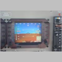
| As
we left Twin Bridges, there were only a few more mountains to cross, by
Bozeman, MT, and we had been climbing to a nice 9,500' on the way
East. But, as we neared Bozeman we wanted more clearance over the
peaks than the cloud cover would allow. We could either descend
below the clouds and circumvent the mountains, or ascend above them and
keep ressing East. Since the terrain was vastly improving, and we
had plenty of O2, we opted for the high route. We climbed to
11,500, then to 13,500, and the clouds kept coming a little higher. So,
we used the power of the IO-540 to pull us a little higher, too.
To keep good cloud clearances, we at one point climbed to almost
16,500' at which point the clouds dropped away a whole bunch and we
started back down again. While we were basically level in cruise,
I shot the above screenshots. I found that at those altitudes,
LOP flying just didn't work. You were rich of peak, and then the
engine would peak during leaning and not really run well. So ROP
it was. But, that was what got amazing. I was flying with a
very sweet 56kt quartering tailwind, doing 159kts TAS while ROP, and a
groundspeed of 180kts. Density altitude was almost 17,000', and
we were still burning our typical 10.0 gph. It was great to have a
plane that could climb that far above the clouds. That said, it's
really easier to cruise the RV-10 between 7,500 and 14,000' or so,
since it's naturally aspirated. As we got further along, we
decided to use that altitude we got in the climb to do a long descent
to stay under any remaining layers of clouds. We descended in the
clear and then stayed down lower for the rest of the trip, because we
knew we had to do more storm circumnavigation. |
|||
 |
 |
 |
 |
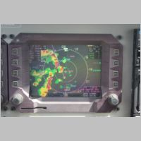
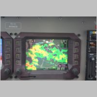
| As
you can see from the radar image above, the storm cells we had to
navigate around were pretty strong. In fact, the ones that went
through Minnesota got pretty severe. Again though, with WSI
combined with eyeballs, what looked like it would be a nightmare was
actually very passable. THe 2nd shot in the row above shows
Devils Tower in the distance, by the way....cool to see on any
trip. Looking at the radar shot above, the next 3 shots are what
that looked like visually out the window. You can see the severe
weather off the Left wing, yet we're in sunny skies, Ahead and to the
left is more severe weather. By staying visual though, we just
flew right around it all, passing right by where we could safely watch
from the distance. I was surprised that such a NON-tall storm
vertically could put out that much rain. |
|||
 |
 |
 |
 |
| Looking
again at the next radar picture above, we were faced with a little
dilema. That area of weather was mostly just rain. There
were areas of heavy rain too. But, what was lacking was any
lightning. With WSI's lightning reports it's easy to see where
some really nasty stuff is. If there's lightning it's probably nasty.
This one was pretty tame. There were airports in our path (as I
zoomed in to the 10nm scale you could see more in our area) that were
landing options, and the total yellow range of the rain was about
10nm....or about 3-4 minutes at our rate of speed. The range of
the green was maybe another 10nm. From past experience with WSI
and weather vs. visual/actual, green is generally either nothing, or
very light, and yellow you can plan to at least get wet...but usually
depending on the type of weather, yellow can be pretty easy. (this will
vary from XM to WSI, and even from storm to storm, so learn your system
and use your eyes!) So, I decided to go for the most tame looking
parts of the weather, that has the shortest crossing time to
clear. I picked a path that cut through the green and a little
yellow, and we descended to 5,500' where we still had excellent
visibility and terrain clearance. The 2 photos that followed were
what we actually had out the window while inside the yellow area of the
rain.....it was somewhere between 7-10 miles of hazy vis forward, and
probably 15-20 miles out the side windows, and it was just light
rain...and you could see on the horizon that it wasn't getting worse
looking or darker. And, within a couple minutes, we were out in
the clear again. With WSI and no outside viz, on an IFR plan,
you'd have to be careful how you routed around things, and it would be
more nerve wreaking to not be able to see what conditions you're
heading into. With NO WSI, and only your eyes, you'd never know
which path to take to get there safely, and you could easily be trapped
by bad weather. With WSI, AND your eyes, staying VFR in fairly
good viz at good ground clearance altitudes, you could navigate through
and around things very well, knowing that you could always do the 180
degree turn and be at some other airport in 10-15 minutes that was in
the clear. |
|||
 |
 |
 |
 |
| After
a day of searching for the best path through the weather, we were not
done yet. We had picked many lower priced fuel options along the
way, and wherever we can, we like to reward those FBO's who price fuel
reasonably by giving them our money. So, not one to give up on
cheap fuel, we recalculated a couple times for fuel stops that were in
clear weather, and far enough along that we would have lots of fuel as
we got near home. The problem was that despite all this bad
weather along our route, our home field destination was being hit by
the worst weather by far....a huge line moving south to north that was
going to last a long time. We didn't even figure we'd try to get
home if we had to enter that weather. So we wante to fly along
and get fuel so we had plenty to get home if needed. We found a
great price and stop at Luverne, MN (KLYV). In picking that fuel
stop, we wanted clear weather, so we really had to seach for which fuel
stop would be both cheap and clear. This one fit the bill, but we
had to get around a pretty intense storm to get there. This one
could have been circled pretty easily, but with a good visual picture
it wasn't a problem. You can see the above radar shot. Not
good...lots of colors there. But, the shots that follow are again
what was out the window. You can see blue skies and no tall
buildups that go all the way up in the path directly through the middle
of the line....where the cells were to each side. Better yet, the line
was only a couple miles wide where there was green. So we flew closer
for a look-see. You can see out our windows the weather was
great. As we passed between the areas of rain, you could see that
we didn't even get wet in this gap. There was rain out each side,
but nothing in the middle, and plenty of good viz. It was a
smooth ride in clear air, and we got to our fuel stop. We're
almost there! |
|||
 |
 |
 |
 |
| With
the good tailwind coming through Minnesota, we had full stomachs, full
tanks, and only about an hour to go. Looking at the iphone weather on
ForeFlight it looked like our airport was JUST clear of the bad
weather, but 15 miles East it was still in that big moving line of
storms. Awesome, we get a chance to get home! We loaded up
right away and headed out for a quick flight home. All the way
across Minnesota it was beautiful. Then as we got nearer our home
airport you can see below that KLUM wasn't far from the bad
weather. Only 9 minutes of flying time from home and yet we have
one more hurdle ahead. As we descended there was a cloud bank
ahead. We listened to the AWOS and it was calling 1100 scattered,
3500 overcast. Hmmm....so it's not that bad at the airport.
I watched the cloud bank carefully as I descended... |
|||
 |
 |
 |
 |
| Looking
at the last photo above we're still in sunny skies and about 15 miles
from home. That cloud bank was pretty low though. Well,
another chance for a look-see. Again, they give you 1200' AGL and
lower, 1 mile and clear of clouds because sometimes those things can
help you get in. Now, the 1 mile viz doesn't turn me on a
bit. 1 mile viz isn't what I'd want to fly in, unless IFR.
But, low altitudes aren't always a problem, provided you can see well
and avoid any obstructions. Being my home area I knew what to
expect as I fly this path all the time. So we approached that layer in
the photo above and checked it out. Sure enough, we had to get
down to about 500', which then legally makes you have to also watch the
ground to stay away from people and houses, but at those low altitudes
we were in very good viz....see the pics below. We only had to
get down to 500' for maybe 1 minute and after we passed under the edge
we were clear to climb back to 700-800' with comfort. The photos
show the viz real well...probably 20 mile viz, just a low
ceiling. The one pic doesn't look that good because we ascended a
little, but if we were 50' lower you'd better see that horizon far
away. For 15 miles of flying, this would do just fine.
Another quick peek at the radar below and we're 9 miles out and the
airport is still clear of the storm. AWOS still says all is
ok. 4 minutes later we're in the pattern, with those 1100'
ceilings, landing under those grey skies. Off our Left wing in
the last photo you can see the storms darkness. I was SO GLAD
that the weather stayed away. I had planned to park the plane and
wait until the airport cleared out, but since the airport was still
clear and we had 800-1100' ceilings and 15-20 mile viz, AND it was
familiar terrain, it made it possible to squeak in. Take away the
viz, the ceiling, or anything else, this wouldn't have been do-able. |
|||
 |
 |
 |
 |
 |
 |
||
Another successful trip, yet the weather didn't want to be nice on either the way out or the way back. Navigating around the weather is not something to take too lightly, but with care and equipment it can make the difference between getting there, and 3 extra nights in a hotel. Also, there are times where an instrument rating is your tool to making a trip "makeable" instead of impossible.....but there are times when flying on instruments near weather doesn't make it safer...it makes it more dangerous. This trip was one that we did the entire thing VFR, because around storms you're often safest to be lower, where you can see everything around you. The key to being able to make X/C trips work is never being afraid to do the 180 degree turn, and don't wait too long to do it. As long as you know that a quick turn back will put you at an airport that won't be pummelled by weather, you can usually put a few more miles on and take another look. The Radar sometimes makes the trip look impossible if you look at it on a wide range scale....but when you zoom in you can see many ways around. I can't even imagine flying x/c the way I used to....wx in the cockpit has to be about the #1 safety tool you can have. Autopilots and instrument ratings are great too.
3000nm +, and we're done with another vacation. The engine burned only 1 to 1.25 qts of oil over this whole distance, too!