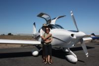
California 2010 - Winging it to the West Coast!
Plus West USA ADS-B report
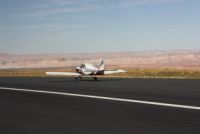
Trip Completed 10/16/2010This trip turned out to be a beautiful flying trip for us. Some of the weather in the weeks before had been looking pretty bad out in the North West, with lots of rain, so a week before we left, we started making alternate plans...to go to Washington D.C. instead, if the weather was an issue. Our original plan was to fly to Oregon, and then perhaps up into Washington to the San Juan islands, and then continue down the entire West coastline to San Diego and back around to home via Sedona. As things often change, they sure did for us. The weather in the Oregon area wasn't going to be good, and on departure day it was easy to see that Washington D.C. was also going to be bad later in the week. (Turned out to be very true) So we decided to just reverse our route and start by going South...through Sedona on the way, and then up to our ultimate destination of San Francisco, and then decide later in the week what the return path would be. As usual, winging it and making no firm plans and no reservations, was the way we approached the trip.
 |
 |
 |
 |
 |
 |
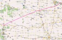 |
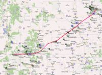
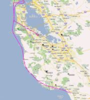
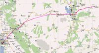
The APRS flight tracking paths above were pretty reliable for the entire trip...the catch in viewing the above pictures is that the APRS lives in Europe and places it's plots via GMT. So, if you fly into the evening as we did, and then you try to go back and look at the track a week later, your plots will show up only for that day in GMT, and may require you to look at 2 days worth of plots to see the whole course. (If you view the plot live, or look within the first week, you can ask to see plots of the last 7 days, and that would allow you to see the entire route.
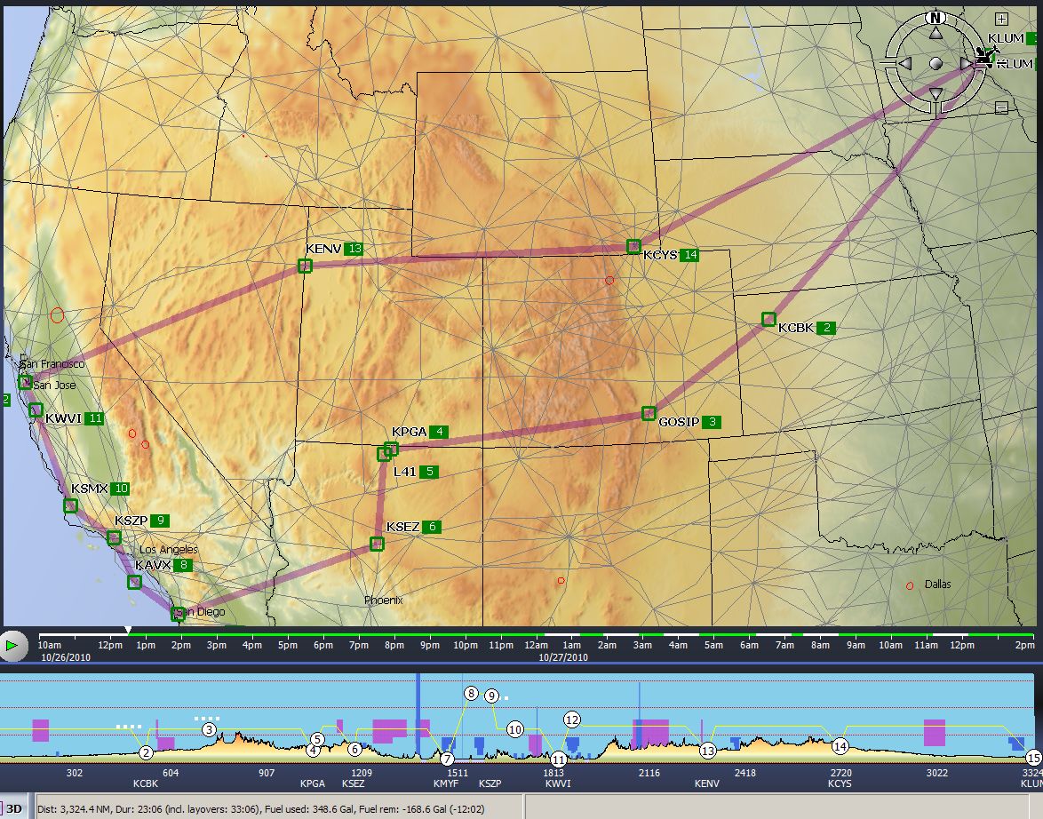
We planned the initial plan via Voyager, as it's very nice when going over the mountains, planning with the Terrain view, and finding reasonable fuel prices in the areas. So Voyager provided us with a general route plan in a very short time. Below is our general route. It showed the mileage at 3,324 but in reality with the added kinks in the route, and shoreline following, it was likely upwards of 3,500nm...or a little over 4,000 miles for you land lubbers. The photo below also shows fuel used at 350 gallons, over 23 hours...this is estimated at 14gph I think. The reality of the trip was that we slowed down at times, circled a bit, and flew about 26 hours, with an average flow probably more like 10.5gph for a total of 275 gallons. I haven't added up my fuel receipts to verify, but it's got to be pretty close.
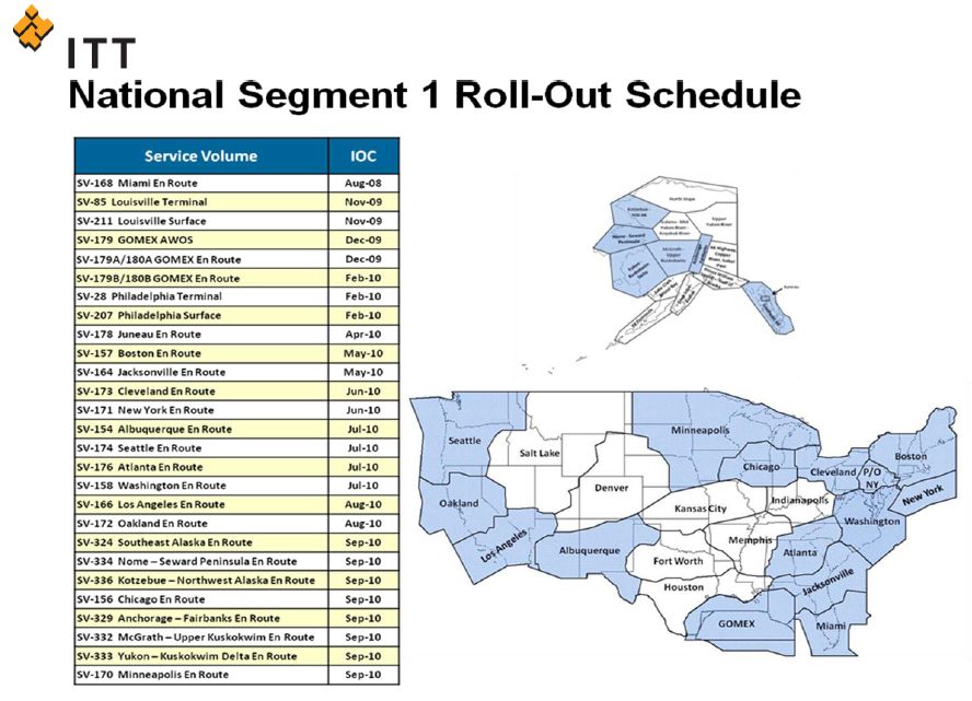
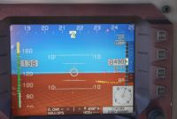
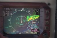
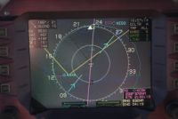
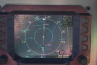
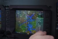
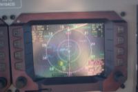
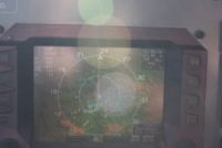
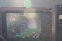
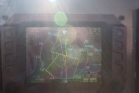
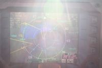
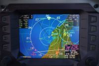
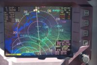
One other thing that was pretty new on this trip was getting the full ADS-B experience. In the last couple months I've upgraded to the ADS600B ADS-B Transceiver from NavWorx. This was the first very long trip that I've had the opportunity to see exactly what the coverage was for ADS-B now that the Segment 1 Roll-out should be nearly complete. I don't remember the exact number but I think at least 300 stations are deployed now around the country, and much of the area I would be flying in for this trip would have coverage. The current coverage map is below. In the next 1.5 years, they are planning to deploy something like 600 additional ground stations that will thicken the coverage and fill in most of what's left. As I do the trip write-up, I'll show some screenshots of traffic in various areas. Suffice it to say, the coverage I saw was very good indeed! There were times that I think I was receiving air-to-air coverage from aircraft, too, unless by chance there was ground coverage in the area. Keep in mind that to get air-to-ground coverage (Traffic sent to you via ground station), you'd have to be in radar coverage. When flying low around the mountains you may be out of radar coverage quite a bit. So if you get traffic in a canyon somewhere, it may be air-to-air, sent directly from their UAT to yours...because you wouldn't have radar coverage. I'll color code my text below for ADS-B reports in blue, so you can pick them out if that's what you're reading this for.
|
Leg
1:
KLUM
-
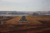
KCBK - KPGA
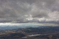
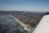
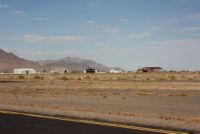
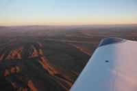
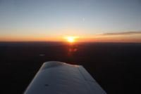
Starting out the trip we had great weather, with just a
little area of storm to pass just beyond the MSP area. Easily
circumnavigated. I love flying with a high overcast, to keep the
worst of the sun out of the cockpit on long trips, especially on days
like this where we'd be chasing the sun as it sets in the west.
8500', LOP approx. 10.5gph, with speeds in the low-mid 160kts
range....the usual. Right
off the bat as I was climbing out of KLUM, I had ADS-B traffic on the
scope at about 1,000agl. That's amazing for me, because I usually
don't get Mode S traffic coverage until I'm at 4,000' and maybe 5
minutes closer towards MSP. To see traffic as I leave my airport
is wonderful! |
||||||||||||||||||
 |
 |
 |
 |
|||||||||||||||
 |
 |
 |
 |
|||||||||||||||
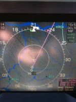
Looking at the screen shots, as we were well outside of MSP's Class Bravo, there is traffic that we see as we pass KRST. The next screenshot shows us over Iowa....in places where I'm not near ANY Class B area, yet there is traffic on my screen...over rural areas. |
||||||||||||||||||
 |
 |
 |
 |
|||||||||||||||
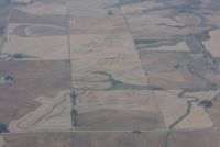
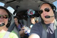
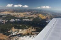
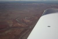
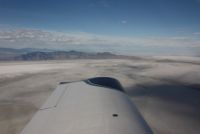
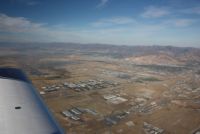
Cruising along over the flatlands, there wasn't much to do, but there were some cool farm fields all carved up as you can see a couple rows above, and the riverbeds and land contours can be neat to watch. Recently, I upgraded to a PMA8000BT audio panel, so to mess around while we were around nothing, I popped up Andrea's iPod touch and we played a movie with the audio over bluetooth. Definitely, with todays changing electronics, I wouldn't panel-mount or fixed mount any entertainment device. They change too fast and you'll end up with something you want to rip out some day. The iPad played movies great for the kids, and the ipod kept us (me) entertained...even if I didn't look at it that often. As we were past Columbus, Nebraska, you see another screenshot with traffic on the screen. This wasn't even in an area that was supposed to have ADS-B I don't think, but I had traffic nonetheless! Coming down into Colby Kansas, a gas stop with a very friend FBO attendant, we had a bunch of bumps and bugs. I don't think I've ever picked up as many bugs as when we landed and departed KCBK. Climbing out of KCBK, we were nearing the foothills of the Rockies, so we started following some airways after a while, and donned our Oxygen cannulas to climb high enough to clear all of the peaks. |
||||||||||||||||||
 |
 |
 |
 |
|||||||||||||||
 |
 |
 |
 |
|||||||||||||||
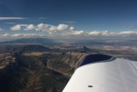
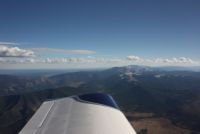
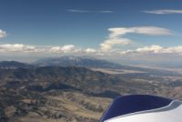
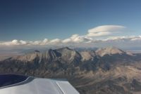
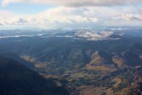
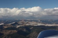
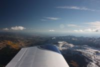
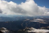
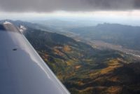
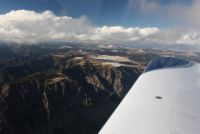
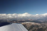
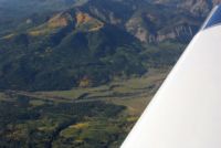
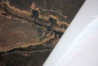
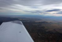
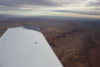
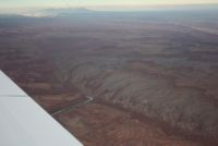
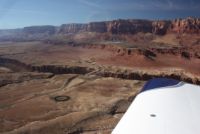
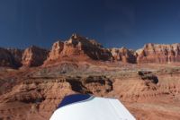
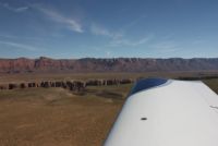
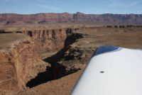
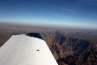
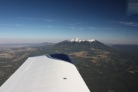
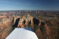
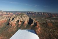
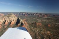
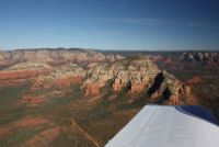
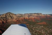
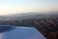
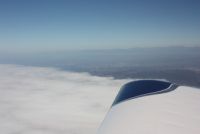
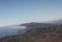
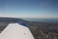
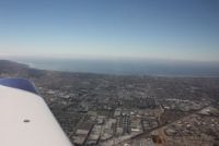
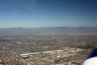
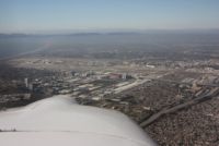
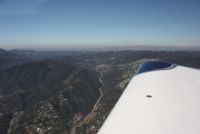
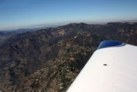
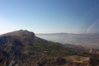
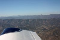
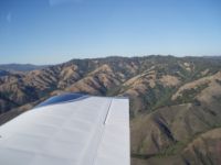
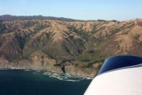
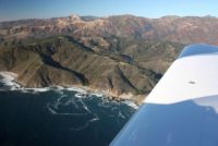
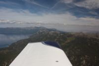
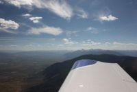
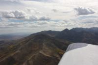
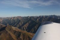
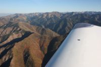
The ride was pretty smooth, and the scenery was spectacular! Some of the mountains are becoming snowcapped now, as we're nearing winter. The clouds were hovering just above the mountains, and the most beautiful thing to see was the mix of evergreens and yellow leaves turning, filling all of the canyons between the mountains. Check out some of these pictures! We were staying between the cloud layer and the mountain tops, which got us up close with both, and gave us some wonderful scenery! |
||||||||||||||||||
 |
 |
 |
 |
|||||||||||||||
 |
 |
 |
 |
|||||||||||||||
 |
 |
 |
 |
|||||||||||||||
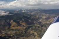
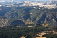
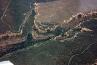
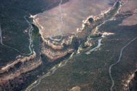
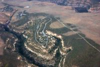
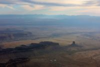
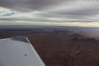
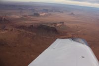
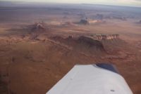
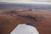
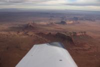
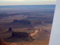
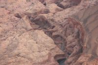
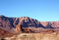
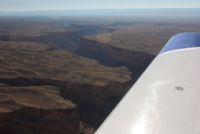
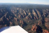
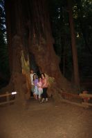
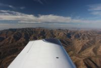
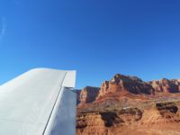
One of the areas we would like to stop some day is Mesa Verde, the place with the cliff dwellings built into the side of the mountains. We flew over and circled the area of the park around them. It's pretty cool how they decided to live in the sides of cliffs but just above them were flat plains of land. Really neat. The last picture in the row below shows the terrain just past Mesa Verde...it dropped right off into low flats, on the way over to monument valley. What a change from only 30 minutes ago where we were near snowcapped mountains and lush canyon valleys. |
||||||||||||||||||
 |
 |
 |
 |
|||||||||||||||
 |
 |
 |
 |
|||||||||||||||
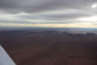
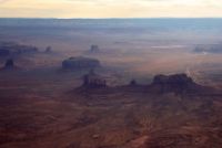
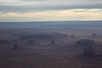
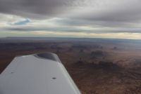
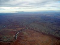
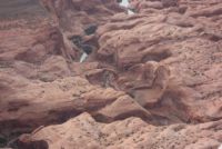
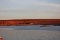
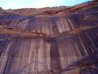
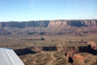
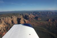
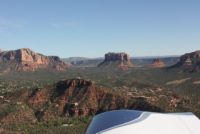
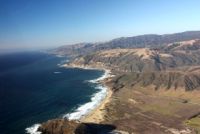
A couple of these photos really show why they call it the painted desert. For an area of the country that's very barren, and void of people, it is certainly some of the most beautiful area of the U.S. that a person can overfly. If we'd have not been going for distance, I'd have dropped down to 500-1000' AGL and taken it all in from a lower altitude, but flying above it gave us a wide view of the land, and it was all breathtaking. The clouds above had cut some of the sunlight, and the reds were shadowed a bit, but as we passed through monument valley (below), the clouds thinned enough to give just the right amount of afternoon sunlight to the photos. We were so excited....I couldn't really believe I was even there it was so surreal. |
||||||||||||||||||
 |
 |
 |
 |
|||||||||||||||
 |
 |
 |
 |
|||||||||||||||
 |
 |
 |
 |
|||||||||||||||
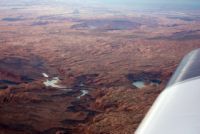
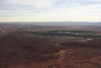
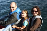
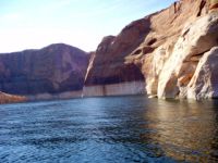
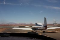
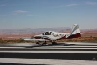
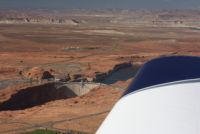
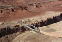
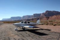
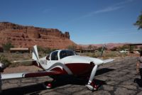
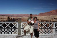
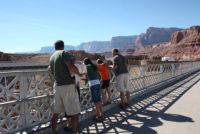
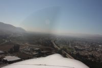
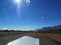
Our intentions for the night were to get to Sedona, and stay the night, departing for San Diego in the morning. At our gas stop at KCBK though, I got a text from Scott. He had been down in Lake Powell with people from work, who had rented a house boat, and they were staying there alone for the night after every one else left that day. They said they had plenty of room, and we looked at our time. It looked like our enroute time would be something like 6 or 7 hours for the day, but that Sedona would be a later arrival...maybe dusk or just after. KPGA (Page), by Lake Powell, would be almost an hour closer. We decided that all the arrows pointed to YES so we changed destinations and headed towards them. Due to the magic of mountain cell service, we were able to eke out a message that we'd be coming, and got plans to hook up. Coming towards Lake Powell, we flew right around Rainbow Bridge...the largest natural rock arch (in the US?) and got a look at it as we passed. It was there that I learned a valuable lesson. :) I had been flying on the same tank for a while, and we were under 10 gallons at the time. In circling around the rainbow bridge, I had kept it at 120Kts, in a turn, but kicked in opposite rudder to help dip the wing so Andrea could catch some photos. We were running 2000 AGL approx, to take the photos, over rugged terrain, and I held the uncoordinated turn around the point for all the photos. After the turn, I re-centered the rudder, rolled wings level, and headed to the airport, flying down the shoreline. Almost immediately the engine stumbled and lost power. Yep, my uncoordinated turn with lower fuel levels had unported the fuel, and left me sucking some air. Almost simultaneous with the sag, I had reached down with the intention to switch tanks anyway, and I switched the fuel lever, and quickly stuffed in the mixture, and the engine roared back to power. It wasn't a life or death thing, because we had some altitude to play with, but over the rugged terrain around the lake, it sure got my attention, and reminded me to check next time before un-coordinated photo turns to set fullest tank...something I knew, but it's a lesson learned more solidly when you actually experience what happens! |
||||||||||||||||||
 |
 |
 |
 |
|||||||||||||||
 |
 |
 |
 |
|||||||||||||||
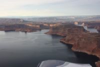
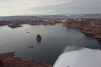
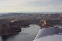
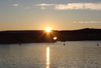
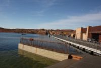
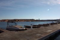
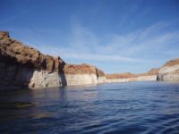
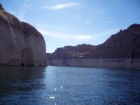
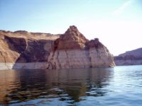
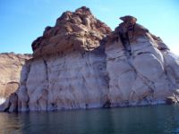
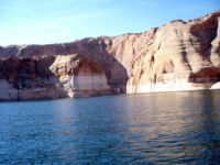
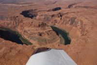
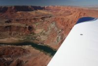
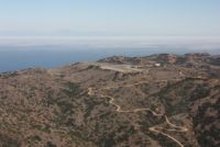
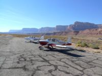
Lake Powell is a a tremendously beautiful lake. You'll see much more for photos below, but flying over it you can't stop taking in the awesome scenery. Page airport KPGA is at the south end of the lake and up on a plateau. I was surprised to hear so much traffic on the radio. That's when I got the real shocker....I saw ADS-B Traffic, in the middle of nowhere, seeing airplanes in the traffic pattern at KPGA! I never thought I'd see that. I'm not sure if they have a ground station and radar coverage of if the planes had ADS-B transmitters, but it sure was cool. Never had a trip with traffic coverage in areas like this before! |
||||||||||||||||||
 |
 |
 |
 |
|||||||||||||||
 |
 |
 |
 |
|||||||||||||||
 |
 |
 |
 |
|||||||||||||||
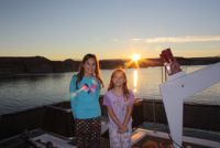
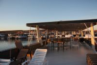
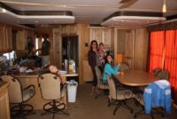
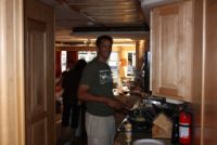
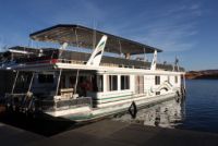
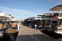
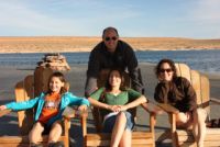
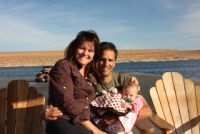
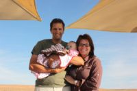
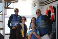
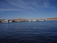
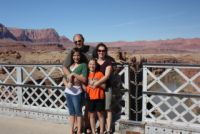
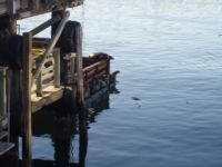
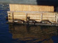
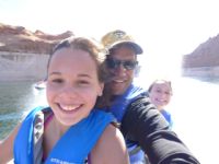
Once we got to town, we headed for the houseboat to hang out with the Schmidt Trio. We'd never been on a houseboat like this before. It was huge! It was super wide, and very long. It had an upper deck, with a swimming slide, and plenty of sleeping space and living area. Very neat. From the harbor, the scenery around is pretty. Not as spectacular as the rest of the lake, but very nice. They did a great job in this marina. They offered jetski rentals and houseboat / ski boat rentals, waterskis, and almost everything to keep you occupied. |
||||||||||||||||||
 |
 |
 |
 |
|||||||||||||||
 |
 |
 |
 |
|||||||||||||||
 |
 |
 |
 |
|||||||||||||||
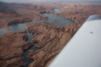
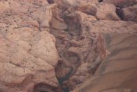
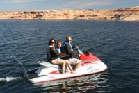
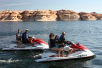
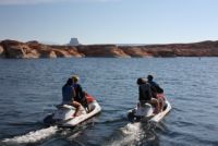
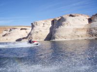
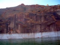
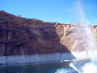
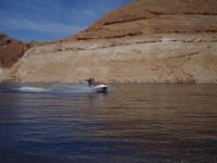
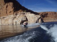
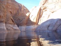
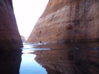
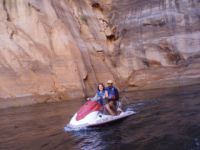
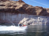
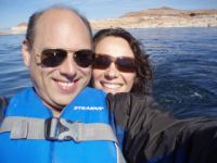
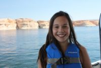
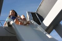
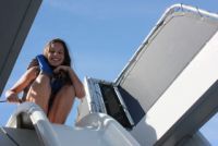
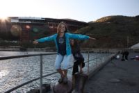
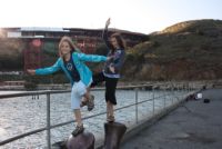
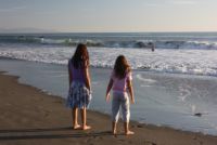
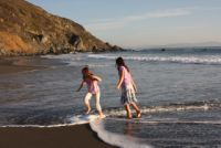
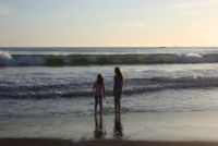
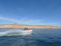
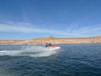
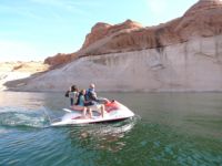
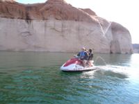
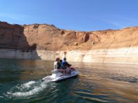
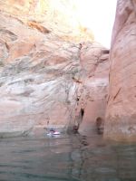
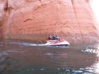
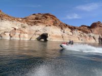
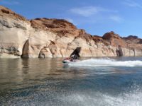
Waking up the next morning, our intention was to keep continuing to California, but with all the beautiful weather, we decided to stay for a half day. We rented jetskis for an hour and went flying through the water canyons of the lake. Navajo canyon was spectacular! Andrea commented to me that if she gets Alzheimers and can't remember anything, she would be happy if she were just left with this one memory of all the scenery on the lake. I'd have to agree...it really was nothing like anything I've ever seen and done. Definitely a place we'll be re-visiting in the future. The jetskis topped out at 48mph, and held 3 people, so we saddled up and headed full-bore up the canyons. I'll let the photos speak for themselves. What a rush to be zipping along sometimes only a handful of yards from big cliffs! After we got back to the boat, the kids swam and went off the slide for a short time, and then we packed it up to head on out. |
||||||||||||||||||
 |
 |
 |
 |
|||||||||||||||
 |
 |
 |
 |
|||||||||||||||
 |
 |
 |
 |
|||||||||||||||
 |
 |
 |
 |
|||||||||||||||
 |
 |
 |
 |
|||||||||||||||
 |
 |
 |
 |
|||||||||||||||
 |
 |
 |
 |
|||||||||||||||
 |
 |
 |
 |
|||||||||||||||
|
Additional Photos I grabbed from Scott's site
Leg 2: KPGA - L41 - KSEZ - KMYF |
||||||||||||||||||
 |
 |
 |
 |
|||||||||||||||
 |
 |
 |
 |
|||||||||||||||
 |
 |
 |
 |
|||||||||||||||
 |
 |
 |
 |
|||||||||||||||
 |
 |
 |
 |
|||||||||||||||
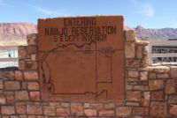
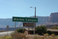
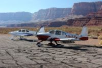
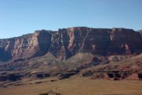
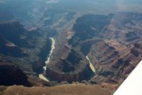
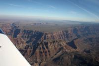
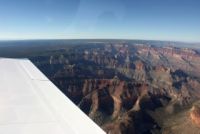
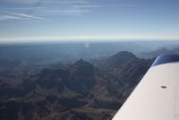
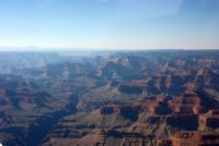
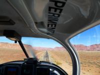
Another side benefit of Marble Canyon as a stop is that it was along our path somewhat, and it was a perfect lead-in to do the Dragon path of the Grand Canyon, on the way to Sedona. The Grand Canyon is divided into flyable segments with GPS endpoints, and we still had those in the Chelton from our previous overflight a couple years earlier, so we just punched them in and flew one leg, and headed on down to Sedona from there. The landscape changes a lot again South of the Grand Canyon, turning more green again. We passed another snowtopped mountin just before descending into Sedona. Passing Flagstaff, we once again had ADS-B Traffic, showing that again, there is coverage in that area! |
||||||||||||||||||
 |
 |
 |
 |
|||||||||||||||
 |
 |
 |
 |
|||||||||||||||
 |
 |
 |
 |
|||||||||||||||
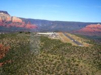
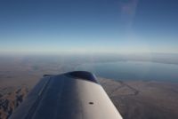
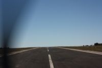
Sedona is one of the more beautiful areas to actually fly into that you'll ever see. The rocks turn a rainbow of greys and reds, and you're also surrounded by green trees. It's very scenic. The landing itself I found to be a non-issue at Sedona, despite the winds, and the fact that the runway is on a plateau. Certainly an easy landing for one of it's type. Catalina Island is in a different league, but Sedona is a good practice, anyway. Very nice little airport and the views you get are astounding. Below you'll see that after Sedona we headed on to San Diego, flying over some flat lands and other cities. Cool enough, we also had ADS-B basically continuous since Flagstaff area (maybe even since Page!) all the way down to Sedona, past Prescott, and Blythe....all the way into San Diego. I'll save you the suspense....yes, we pretty much had traffic coverage ALL THE WAY up the California coast, and even beyond into Reno!!! I can't tell you that I was in view of a ground station at all times, but I saw traffic in nearly all places. Flying from Sedona to San Diego we had one target on screen flying in our general direction for a half hour or more. Not sure if they had a transmitter in their plane or not, but we saw 'em! |
||||||||||||||||||
 |
 |
 |
 |
|||||||||||||||
 |
 |
 |
 |
|||||||||||||||
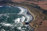
Leg 3: KMYF - KAVX -
KSZP - KWVI
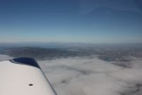
After staying overnight in San Diego, we packed up and headed right out for the coast. I've never been a fan of California other than as a visit, and the hard part is visiting the good places without getting sucked up and slowed down in the bad places. Southern California has some beautiful things to see, but is way too crowded and offers less value when you compare the scenery vs. congestion, so our goal was to head North. The goal for the day was to fly up the cost along the coastline as long as possible, and we did that for much of the time, but we had a side trip in mind too...Catalina Island. With it's popularity as a spectacular flying destination, I really wanted the opportunity to put N104CD on the ground on it's famous runway. When we took off in the a.m., the airports had just went VFR, as they have a few hundred foot thick layer of fog that covers everything near shore on many mornings. The overwater time was almost completely flying above the undercast clouds over the ocean. I had called the island in the morning and the guy there said it was completely VFR at the airport...the island was surrounded by a sea of clouds. |
||||||||||||||||||
 |
 |
 |
 |
|||||||||||||||
 |
 |
 |
 |
|||||||||||||||
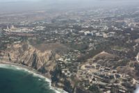
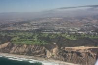
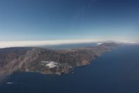
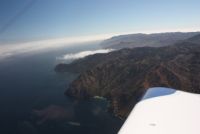
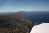
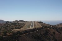
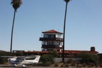
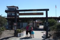
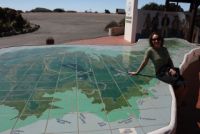
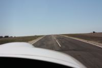
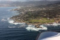
As you fly along the coast, you can see Catalina island off in the distance, towering above the ocean. Around the island, the conditions caused the clouds to be clear in a ring around the island. We had to fly in over land, and then do a Right downwind for landing, to land in the appropriate runway direction for other landing traffic...and yes, there were planes to watch out for out there...it's a busy place. I had read in advance all of the precautionary info. The runway slopes upwards for 2/3 of the runway, so if you're at the end ready to roll, you can't see any planes past the runway peak that may be sitting on the runway at the other end. It's not a problem during landing because you can see the whole runway as you descend. Visually though, on touchdown, it makes the runway look shorter than it is, so people crash because they abort the landing...thinking they won't stop in time, even though they have plenty of time. To fly to the island, you have to get permission to land. This is done by just calling on unicom about 10 miles out telling them you're inbound, and they give you the current winds and permission. There is a landing fee, and although all the documentation you'll ever see says it's $20, it isn't...at least not anymore. It's $25, and they do expect it to be paid. They accept credit cards, or cash, so you're ok as long as you pay. The airport itself is small, but nice, with a big tiled map of the island, and lots of little things to browse as you enter the terminal. They have a great restaurant that's famous for their real, actual buffalo burgers, and also there is a gift shop there. A perfect place to do lunch, if you don't intend to go down by bus into the city below. In the back, there are also some very cool pictures with some famous people in them, showing the first passenger service by air to the island...done by seaplane, and some things about how they made the runway, and what they did with it during WWII. Very interesting little story. Yes, there is ADS-B coverage at the island! |
||||||||||||||||||
 |
 |
 |
 |
|||||||||||||||
 |
 |
 |
 |
|||||||||||||||
 |
 |
 |
 |
|||||||||||||||
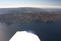
Departing the island gives you one of the coolest little takeoffs you'll find, too. The ground just drops away in a cliff as you leave the end of the runway. Very neat and scenic. The trip out to the island took us something near 14 minutes...with a few minutes over water without gliding distance to shore...maybe 3 or 4 minutes. We crossed at 6,500' on the way over, wearing our life vests, and having the PLB handy. On the return trip, with the winds, it was calling for an 8 minute flight to our next waypoint, which was on the mainland shoreline, so we didn't bother climbing and only flew to 3,500'. It happened so quick that by the time we took off, climbed up, and leveled out, we were over half way and ready to begin a descent. |
||||||||||||||||||
 |
 |
 |
 |
|||||||||||||||
 |
 |
 |
 |
|||||||||||||||
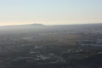
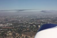
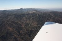
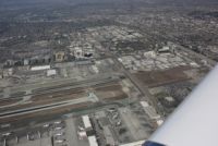
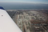
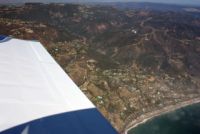
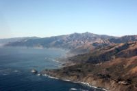
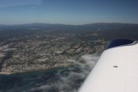
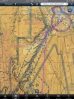
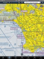
One of my big paranoia's about the flying out on the coast was that there is a lot of airspace, and a lot of mountains, and water, and I didn't know how complicated it would all be to navigate around. As it turned out, it was really pretty simple. I used the iPad each day to plot my course around everything. There are numerous GPS fixes that you find on the Sectional and TAC views on Foreflight on the iPad, and I simply plugged in navaids, fixes, and airports, making sure the lines would route me around everything. Then before I took off, I entered them all into the Chelton and that made the flight go really simply. The catch was that while Foreflight is very very complete on it's sectional and TAC views, and very easy to read and follow yourself, it lacks one thing (as far as I can tell)...you don't get the reverse side tab info that goes on the TAC chart for LAX. That's somewhat important...important to someone not familiar, anyway. The TAC chart depicts some very nice VFR corridors that you can fly right over LAX, to avoid having to get Class Bravo clearance. I didn't want to have to deal with Bravo clearance over LAX, and preferred to make limited use of flight following, too. I wanted the freedom to navigate the shoreline. Well, the VFR corridors were shown on the TAC, but not all of the info. It said to see the chart inset info. So, I bought an actual LAX TAC chart and looked at it. It had a nice little chart showing the "mini route" (my VFR corridor) and info about the altitude required, the entry point, and the instructions for staying on path. It was VERY simple...just enter at one fix, and fly to the VOR, at 2500'. Can't get simpler than that. But, seeing it on paper for an unfamiliar pilot, was something you really needed to do. As we approached the shoreline we started flying over very dense areas, headed for the mini-route entry point. That mini-route takes you RIGHT over top of LAX, South to North, at 2500', providing a way for them to have airplanes landing on the perpendicular runways running under you from both sides. See the photos and yeah, we're RIGHT ON TOP of the airport. It was very cool. On one of the pics below you also see the Hollywood sign, way out on a hillside. The area is much more urban than many places you'd fly, so seeing things in town wasn't easy...for instance, I don't know where Disney even was, but it's much easier seeing Disney World in Florida anyway. After flying over LAX, we quickly turned West to the shoreline around Malibu again, and flew up the shores as far as we could, then turned inland again, and headed for KSZP...Santa Paula, home of Lightspeed Engineering...maker of my electronic ignition. |
||||||||||||||||||
 |
 |
 |
 |
|||||||||||||||
 |
 |
 |
 |
|||||||||||||||
 |
 |
 |
 |
|||||||||||||||
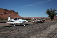
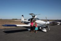
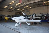
Santa Paula is a small, single runway strip, and looks to be a very busy place. It was pretty packed in there with lots of hangars, and was a pretty cool looking airport. We pulled up in front of Klaus's hangar (Lightspeed Engineering). Before the trip, I had had a few instances where the electronic ignition failed to operate on initial startup. At first I wondered if I had just not flipped the right switches. As part of the troubleshooting I pulled off the keyswitch wiring connector, and put it back on. Then when it happened the 2nd time, I went through it all again and decided it wasn't just me...and after pulling the connector, it worked again. After having maybe one or two more instances, it happened right before this trip, and I was just about to borrow a loaner, but took the box out, opened it up, saw nothing worrysome, and started scratching my head. There is only one socketed part on it, so I pushed and wiggled that, to ensure it was seated well after living for 650+ hours vibrating on my firewall. I also sprayed contact cleaner on it's D-Sub connectors. After that, I never had so much as a blip out of it again. I figured it must have been an intermittent connection, but since I was going to California anyway, why not take it to Klaus. It took almost no time for me to yank the box, and he bench tested it to higher RPM's than I ever would see. It performed perfectly. Over the years, mods come out, each one usually involving changing a component for a newer one that reduces either current draw, or heat. Klaus had a quick mod that he could do for me that would reduce a little heat, (I already had the vent tube), and so we did that, and tested and tuned it again, and stuck it in the plane. No problems, and it's been working great ever since I cleaned those contacts. Very nice to be able to swing through and have him bench test it for me though...what a guy. Talking to him about reliability, I'm unwavered in my happiness with the unit. My issue only happened on first-runs of the day, and always ended up running perfectly in flight. It sounds like the only thing that fails from time to time is a coil perhaps...but otherwise they've had a great service record. In comparing jules of power, they have well over 2X or 3X the spark energy as P-Mags/E-Mags, so there is a lot of firing power there. A guy came by to talk to him while I was there and said he really thought that a Lightspeed ignition saved his wive's life...she had a failure in her engine that caused oil to get by the plugs, and the other plugs were super fouled from the oil, but the lightspeed plugs had the power to fire right through all that crap and bring her home safe. Neat to hear that first hand as a bystander. |
||||||||||||||||||
 |
 |
 |
 |
|||||||||||||||
 |
 |
 |
 |
|||||||||||||||
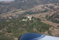
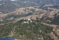
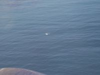
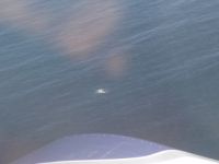
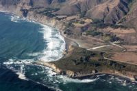
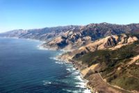
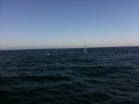
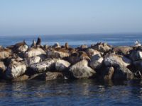
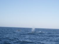
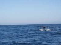
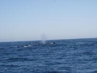
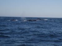
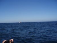
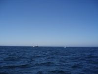
A couple minutes after leaving Santa Paula, we're back again running up the coast. There was some restricted airspace around the shoreline by Vandenberg Air Force Base, unfortunately, so we had to swing inland for a few minutes, but then back out to the shoreline again. The shoreline is a beautiful flight, providing little landing area in event of an emergency. Above you see pictures of the Hurst Castle, just inland from the shoreline. We also got a huge surprise....one that we'd had our eyes open for. As we flew up the coast, we saw something breaching the water and sure enough there were 3 WHALES swimming below us. We couldn't tell if they were grey whales or humpbacks, but they were definitely whales! Then, we kept flying up the shoreline and saw sights like all the photos below, but I suddenly spied a bunch more splashes from something breaching the water. It ended up being maybe 50 or more Dolphins, jumping out of the water all over the place, all traveling in the same direction! Amazing, and exactly what we had hoped for out of this trip!! |
||||||||||||||||||
 |
 |
 |
 |
|||||||||||||||
 |
 |
 |
 |
|||||||||||||||
 |
 |
 |
 |
|||||||||||||||
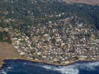
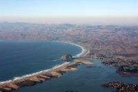
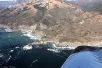
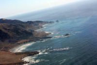
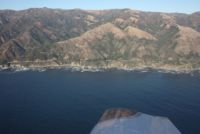
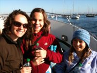
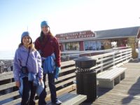
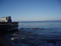
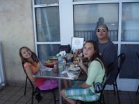
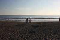
The destination for the evening was KWVI, Watsonville California, and then to stay at Monterey around the bay for a couple days. Many of you RV-10 builders will know that Watsonville is home of AirCrafters, owned by RV-10 builder Dave Saylor. He's got a cool hangar there and has a bunch of planes that he's working on with builders. Being the great guy that he is, he gave me a ride to Hertz to get a car, after him offering but me declining, the use of his truck. Well, they had no cars available, but Dave said to go ahead and use the truck...so I took him up on it. A big thanks to you Dave!!! We hangared the plane with him and then headed to Monterey. Monterey is a nice little town...especially cool to go down to Fisherman's Wharf. Funny how tons of restaurants have people outside with samples, trying to lure you inside. We were pretty eager, being starved from our trip. The hotel rates in Monterey weren't bad at all, but the hotels weren't new buildings, so you want to know what you're getting in some cases. We stayed one night in a Comfort in and Suites and had a slightly more shabby room than what we'd normally get, and spent about $100 on it. My goal was to get a 2-room suite, giving everyone their privacy and at this hotel, we paid more and didn't get that. The second night though we stayed at a nice little Clarion suites and had a 2 room suite with a nice indoor pool and hot tub, and paid something like $69...a far better deal. Not making reservations in advance made us have to shop for hotels, but it helped in that we got to change places for the 2nd night, saving money and getting a nicer place. There is a lot of competition this time of year in monterey, so finding rooms for a reasonable rate wasn't hard...we even were quoted lower rates at some places. Before we even got in and fed though, we signed up for a whale watching boat tour the next day. There are a few places to choose from there in Monterey, and apparently it's one of the best places to do whale watches because the trenches are very near shore at Monterey...you'd have to travel out many more miles to get to the deep water if you were up in the San Francisco area. So it was with great anticipation we went to Monterey to see the whales. I wanted as much of a "guaranteed" trip as I could get, and apparently in Monterey they are about 98% successful. |
||||||||||||||||||
 |
 |
 |
 |
|||||||||||||||
 |
 |
 |
 |
|||||||||||||||
 |
 |
 |
 |
|||||||||||||||
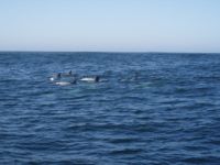
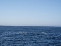
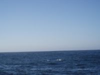
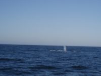
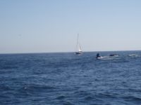
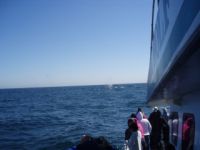
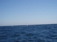
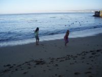
We had taken some "Bonine" (sp?) right before we got on the boat, as the waves were running 10-12' offshore, so we were pretty prepared for the ride. As we went out to sea, it didn't take too long and we ran across a pod of Dolphins all swimming together around us. Neat to see so many. Then we continued on to deeper water. After not too long again, we could see whale blows, coming from a pod of Humpbacks! There were at least 7 of them in the pod that we saw all together, and we stayed near them for a long time. They're really neat to see, often showing tail flukes as they breach and dive on the surface. After wathching humpbacks for a good amount of time, we set out to deeper water, as we weren't even out to the trenches yet, and soon came across a couple of Blue whales....which are roughly TWICE the size of humpbacks. Blue whales don't breach very often like humpbacks, and have a smaller fin, and don't often show their tales. We stayed near them and after a bit they even surfaced real near to the boat. Amazing huge creatures! After that, we headed back to town to enjoy the rest of the day. |
||||||||||||||||||
 |
 |
 |
 |
|||||||||||||||
 |
 |
 |
 |
|||||||||||||||
 |
 |
 |
 |
|||||||||||||||
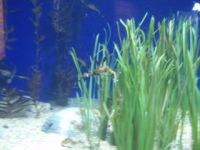
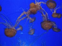
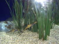
The rest of the day was spent hanging out in the Monterey Aquarium. It's an awesome aquarium with lots of cool exhibits and things that the kids love to see. Highly recommended as a stop for the family. They even had a scuba diver in one of the big tanks, talking to the audience with the same Aga masks that Andrea and I used to use. After the aquarium, we walked back to the car through Cannery Row, and had some supper at a great italian restaurant. All restaurants in that area sell seafood, some cooked in a variety of different ways. |
||||||||||||||||||
 |
 |
 |
 |
|||||||||||||||
 |
 |
 |
 |
|||||||||||||||
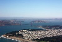
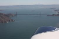
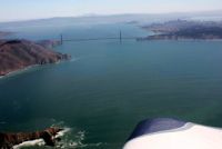
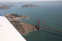
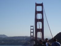
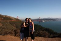
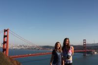
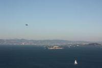
Leg 4: KWVI -
KSQL
This leg was very short,
but very cool. The direct distance was only about a 20-25 minute
flight, but we flew up the shoreline again, staying outside of KSFO's
Class Bravo. We again had
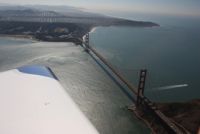
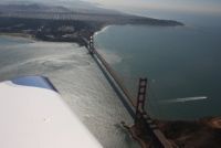
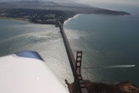
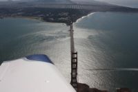
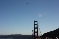
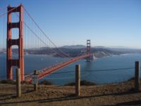
ADS-B Traffic available. As we neared San Francisco, I
asked for flight following and told them my intentions were a Golden
Gate tour. They just said to remain offshore and outside of Class
B, and as long as I didn't go past the Bay Bridge, they didn't care
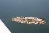
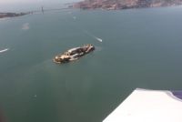
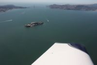
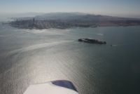
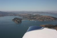
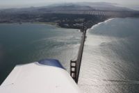
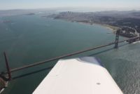
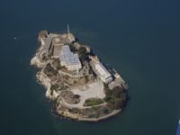
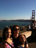
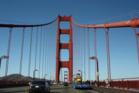
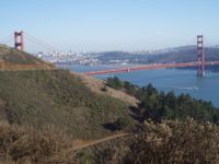
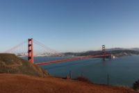
what we did. So we flew around the Golden Gate area and Alcatraz
at about 1800', coming up the shore, over the bridge, circling
Alcatraz, and then back out to sea and down the shoreline. The
words can't describe the excitement in flying over and around the
bridge, but I'll just leave the photos speak for themselves. Our
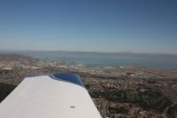
destination airport was KSQL, shown in the last aerial shot in this
section. As you fly in to KSQL, you also pass right by KSFO,
which has runways right out onto the water in the bay, and then you
come up to KSQL. KSQL has a small runway, with an overnight fee
of $10, but it's the most convenient airport for people wanting to land
and tour downtown. I had pre-arranged an Enterprise rental car
before I got there, so it wasn't long before we were headed into town,
after we landed and said hi to the guys at Rabbit Aviation, the
on-field FBO for fuel.
|
||||||||||||||||||
 |
 |
 |
 |
|||||||||||||||
 |
 |
 |
 |
|||||||||||||||
 |
 |
 |
 |
|||||||||||||||
 |
 |
 |
 |
|||||||||||||||
 |
 |
 |
 |
|||||||||||||||
 |
 |
 |
 |
|||||||||||||||
 |
 |
 |
 |
|||||||||||||||
 . . |
 |
 |
 |
|||||||||||||||
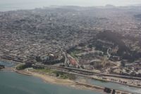
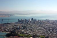
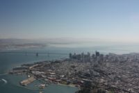
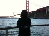
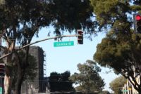
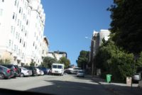
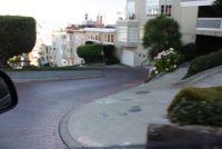
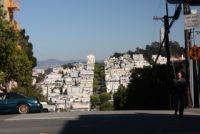
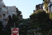
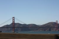
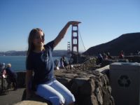
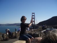
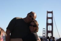
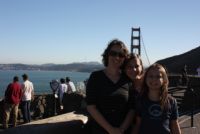
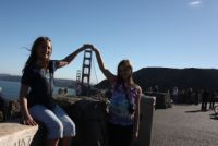
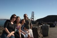
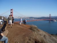
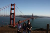
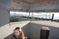
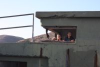
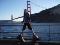
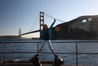
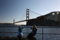
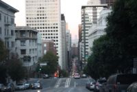
San Francisco can be kind of a pain for tourists. In fact, from a logistical point of view, it's probably about the worst place we've been. From a scenery point of view, it's excellent. Parking downtown or at Pier 39 or at Fisherman's Wharf isn't cheap. If you worked there and had to use a public lot, you'd pay maybe $29/day for parking. Hotels downtown will quote you parking rates and most charge extra for parking...along that same $25-30 price range, per day. It's a parking nightmare. A tip is, if you travel to the Wharf, make sure you use the wharf's parking lot and you get 2 hours free if you get your parking validated by a listed restaurant. If you travel to next-door Pier 39, use THEIR parking ramp, and you have to validate at a different list of resturants. So that's the big key...learn where to park, and how you'll do it cheaply. The 2nd night there, we parked on the street after 7pm for free parking. That first day we focused on doing some basic sightseeing, and getting a hotel and food. We drove into town and drove up and down some cool hills...I had wanted to show the kids the insane hills that the houses are built on, and how people park on the street. Then we drove down the famous Lombard street, and out for a drive over the Golden Gate Bridge, to the North side, where there are some cool places to park and take pictures, and play in in former Military bunkers. Very awesome views are available from the North side of the bridge...and over there, you don't have to deal with parking. For the hotel for the night, we quickly found out that staying downtown or by the wharf was expensive, and it got cheaper as you went South. We ended up staying just North of KSFO, and got a great rate, in a very nice Comfort Suites, with a nice hot tub, and good rooms. Below
are
pictures
of the sights around San Francisco and the Golden Gate
|
||||||||||||||||||
 |
 |
 |
 |
|||||||||||||||
 |
 |
 |
 |
|||||||||||||||
 |
 |
 |
 |
|||||||||||||||
 |
 |
 |
 |
|||||||||||||||
 |
 |
 |
 |
|||||||||||||||
 |
 |
 |
 |
|||||||||||||||
 |
 |
 |
 |
|||||||||||||||
 |
 |
 |
 |
|||||||||||||||
 |
 |
 |
 |
|||||||||||||||
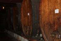
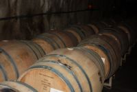
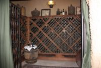
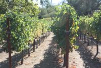
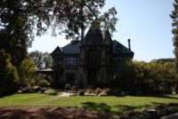
The next day we got up and headed out over the Bay Bridge for the Napa Valley, to see all the wineries. We planned to go to Berringer vineyard, where we got a tour of one of their original old wine cellars. The photo below where all of the bottles are, is where a scene from the movie "A Walk in the Clouds" was filmed. Neat little stop, but not one we'd spend all day at, since the kids can't sample wine, and Andrea and I don't drink much of it ourselves. |
||||||||||||||||||
 |
 |
 |
 |
|||||||||||||||
 |
 |
 |
 |
|||||||||||||||
 |
 |
 |
 |
|||||||||||||||
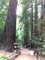
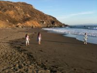
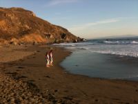
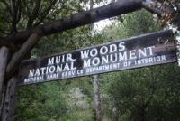
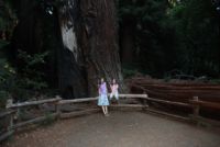
After the winery, we headed West over to a site Andrea had heard of but I hadn't....Muir Woods National Monument. It's the home of a valley of Redwoods maybe 250' tall, and it's got to be about the most beautiful and quiet woods that I've ever been in. Once again, lots of history there, as there is in the entire San Francisco area. We hung out in the woods for a bit, and then went down to Muir Beach, on our way back to town. The kids thought Muir Woods was pretty cool too, so definitely a recommended family stop. |
||||||||||||||||||
 |
 |
 |
 |
|||||||||||||||
 |
 |
 |
 |
|||||||||||||||
 |
 |
 |
 |
|||||||||||||||
Leg 5: KSQL - KENV -
KCYS
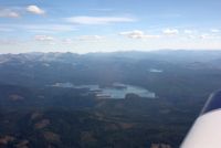
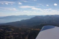
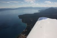
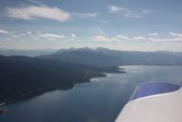
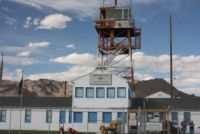
After a couple days in San Francisco, and getting closer to the week's end, we decided to start heading for home. This was a pretty cool flight. We knew we wouldn't make it home easily, because we had about 9.X hours to fly, and with the timezone change and shortened daylight this time of year, we didn't have a lot of daylight time to fly in...and I wasn't feeling like doing a long night flight over the plains for no reason. So we set our sights on just getting to the East of the Rockies, wherever looked the best. As we headed East, we climbed to 9,500', an altitude we could fly at and not use Oxygen...and we ended up at 9,500' for the entire trip home. Yes, we were able to fly a great route without ever having to go any higher. Our flight path took us right towards Reno, NV, and to cross some lower peaks we went just South, directly over Lake Tahoe. Really pretty little lake up in the mountains. I'd love to see it in the winter time. Then we continued East towards Salt Lake City, where I knew I could fly the canyons out to the East of town, and get home without going too high. We planned a gas stop before SLC so we'd have plenty of fuel to get completely through the Rockies before stopping for the night. I didn't know much about the airports, other than the fuel prices, but we planned to stop at KENV...Wendover, UT. Turned out to be an awesome little stop. As we came in to land, the airport looked huge and I thought it must be an old Military airport. Sure enough, when we were on the ground, we found out that there is a TON of history here. Wendover is where the Atomic Bomb was loaded onto the Enola Gay, to later be dropped on Japan. It's also where the pilots trained, and it used to house over 20,000 military men. The city is really small, and just down the block as you cross into Nevada, is a Casino that would make a great overnight stay if you ever needed. There is a rusty hangar on the airport that used to hold the Enola Gay, and there is a small museum inside with a mock-up of the A-Bomb. Really cool little place. |
||||||||||||||||||
 |
 |
 |
 |
|||||||||||||||
 |
 |
 |
 |
|||||||||||||||
 |
 |
 |
 |
|||||||||||||||
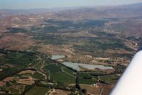
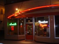
Continuing past Wendover, you squeeze your way between 2 restricted areas, and then you're right near the Bonneville Salt Flats. We crossed right over Bonneville VOR on the way towards SLC. Approaching SLC, I set a GPS waypoint on Parley's Canyon, and asked for Class B clearance to fly right over the city and to the canyon...where I could follow I-80 Eastbound through the higher mountains, and on to the Cheyenne area. It didn't take too long to navigate the high ground and we were crusing at 9500', sometimes only 2500' over the ground, over Wyoming. As the sun set for the day, it gave us some spectacular sunset views against the mountains, and we landed at Cheyenne right at dusk. I had picked Cheyenne because Sky Harbor, the FBO, could arrange a hotel stay at the Plains Hotel, where we didn't need a rental car since they have an airport shuttle. The hotel itself has been stayed in by people like Presidents Reagan, Kennedy, and Roosevelt. It's an old historic hotel. Dinner was a FANTASTIC pizza place across the street, called Mondello Downtown Pizza. Very good pizza! The stop was pretty un-eventful, filled with pleasantries, with the exeption of paying $9 for a quart of Philips x/c 20-50 at Sky Harbor. Their fuel isn't extreme, but someone's lost their marbles when it comes to the price of Philips oil. $6 is as much as that stuff's worth on the retail market. I use Exxon Elite, myself, but many FBO's don't carry it, and if I'm going to buy something in the field, I may as well save and buy Phillips. |
||||||||||||||||||
 |
 |
 |
 |
|||||||||||||||
 |
 |
 |
||||||||||||||||
Leg 6: KCYS -
KLUM
The trip home had nothing exciting to offer, but we got some great views of the plains. We only took about 3.5 hours from Cheyenne to KLUM, as the tailwinds got stronger and stronger as we neared home, topping out around 50kts. It's a 3.5-4 hour trip on most days, and it went smooth as usual. |
||||||||||||||||||

A note about the iPad
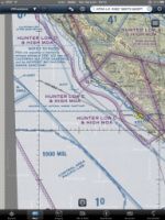
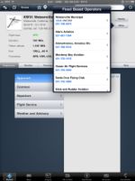
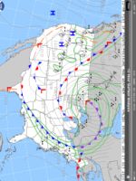
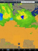
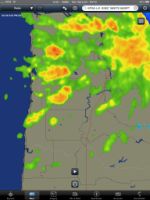
This trip as I mentioned above, I originally planned on Voyager, planning the route, looking for routes over the mountains, and checking for good midpoint fuel stops. But, once I had the basic plan down, I decided to try using the iPad for most everything on the trip. I got a 3G data plan just for the month, so we'd have weather data available, and of course the 3G model has a built-in GPS as well. I also purchased a new app called Navigon, for my iphone, for street maps and turn by turn GPS. Additionally we found the google map app on ipad very handy throughout the trip. Once we got airborne, we did everything with the ipad. We tracked our position with GPS, and found it perfectly reliable and trouble free. Daily I pinch-zoomed the map in and out and found good waypoints for my routing, which was complex at times with many fixes. I checked the weather, and monitored our progress on the ipad. Somewhere I have photos of the iPad compared to a tablet PC, and although I don't know where the photos are, I can tell you that the iPad (with my anti-glare screen protector) is brighter, and easier to read than a ViewAnywhere display. It's a fast box, that does almost everything you could want in an in-flight chart viewer. This trip was a great test of it's capabilities. Once enroute, I used it to plan flights over high terrain, just by using the VFR sectionals. I plotted around restricted airspace, and did everything via iPad. The thumbnails below are just a small piece of the imagery available. Look at them in full scale and check it out. The middle one on the bottom is the massive storm happening over Wisconsin as I write this...the 2nd lowest pressure ever recorded in history...second only to the storm that sank the Edmund Fitzgerald. Amazing weather. Anyway, the ipad is a fantastic box, and the perfect form factor for what we do with it in the cockpit. It makes an almost ideal entertainment device, and we used it with google maps to search and find hotels near us with great agility. If Voyager only had an ipad app ready, it would be great, but Foreflight really shines, and they've rapidly delivered nearly every feature you could want. Foreflight 3.7 just came out this week, and it even added fuel price integration, which they did in a top notch way...and although you can't save the info for use in flight like you can with Voyager, you can take screenshots of anything in a half-second, so if you're willing to snap a pile of screenshots you can easily compile data for most routes before you take off. I'd have to rank iPad (and iPhone) as the most useful tools I've had for many things, to date, even in my field of networking, I use them every day. Highly recommended for any pilot, and you can basically now replace a handheld GPS with one of these and be very very satisfied.
|
|
|
|
|
|
|