Alaska 2012 - Day 11
To Anchorage - Then Denali! 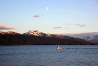 |
 |
 |
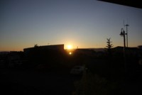 |
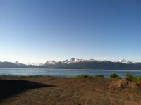
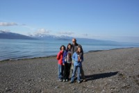
This was one of the very rare days on the trip that we woke up to not just good, but great weather. Weather was always a factor in our flights in Alaska, but today you could just tell was going to be great, and it sure was! |
|||
 |
 |
 |
 |
 |
 |
 |
 |
 |
 |
 |
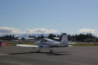 |
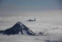
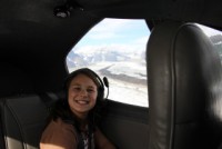
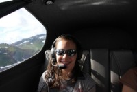
We got up and got our trolley to the airport with the group, and Ed was feeling a little under the weather so Andrea and Sheila switched places and Andrea went with Ed in case he needed an extra set of hands. This also allowed Andrea to get some great photos that actually included our plane for once! |
|||
 |
 |
 |
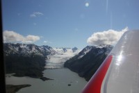 |
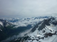
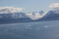
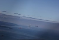
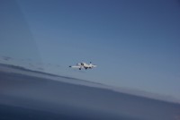
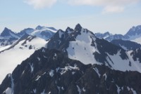
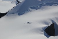
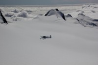
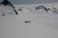
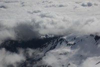
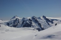
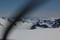
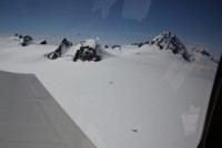
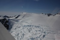
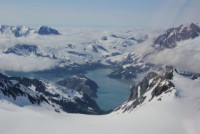
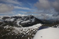
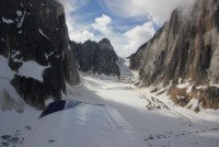
By now the group has built up some better formation skills, and everyone was able to stay much closer without things getting too wild. It was kind of important to stay close on this flight. As you can see in some of the photos below, airplanes are very very hard to see against white snow-capped mountains. Sometimes, you'll see the SHADOW of the airplane better than you will the airplane itself. So maintaining visual contact is of key importance. The group stuck together for this leg, and soon we were cruising down the Harding Ice Field. The tops of the mountains that spawn all of these glaciers are topped with literally HUNDREDS of feet of snowcover. What looks like tiny moutains sticking up through the snow is actually a large mountain, but there's so much snow between all the peaks filling the valleys that it makes the mountain look tiny. |
|||
 |
 |
 |
 |
 |
 |
 |
 |
 |
 |
 |
 |
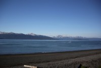
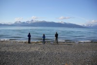
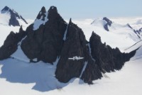
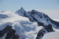
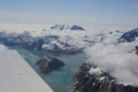
I could hardly believe my eyes as we flew along...the scenery was some of the most breathtaking that I've ever seen, let alone flown through. If you go to Alaska, you don't want to miss this area...Homer to Seward was some of the best stuff we ever got to see! |
|||
 |
 |
 |
 |
 |
 |
 |
 |
 |
 |
 |
 |
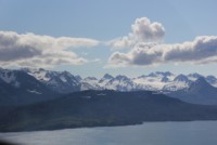
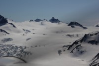
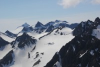
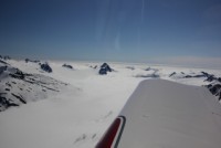
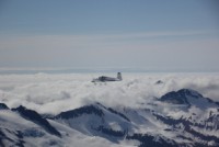
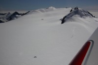
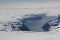
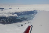
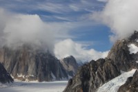
To the North were valleys and peaks and scattered clouds, and if we needed out, it was largely doable. To the South was undercast mostly, with the occasional glimpse of an inlet on the Seward/Whittier side of the peninsula. I think having the clouds actually made this leg far more enjoyable than if it had been totally clear. The snow was so ultra thick at some of the tops, that if it were steep, the snowcap would crack and avalanche down into the valleys, where they would then form into glaciers. |
|||
 |
 |
 |
 |
 |
 |
 |
 |
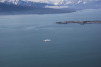
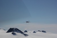
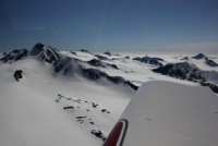
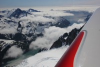
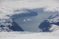
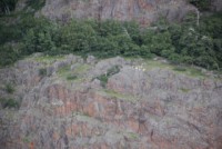
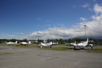
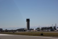
With the weather being fairly good, but overcast and slightly worse conditions ahead, we had a choice...take the quick route to Anchorage, or the scenic route. The scenic route meant we'd have to make a mountain pass that was potentially overcast above, but we opted for that way anyway. When we got up to it, there was a little dip between 2 peaks, with overcast clouds above, leaving about 100-200' of gap that we had to shoot through to get to the other side. It was intimidating at first, but we shot right through the gap and the mountain fell away, leaving us flying high above the next valley enroute to Anchorage. Soon enough we were along Turnagain Bay, and saw the Dall Sheep along the cliffs. Again, at Anchorage (Merrill Field), Dale had made great arrangements for the group. They had NOTAM'd off the camping area, so each plane got it's own airplane campsite to park in. He also arranged for the rental car agency to pick us up right there, so we could go rent cars, and the hotel (Millenium) to pick up the non-drivers and take them to the hotel to check in. One of the following days, we took a tour of the Merrill Field tower, which was pretty cool for the kids and for us. They got to see how the sectors are divided, and what is all on the screens of ATC, and see them in action. |
|||
 |
 |
 |
 |
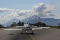
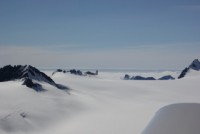
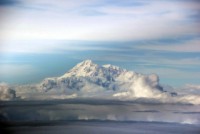
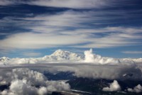
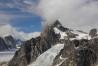
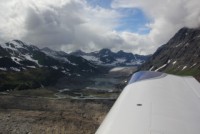
Once again, after landing, everyone else wanted to go scramble to the hotel, but we looked at the great weather and thought that maybe it would be our last shot at seeing Mt. McKinley (Denali). So we piled back in the plane and topped off, and headed out to see if we could get close. The weather was overcast inland again, so we wanted to see the TOP for sure, so we climbed up and got on top at 10,500' and headed straight for the mountain. You can see it FAR in the distance by plane, and it is a HUGE mountain. In fact, even though it isn't the tallest in the world, it is either the biggest or one of the biggest in total size. The thing sticks up from the ground like a massive ship of rock sailing on the cloudy seas. |
|||
 |
 |
 |
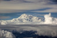 |
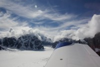
As we got closer, we lucked out, as indeed the layer of clouds became broken and scattered near the mountain. We took some photos on top, and then spiraled down onto Ruth Glacer and headed back up the mountain while sightseeing the glacier. |
|||
 |
 |
 |
 |
 |
 |
 |
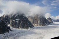 |
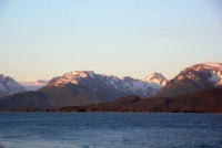
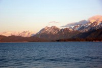
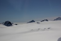
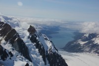
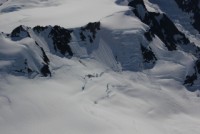
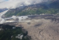
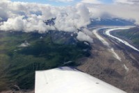
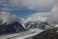
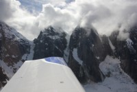
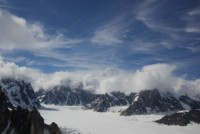
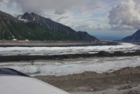
I don't think I was quite prepared for the awesome sights along Ruth Glacier. It was totally different than the ones by Homer. This was much longer and larger, with different rocky peaks on each side, with clouds surrounding their tops. They looked like cloud topped castles in the sky. It was completely awesome! |
|||
 |
 |
 |
 |
 |
 |
 |
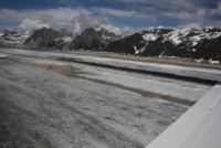 |
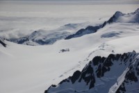
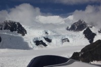
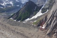
Coming down the glacier again, we were amazed by how the ice and dirt comes up with it's own formation. There are areas where the glacier leaves a well formed dirt berm on the side that looks neater than if an earth mover had plowed it there. Then down the center of the glacier there were a couple of stripes of dirt in straight and constant berms. one was dark, and one was light...obviously being two different types of rock. How they formed in that perfect line was just amazing to us. After flying this flight we were VERY glad we did it. It was awesome, and the weather never did get good enough again to go see Denali. |
|||
 |
 |
 |
|
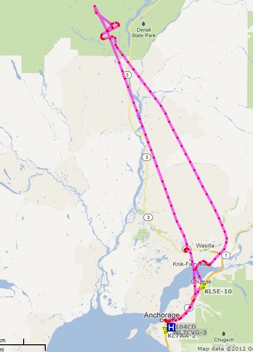
Surprisingly, APRS worked for our tour around Denali, too!