NavWorX ADS- B Testing in N104CD
Added 10/26/2008This year at OSH 2008, if you wandered all the big vendor hangars like I did, you may have run across a new company called NavWorX. They were a little bit harder to find than some, not in the "big 4" center hangars, but up nearer to the flightline, in I believe it was called Hangar E, the same one where TCW Technologies was showing off their Safety-Trim and other new products. NavWorX is a new producer (founded in 2007 but working on their products for a few years prior) of ADS-B transceivers for the GA market. I myself walked by them quickly, and saw their transceiver on display, and it grabbed my attention enough for a stop. Turns out they were interested in getting hooked up with the various EFIS manufacturers to ensure that their product integrated into lots of systems. As you may or may not know, before this, your ADS-B choices were basically limited to Garmin....the monopolizing giant in the market, and as with most things garmin, all the technology was proprietary....you buy one garmin product and you may end up buying ALL garmin if you wanted it to work with all the peripherals. But here was a new company producing a new ADS-B transciever (and a portable receiver-only) for FAR less (many thousands) than Garmin's offering. So I wrote down my EFIS of choice (Chelton) on their list of customer-requested vendor integrations, and went on my way. NavWorX by the way is not at all affiliated with WxWorX, an XM satellite weather provider.
Surprise surprise, a few months later on the Chelton EFIS forum that I started, one of the NavWorX people, Bill Moffitt, joined in to announce that he was going to be working on integrating their system into the Chelton EFIS. I offered my assistance, and as anyone who knows me knows, I love interfacing and wiring things, and I love digging in and understanding how it all works on a deeper level, so this was a great opportunity. A little less than a month later, Bill was coming up near this part of the country, so we decided to hook up and see what we could accomplish. It may be easy, or it may take work, but we had to do some wiring and testing to find out.
Before I go to far into what we did, let me put up some links to ADS-B information:
ADS-B Coverage areas
ADS-B Wikipedia Page
FAA's ADS-B Fact Sheet
So how did it go? Well, it was, in short, a smashing success! I prepared the plane by building a couple of wiring harnesses that I could insert inline into my existing TIS Traffic system (the GTX-330) and my existing Wx system (WSI), and use these harnesses to replace those services with the NavWorX ADS-B system....and to analyze the signals, if necessary, from the other systems. In the end though, it was much simpler than I imagined, as NavWorX really has their system prepared. One other HUGE help is that Chelton already has all of the ADS-B capabilities in their system as well. Chelton was involved in the Capstone project in Alaska, and they used ADS-B up there as part of that project, so it is one of the very few systems that is already ready for ADS-B today. To get it going, all it took was one simple harness connection, and 2 line changes on my EFIS. For the future, with a permanent mount system, I'll add a couple of additional wires so that I can provide my accurate Baro Corrected altitude to the system, or the WAAS GPS signal from my GNS-480, to provide a more accurate altitude to transmit via the ASD-B Transmitter. But the wiring itself is very minimal to get it all operational. It was great having Bill right there to work with, as it gave me a better understanding of the capabilities and function, and he knew right away the various technical things that we'd have to do to make it all work and talk correctly. One note about the systems...the PADS600 (and ADS600) is a receiver-only UAT, but NavWorX will also be offering a transceiver that does the transmit portion of the ADS-B also. There may also be a split-mode senario in that some users may opt to upgrade their GTX-330 transponder to the 1090 ES standard to meet the mandate for ADS-B out.
From NavWorX:
1. The PADS600 is a portable
ADS-B receiver-only product (comes with
USB and Garmin 396/496 connectors, bluetooth optional, separate dc jack
for power) - (This is what we used for this page of photos, although it
was a prototype with
different connector)
2. The ADS600 is a non-portable ADS-B receiver-only product (comes with DB37 low density connector containing various interfaces - RS232 for ADS-B data in/out, RS422 for GPS timemark signal for external WAAS GPS navigator connection (eliminates the need to use our internal GPS, and hence having to connect a separate GPS antenna. optional ARINC 429 interface for connecting to devices that display ARINC 735 TCAS traffic (e.g. Garmin 430/530, GNS480).
3. The ADS600-T is the transceiver. Due to be certified by the end of 2009.
"We plan on certifying both the receiver and transceiver. For now, we will be selling un-certified ADS600 and PADS600 until that time. If one purchases any product (cert or un-cert) from us before the certified transceiver comes available, they can upgrade for cost difference plus shipping. That's our plan for now. I have to say for legal reasons that we reserve the right to change any thing I've mentioned above, at any time (mainly because if the FAA finalizes the NPRM and it contains something drastic that would change our cost structure, we'd have to pass that along."
|
|
|
|
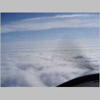
| Taking
off out of of KLUM, it was a nasty ugly cold grey day with lots of wind
and gusts. Talking to Bill who had just flown up from Rockford,
IL, the tops didn't sound too high so rather than bang around under the
clouds with 1000-2000' ceilings and yuck, I filed and blasted up to a
sunny day above and a great tailwind. It was a perfectly smooth
flight, ending with a VFR approach and landing. |
|||
|
|
|
|
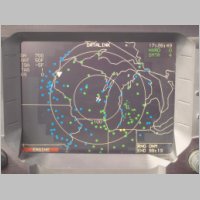
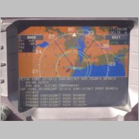
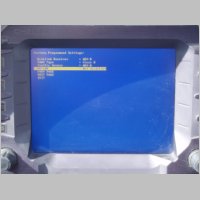
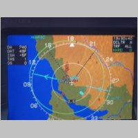
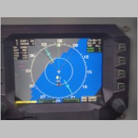
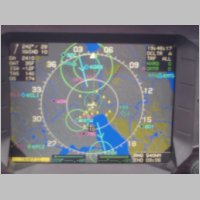
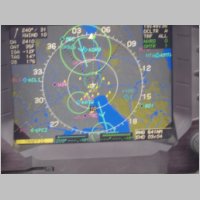
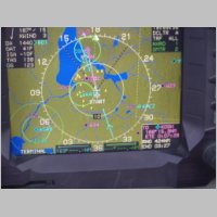
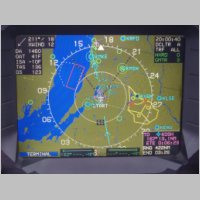
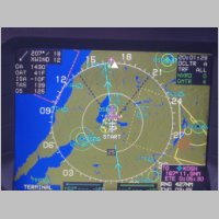
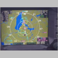
| I'll
have to explain the photos a bit. In the first photo above, you
can see the grey/black shaded background areas that show the ADS-B
weather depiction coverage that is provided by the KOSH ground
station. So the weather didn't give me US-Wide WX, but this photo
was taken on the ground, and it shows the Datalink page with the
current weather conditions at airports around the area. In the
2nd photo, we pulled up the TAF for Chicago O'Hare, just to see if we
could get a TAF. The weather updates came VERY quickly. The
3rd screen is the config screen on the Chelton, showing the traffic and
weather system both being set to ADS-B. And the 4th photo shows a
traffic target at the 5 o'clock position that we saw while we were on
the ground. One thing to keep in mind when looking at traffic in the following photos is, this unit was set to NOT filter traffic based on distance from us. Therefore we could see traffic even 100 miles from our present location. It COULD be set this way if the user requested it, but most users will not want to clutter the screen with traffic that is that far away. Also let me apologize for one thing in all the photos below...it was a VERY turbulent and bumpy day for shooting in-cockpit photos, and all of the phots from here on were in-flight, so many didn't turn out as good as I'd hoped. |
|||
|
|
|
|
| For
this set of photos there are a couple of notes as well. In the
first photo, we found one good thing about our "live" testing...we were
picking up a traffic target that was trailing us by just over
.25nm...but the target was us. This is an effect of the
inaccuracies of the Radar station, and how it places you as a target
for ADS-B in relation to the traffic that is sent from the GTX-330's
Mode S TIS. In short, since I have TIS in the plane with my
GTX-330, the system sees 2 targets, and the NavWorX receiver has to
filter it out that you are not 2 planes. You DO want to see
planes at your position that are above and below you, or coming at you,
but traffic that is at your exact position or very very close to it,
traveling with you, is probably not traffic that is going to hit
you...so you don't display traffic that is or could be YOU. So
based on our findings on the local radar, they're going to slightly
adjust their filtering for these duplicate traffic entries. The
2nd and 3rd photos show some traffic that we had on the display, and
the 4th photo shows the portable receiver and temporary wiring
connections, with the system sitting on my glareshield. |
|||
|
|
|
|
| In
these photos above you can see other various traffic hits, and note the
range ring on the circles...you can see we're picking up traffic WAY
far away. It wasn't a busy day for seeing traffic, as it wasn't a
fun day to just be flying around for "pleasure".
Unfortunately, other than a couple of tiny areas, there wasn't any bad
weather to show on the NexRad, so I don't have a great depiction of
that, but if you look closely at some of the airports, you'll see that
they have blue or green fill to their circles, indicating that we're
receiving the weather conditions for those airports. You can look
up what current winds and altimeter settings are for many airports
along the route. |
|||
|
|
|
|
|
|
|
|
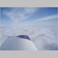
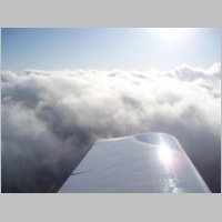
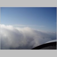
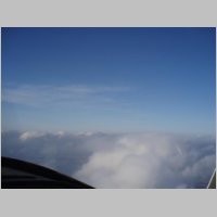
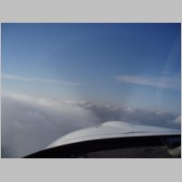
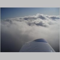
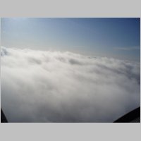
| Then
at the end of the day I was pleased to see that the clouds only
extended about 15 minutes from KOSH to home (about 155nm), so I got to
have a fun climbout and a great trip home. Being a colder day in
Wisconsin, and being alone in the plane, I was once again surprised at
the performance of the RV-10. I don't fly alone that much, so it
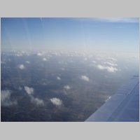
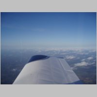
is amazing to experience it again. The plane climbs at a very
steep angle, when at light weights, and I was climbing over 2000fpm for
a while. I blew out the top of KOSH's airspace within 3 miles of
takeoff, so I got a frequency change and kept climbing. I weaved
my way through a good hole in the clouds, and kept climbing.
Within about 6 or 7 miles from OSH I was at 6500', and then about 9
miles I was at 8500', leveling off for the trip home. I faced a
45kt headwind on the way home, but the trip still was pleasant in the
perfectly smooth air at altitude. |
|||