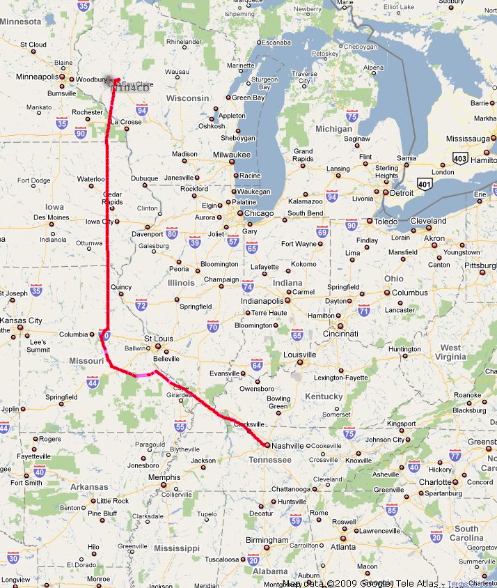
Christmas 2009 - Cold Flying to Florida
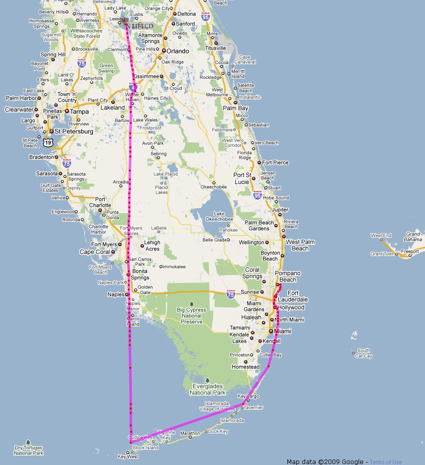
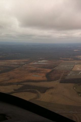
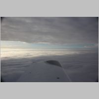
Completed 12/27/2009 - Approx. 580 hoursWith no real vacations for a few months, and work pressure in full swing, we really wanted to get out of town for Christmas. Other years we've traded wings for skis and headed out skiing, but this year the snow just wasn't what we needed if we were going to have a good ski week...although it dumped on much of the country while we were in Florida. Living in Wisconsin I've always had a hard time planning flights for long trips during this season. I've always been a bit paranoid about icing (which most would say is with good reason), so I've often just chosen to fly VFR underneath if I were going to go anywhere. I've picked up a pretty good coating of clear ice in a wet cloud at 0 degrees F before (in another plane), which caught my attention in a hurry, and so I've been very cautious about cold weather IMC flying in the RV-10. This trip though would teach me a little more about realistic weather conditions in mid-winter, and how they come into play with the RV-10's performance...and, that sometimes I should re-think my strategies of summer when flying in the winter. In the summer, and around heavy scattered rain or thunderstorms, I stay completely VFR almost exclusively, choosing to fly VFR underneath if there is any question of proximity to highly convective weather. The last thing I want is to be stuck in the clouds and flying into a storm cell. I started this flight with some residuals of that attitude about the clouds. My thought was that I didn't want to spend ANY time in clouds where I would have to be stuck in a cloud layer...on top is ok, underneath is fine, but I wasn't going to let myself get in a position where if I were picking up ice, I was going to have to fly an emergency approach. As it turned out, I didn't have as much to worry about as I thought. I'll continue inline with the photos...
 |
 |
 |
 |
| In
the
morning
I
spent
a
lot of time scouring the weather on the internet
and through my Foreflight software on the iphone, and tried to look at
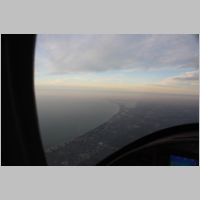
every bit of weather imagery I'd need to make a good go/no-go
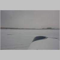
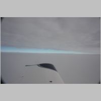
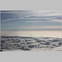
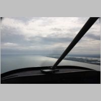
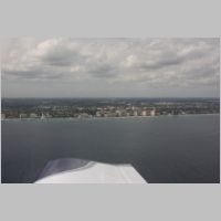
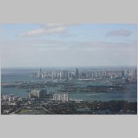
decision. The weather outside wasn't very nice on the ground, as
you can see in the first photo. Nothing horrible, but the sky
didn't seem to be the place where you'd want to be. But, the
pireps and info I got from Voyager's flight planner had all showed me a
couple of key things, and they were backed up by the briefer I talked
to....the cloud layer topped out between 4,000' and 6,000', which is
only about 3-5 minutes MAX for my climb, and although the clouds
extended for 1/3 of our trip to Florida, we could have a 30-50kt
tailwind if we got what was forecast. So off to the airport we
headed. I reasoned that the total time in the clouds on climbout
would likely be under 3-5 minutes at the RV-10's climb rate, so even
though there were some clouds and it was below freezing, the time spent
in the clouds should allow me to get to a good cruising altitude with
not much icing worries. To be extra safe, when I decided to call
clearance delivery on the phone instead of post-takeoff, and have them
request that my initial climb be directly to my assigned altitude, with
no intermediate steps. My request was granted and I was cleared
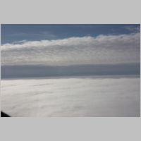
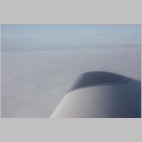
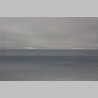
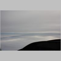
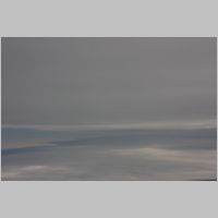
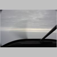
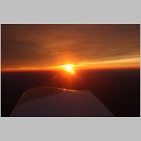
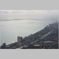
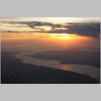
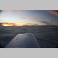
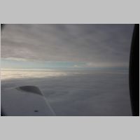
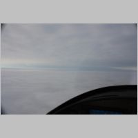
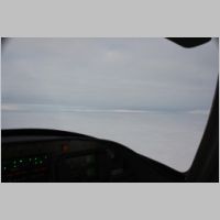
as filed, so we were on our way. Within 2 or 3 minutes max, we were on top of that ugly grey day, in much more comfortable and safer looking clear skies, zipping along with a good tailwind that was projected to pick up even more as we climbed. We did see just the smallest discoloration on the leading edge of the wings as we passed through 3000', indicating that the clouds contained enough moisture for very light ice to form at a very slow rate, but we were in the clouds such a small amount that you could barely make it out. As we cruised comfortably along at 9,000', high above the undercast, we could see in the distance that the plan would perhaps be changing shortly. To the East was still blue sky, but directly ahead we started to get another grey overcast...another layer of clouds above us, and with cloud layers at altitude, it's very hard to predict sometimes if those clouds 10 miles ahead are at or above/below your altitude. Since they didn't look too thick, and we brought our O2, I was prepared to go to 15,000' or more if necessary, to make this a clear-sky trip. I waited it out a few more minutes and it didn't take long before we had to make our next move. The clouds started skimming our canopy top....time to either decend or ascend 2000' to the next IFR cruising level. Well, down would have likely been fine, but the tailwinds were lesser, and as I looked up at the clouds, I could see a very sharply distinct round sun. I knew then that the cloud layer was thin, so I called ATC and requested 11,000' and they approved it. As I approached 11k, I called them again and said I thought I might still be just a little bit out of reach of the tops, and they said I could just keep climbing and they'd give me a block clearance from 11k to 12K'....perfect...a block clearance works out real well in that it gives you the latitude to go where you need to go. As we moved through that layer of clouds, we once again picked up some light ice, but this time it was enough to sparkle the windshield too, but at 11,400 we were out the top and in clear skies once again. |
|||
 |
 |
 |
 |
 |
 |
 |
 |
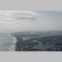
| Cruising
on
top
we
had
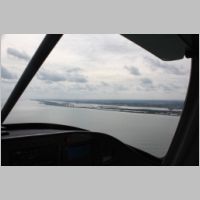
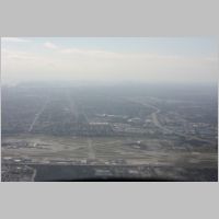
a great view of all the route of the flight, and it
looked beautiful. We were making good headway with groundspeeds
sometimes approaching 205 or more kts. Running LOP at between
9.5-10gph, we were getting anywhere from 155-165kts TAS, and had a
perfectly smooth ride. When we were about 45 minutes into the flight or
more, I did a quick range check of our total range available with full
fuel and we were only 5 minutes short of our destination, KLEE and our
remaining range was over 1000nm. That means that with one fuel
stop planned, we had no issues getting down there in record time.
|
|||
 |
 |
 |
 |
 |
 |
 |
 |
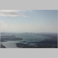
| We
stopped
at
one
of
the nicer little fuel stops along the way, KSYI,
where the fuel price was the lowest in the area, and we made a turn
time of maybe 15-20 minutes max, so in no time we were back in the air
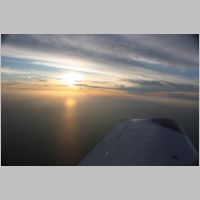
and on our way. As we fly past the Nashville area, we started
picking up ADS-B TIS-B traffic targets from our NavWorx ADS600
receiver. I wish we had ADS-B at our home field, because as we
left Shelbyville we could watch traffic departing the airport and knew
right where all the planes in the area were. As we flew over
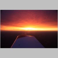
Georgia and Northern Florida, the sun began to set, giving us a great
view of the setting sun. We didn't leave early enough to arrive
in daylight, with the short days of winter, but the weather was plenty
good and the flight would be easy and uneventful. It was a record
speed trip for us, with about 1100nm flown, in 6 hours flat, including
all taxi time...which even with taxi time leaves us with about a 180kt
average
speed with the tailwind. What a way to fly! |
|||
 |
 |
||
 |
 |
 |
 |
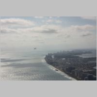
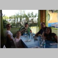
| The
next
day
we
decided that with a couple of days to play before
Christmas, we would go to Ft. Lauderdale and do some dive gear shopping
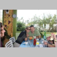
and meet up with those very famous RV-10 builders, Lenny and
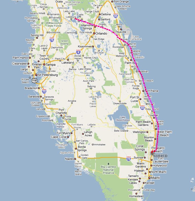
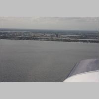
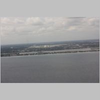
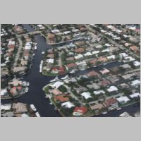
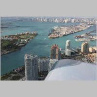
Hugo. To get down the coast, the most fun way to go is to fly the
coastline itself, at low altitudes, where you can go completely
VFR. To get through the Orlando area, I grabbed flight following
and got cleared through class Bravo for some of the route out near the
Kennedy Space Center. You could see the launch pads and
bulildings in the distance. Once out to the shoreline we just
kept flight following for much of the trip, staying just offshore, at
about 1000-1500msl, or agl...whatever you want to call it when you're
flying over the oceans. :) We took in the sights along the way
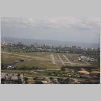
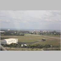
and soon approached KPMP, Pamano Beach airport, where we spied the
GoodYear blimp, out doing some flights. By the time we were in
the pattern, they were landing it on the field and we got a good look
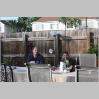
at it up close. We met up with Lenny and did lunch and some
shopping and then back to his place to meet Hugo for dinner. A
fun couple of guys and their gals, we had a good meal and prepped for
our next day. |
|||
 |
 |
 |
 |
 |
 |
 |
 |
| In
the
morning
we
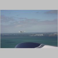
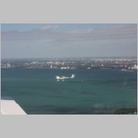
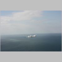
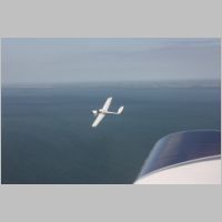
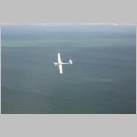
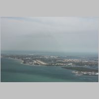
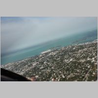
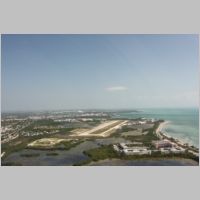
planned to fly down to Key West, again along the
coastline. Key west is very quick to get to by air, but miserably
long by car. We enjoyed the trip, trying to stay behind Lenny's
Katana for a while. It takes a lot of work to get an RV-10 to fly
that slowly...most of the time I was maintaining only 12-14" of MP, and
by my throttle quadrant, that's about 1/4 throttle. We literally
ran some circles around them as we took some aerial photos along the
way. Don't feel too sorry for Lenny's Katana though, as he'll be
graduating to the RV-10 soon enough. The Katana is serving very
well right now as a trainer for Lenny's wonderful lady. Below are
some aerial shots of the trip. |
|||
 |
 |
 |
 |
 |
 |
 |
 |
 |
 |
 |
 |
 |
 |
 |
 |
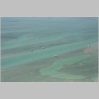
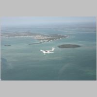
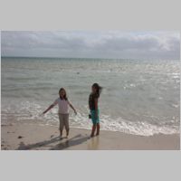
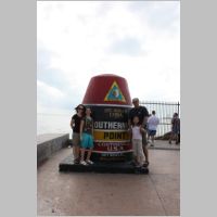
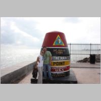
| Approaching
Key
West,
we
called Key West Approach and got cleared offshore through
the military airspace and for a downwind to KEYW. It was pretty
windy and very bumpy on the approach that day, but we all made it down
no problem. Once on the ground we took a cab to town. It's a
little pricey at $8 per head, but it seems to be the only way into
town....and the $8 only gets you one way. We had the cab driver
take us directly to a beachside restaurant, and then we walked to the
point and took in the town, making it just a short day in Key West so
we could get home as soon as possible after dusk to KLEE. |
|||
 |
 |
 |
 |
 |
 |
 |
|
 |
 |
 |
 |
| For
the
return
trip
we filed IFR direct, climing straight to 8,000' and
making the trip faster by shortening the distance, and also giving us a
neutral or very slight tailwind. As we neared 8,000' over the
vast water, ATC threw me a curve that I've never had to officially
completely do before...they called and said I should plan on flying the
Minnie.4 IFR arrival, which would allow them to predefine my flight
route through the Orlando area. Where I usually fly, and to and
around the airports I fly to, STAR's (Standard Arrivals) are not really
used often...they're mainly a tool for the big planes. Pilots
from the West Coast are much more familiar with them, but not us
flatlander Midwesterners. Well, when they asked if I had the
procedure on board, I said "Yeah, I'm pretty sure I got it, but can you
give me until I near the coast to prepare?" They said, "Sure, for
now just go direct RSW and that will be where you enter the
arrival." I didn't want to do anything to add to my workload
while over water until I was completely leveled out, trimmed out,
leaned out, and had things all set with the autopilot on. There's
just something about being over water that makes you take things slow
and easy. :) Well, I knew I had the STAR on board, because I had
my 2 favorite tools on board....one is Seattle Avionics Voyager.
I have every chart for the 48 states downloaded and updated at all
times, including all approaches and arrivals. I don't download
Alaska and Hawaii, because I know I won't be going there on the spur of
the moment, but the way we travel in the RV-10, we could end up in any
of the 48 states on a days notice...we don't plan our vacation
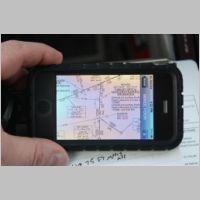
destinations very far in advance. The other tool I had was the
recently updated Foreflight Mobile 3.0 on my iPhone. The 3.0
version was just released before this trip, and I found the trip to be
the perfect opportunity to test its features. The added GPS
integration to IFR Low/High Enroute charts and sectionals, and they
added a good download manager to download each Sectional, IFR Enroute,
TAC and Approaches on a state-by-state basis. I could have fired
up the Voyager tablet to get the arrival, but as I didn't have a hard
IMC approach to fly, I figured I'd try using just my iPhone. With
Foreflight 3.0, I had the Minnie.4 arrival pulled up in seconds, and
was able to zoom and pan and read all the appropriate notes, and soon
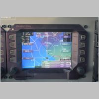
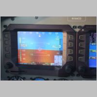
knew the details of the arrival. The Cheltons, by the way, also
had the whole arrival in them, so all I had to do was say I wanted to
add the Minnie.4 arrival on to my destination, with an entry at RSW,
and it drew the entire arrival into my flight plan, and calculated my
distance and fuel remaining and everything I needed to know. It's
always nice, and appropriate though, to read the entire chart and all
it's notes, to know the procedure. Oh, and the side benefit of
the trip...we got to see another sunset in the distance. ;) |
|||
 |
 |
 |
|
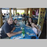
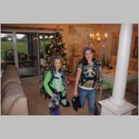
For Christmas, we hung out with family, the kids got to swim, which they always love, and they got a couple of their Christmas presents...the SCUBA gear we shopped for in preparation for their upcoming Bahamas trip we're going to take. We wanted to get equipment that would allow us 4 to travel with our own gear, and today there are some great lightweight options for regulators and BCD's, so we got the lightest and most compact eqiupment we could get to fit them.
 |
 |
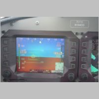
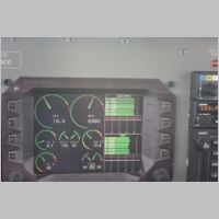
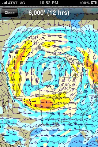
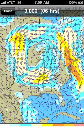
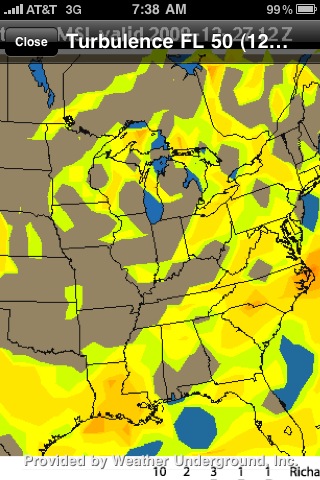
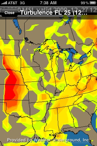
The trip home was going to prove to be the hard part, as usual. For some reason the weather always seems to disagree with us most when we want to go home. We had a very small window of even halfway good looking forecast, having dodged what turned out to be a real big winter storm by leaving from home just in time, and now, if we didn't get home quick, we'd be fighting weather for days. Winter is a little tougher to make trips that can be kept to a tight schedule. We left for home, knowing that we had some strong winds...see the iphone wind screenshots below.
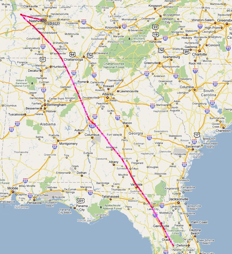
We ended up having to split the trip into 2 days, having passed Nashville and being in really bad turbulence, we turned and ran for a nearby overnight stop, in hopes that the next day would be better.
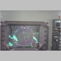
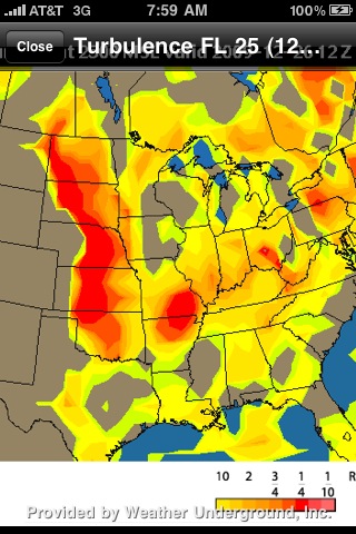
What I was HOPING for was to fly right into that big, massive circular counter-clockwise flowing air mass and ride a tailwind northbound, while trying to get myself into the center of it's core, where the winds were calm. It's like trying to fly into a hurricane that is hundreds of miles wide, but not nearly as severe. The turbulence charts below also how bad some of the areas of turbulence were expected to be. I feel that often it's best to go out and see what ACTUAL conditions are before giving up on a flight, because skies weren't real cloudy, it was just wind for much of the first half of the trip, and I reasoned that if I could just make Northern Missouri, I'd be in much calmer air, and that with the added tailwind I might be able to make it pretty quickly too. As it turned out, it was practically perfectly calm until we reached Tennesse. So we did get pretty far, but as we neared Nashville, we started to get completely pounded. I stuck it out for a while, reasoning that if we made it into the flowing air, it might be better...better than the air on the outer edges that is causing shear with the non-fast-moving air. But, we stayed with it for quite a few miles and it just wasn't working out. I tried down to as low as 800-1000AGL, and up to the 6000+ range. I would have tried for even higher, but I was so on edge thinking I'd probably be landing anyway, that I didn't try. That was probably a mistake though, because I could have easily found that at 10,000' it was much smoother. That was a mistake, but oh well. I shoulda tried.
So we plugged along in this awful turbulence until I finally gave up and we decided to just call it a night and hang out in Nashville. The kids love staying in hotels with pools...in fact, we often choose hotels over friends/families houses because we love a night pool and hot tub. So this was a good opportunity to relax and make the next day an easier day. We rented a car at KJWN, and used the iphone to find us a great hotel downtown with a pool, and free breakfast. In the a.m. we were on our way home again. Here is where I made another mistake on the trip. We started out climbing up VFR and got on top of a broken layer. It was comfortable and smooth. There was a large mass of snow around the St. Louis area, and it was directly in our path. I wanted to stay VFR because I thought a snowstorm that large would probably be taller than we could cross over top of. I also worried that if I went IFR, I'd be stuck up on top and have to do an extended approach in what may be icy snowy clouds. So I stayed VFR. I didn't call a briefer, but relied on everything I could find online for weather, to interpret it myself. That was another mistake. I'm sure that the briefer would have told me things that I could have used to make this leg of the trip easier. As that cloud layer went broken, I got below it, where we had a good headwind, and some lighter and very manageable turbulence.....but the problem was, to avoid that snowstorm I'd have to fly a couple hundred miles out of my way...doing it all into a headwind. We slogged it out, and used the WSI picture to fly right up to the edge of the snowstorm to check it out. I thought that if the visibility wasn't too bad, I'd cut the corner or maybe even cut straight through, as long as I could do it well within VFR standards and it wasn't going to be anything that would be icing. That was the plan. It worked out OK as far as the plan goes, as we entered the snowing area, the viz got down to VFR minimums and we were down to 1000-1200AGL. It was good enough to avoid towers and obstacles, but not great, so we pulled back out the edge of the snow and circumnavigated it more. As we got closer to a gas stop, which we picked using Voyager while in-flight, for it's cheap fuel, we cut through the edge of the snow again. It started to get to be worse vis again, but suddenly as we neared the edge of the blue on the WSI display, we started to see holes in the clouds and sun pouring through! It was then that I realized how stupid that plan was. Those clouds weren't high, and I would have been MUCH more comfortable, much faster, and have a MUCH nicer ride if I had just dug in and filed IFR and flew right over top. If I had known the tops, it would have been an easy choice, but I didn't get a good report on cloud tops...which is always hard to predict accurately anyway. We stopped at KMYJ Mexico Missouri, home of Zenith Aircraft, and fueled up, and filed IFR for home. Climbing out, I had to slap myself again as we very quickly cleared the tops of everything around us and were in perfectly smooth skies, well above any clouds. As we moved northward, it completely cleared below us too.
To give one more challenge to the trip, and add to a little more tension, we had what I knew would be a cloud layer over our home area. As we neared southern Minnesota, we had to move up to 10,000' from 8,000' to stay above all the clouds, which meant that I'd have to spend at least a little time in the clouds. Being in my home area was very comforting though. The airport about 15nm East of mine was reporting 4800 broken, while my home field was reporting 1400 overcast. So I knew I was going to fly an approach, but I also knew that it wouldn't be completely unbearable. ATC said that people had been going into the bigger airport doing visual approaches earlier, so it couldn't be too awful. As we got closer, the report went down to 4000 broken. I prepared for the approach and my plan was to stay as high as possible for as long as possible, to allow myself to stay clear of clouds as long as I could. They gave me a "pilots discretion" descent, so I held it at 6000' until I calculated that I could do a quick 1000fpm descent to the IAF of my IFR approach to my home airport. Once I got to that point, I did a quick drop into the clouds, and by the time I hit the IAF, I was in broken clouds, with occasional glimpses of the ground. No ice buildup at all. I could have easily cancelled IFR and gone in VFR at that point, but as it's always nice to talk to ATC and log an approach, I decided to fly the whole approach. A quick reversing turn, and I was set up for the RNAV-27 @ KLUM. The approach went fantastic, and I even got a good video of the whole thing that I may post here some day if people want to see it. As I approached to land, the runway was fully covered with light snow, so the entire airport was white. We retired the plane for the night.
 |
 |
 |
 |
 |
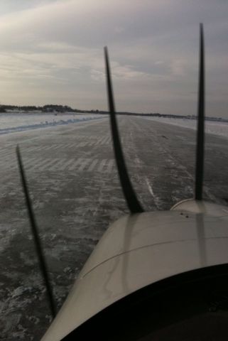
I was amazed a few days later when I went out for a flight. Our city-plowed airport was left unplowed for too long during that winter storm. They didn't even TRY to keep the freezing rain and snow from covering the runway. So once the light snow was gone, what I was left to see was a 100% iced over runway, covered with about 1/4" of solid clear ice. You couldn't even attempt a run-up as your tires would just slide under any power at all. So goes life in winter in Wisconsin! Funny that the other airport nearby wasn't icy like this....that's what happens when someone actually cares to plow right away.