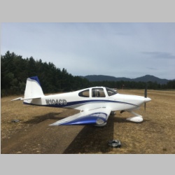
Eclipse 2017 - Trip to Oregon
Completed 8/22/2017With a once-in-a-long-time event such as the 2017 Total Eclipse happening, we had long ago planned this as a vacation week. I'd put it on the calendar back in late 2016 when I'd first heard of it, and planned to make it our biggest trip of the summer. Sadly, with Colleen heading off to college at the end of August this year, this would be one of our last trips where we knew the whole family could make it, so we wanted to get it on everyone's calendar right away. I've never seen a total eclipse before, but a few years ago we did get to see a partial eclipse with the kids through welding hoods. It was neat, but not so impressive as to be worth making a long trip to see it again. I wasn't sure how much different a total eclipse would be, but as the year rolled along, I had been seeing more and more information about it in various news articles, so my curiosity was growing. By July I'd seen some pretty impressive photos of other total eclipses (would that be eclipsi? :) ) and thought it could indeed be pretty cool. I had no idea that it would be as cool as it turned out to be, however.
In planning this vacation, our primary goal became our secondary goal, once we figured out where we wanted to view the eclipse. This one was going to cut across the entire US, starting in Oregon. In reading weather probability predictions, Oregon and Idaho were also the areas with the most likely forecast for clear skies. Once I heard that, our goals started to flip-flop. Our entire family decided that our primary goal of the trip would be to go see my buddy Ed and his family out in the Portland/Hillsboro area, with the secondary bonus being to see the eclipse. We would just depart Oregon and fly as fast to the East as we had to, if the weather forecast for Oregon was going to fall through. I was a bit skeptical about Idaho being an "ideal" location, because there are usually many forest fires in Eastern Oregon, and in Idaho, causing some smoke filled skies. This held true for this summer as well, as indeed there were fires around the Mt. Jefferson area which was nearly right on the line of totality. It would have been plenty visible, but the view wouldn't have been perfect all the way from the cascades into about Utah, as we later found that the smoke had blown hundreds of miles to the East....mostly to the area South of Mt. Jefferson.
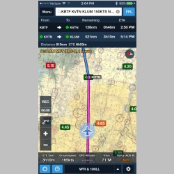
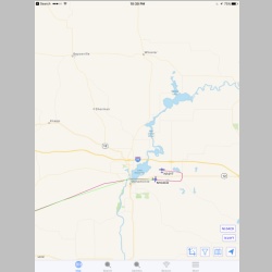
We had some other small goals for the trip as well. These weren't deal breakers if we missed them. One was to fly over crater lake, since we were in Oregon and had never seen it. This one didn't work out, if you check out this screenshot (also pictured below on the page) of the TFR's around crater lake. Another goal was to once again fly to Nehalem Bay and go to the Pacific Ocean for a quick trip. And another was to stop in at Johnson Creek, even if we didn't camp there. With a small set of goals, we didn't make much in the way of firm plans, other than to get to Oregon as quickly as possible. When Friday the 18th came, we loaded up and departed...
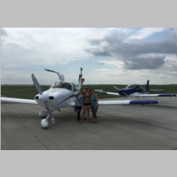
Only this trip had one very cool little twist to it. Originally we had planned to bring my parents along, but for a couple reasons that didn't happen. Bringing them would have required us to bring 2 airplanes. That would make this the first trip that Andrea, and also Danielle, could fly on a very long cross-country flight, without me in the airplane for much of it! We ultimately decided to bring camping gear along, and from past experiences when the kids were far smaller, that meant a very heavy RV-10, filling the back seats between the passengers all the way to the ceiling. Either that, or we bring 2 airplanes and for the first time ever, have plenty of space and much lighter loads. The RV-14 hauls a good load for the 2 people in it, but the RV-10 really shines as a 2-seater if you're doing a camping trip, so we threw the heaviest things in the RV-10. We filled the baggage area up past the seat tops, and filled the rear seats up nearly to the seat tops as well. As it turned out, it was really the best way to go for this trip, and it allowed us to pack without compromising on space or leaving things behind. When packing for camping for 4 in the RV-10, we even share a single travel sized tube of toothpaste to save weight, and our shower towels are single 14"x18" microfiber cloths. This time we could even bring real towels! With an RV-10 and and RV-14 to fly, this was going to turn into a real adventure!
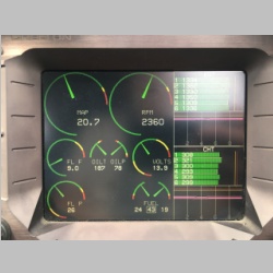
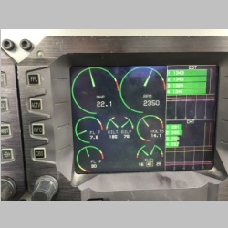
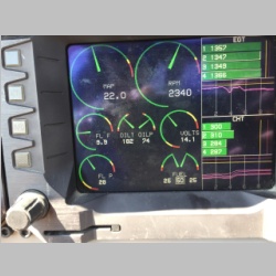
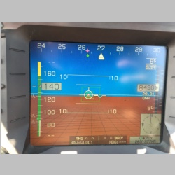
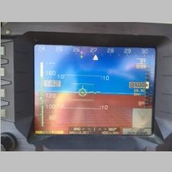
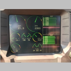
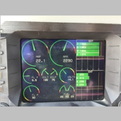
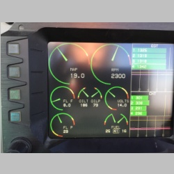
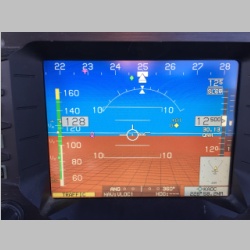
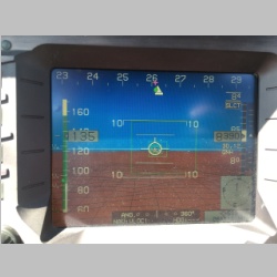
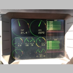
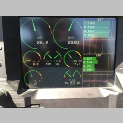
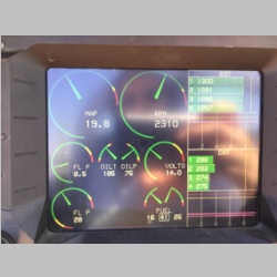
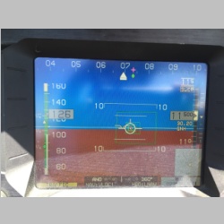
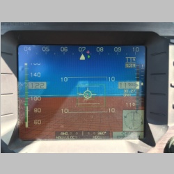
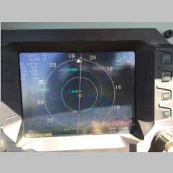
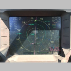
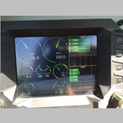
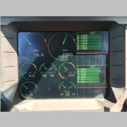
Most of the EFIS screenshots below are just for my own reference, to compare the two airplanes later when I get time to study the flight in more detail.
 |
 |
 |
 |
|||||||||
Departing KLUM, Andrea and Colleen flew the RV-14 while Danielle and I did a little cross-country skill work and did a cool ded reckoning, pilotage, and compass navigation flight. Her calculations put us right over the waypoints we choose, and right on top of the flyover destination airport we had picked from which we would continue via electronic navigation methods. It was the lowest weather we had on the trip, giving everyone the chance to stay out of the sun and route past the only real rainshowers we would see on the trip. |
||||||||||||
 |
 |
 |
 |
|||||||||
 |
 |
 |
 |
|||||||||
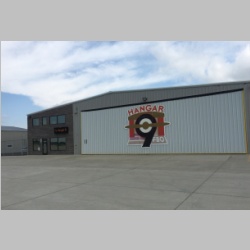
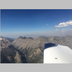
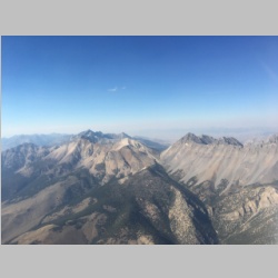
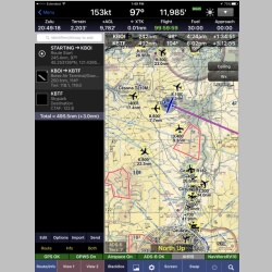
Our first fuel stop was Aberdeen, SD. (KABR) where we were greeted by a line guy from one FBO trying frantically to get us to taxi to his parking spot. We argued between the planes on where to go. I knew from past experience that hangar 9 was a nice FBO and they had better fuel prices, and hey, to all you FBO's out there, if there's a nice FBO with lower fuel prices than you have, that's where I'm headed. Once Andrea told the guy we were going to the self-serve, he quickly walked away, dejected. Inside Hangar 9 they had some great deserts, and it is a very nice FBO. Very happy to top off with them. I don't have any pictures of our second fuel stop, which was Powell, WY (KPOY). That turned out to be a pretty cool stop again...my first time having been there was last year in the RV-14 when going to Johnson Creek. It's an airstrip on a high plateau compared to the surrounding land, and there is a lot of aerobatic activity at that airport. In fact, we had to wait to land for some aerobatic practice to end, and we got to watch them fly while we topped off the planes. That leg from KABR to KPOY was the worst on the trip, being mostly over South Dakota and Wyoming, and during the afternoon. We got beat up by turbulence for 3 or more hours. Departing KPOY we chose to fly over KCOD (Cody, WY) and fly up the entrance to Yellowstone park, and right over top of Yellowstone Lake, continuing on to Idaho. We planned to only go as far as Johnson Creek for the day, to keep the number of hours in the air manageable for everyone. As we got closer to Johnson Creek area, we decided to skip a different Idaho fuel stop and just plan to get fuel at Cascade, ID (U70) before we headed to Hillsboro (KHIO) the next day. |
||||||||||||
 |
 |
 |
 |
|||||||||
 |
 |
 |
 |
|||||||||
 |
 |
 |
 |
|||||||||
 |
 |
 |
 |
|||||||||
 |
 |
 |
 |
|||||||||
 |
 |
 |
 |
|||||||||
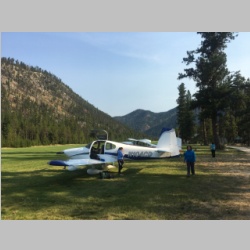
We parked the RV-14 at U70 for the night, loaded up only our overnight supplies and camp stove and food, and flew in to Johnson Creek in the RV-10. Johnson Creek is both an easy, and hard flight, depending on how you look at it. There are definite procedures to follow as you fly down into the canyon and land there, but, if you're flying a well performing airplane like we were, many of the normal worries are reduced a bit, as the RV's handle these high density altitude airports real well. The elevation is nearly 5,000' at Johnson Creek, but the RV's climb very well at those altitudes. Still, the procedures and proximity to terrain are things to learn before you go. I heard that there are even CFI's in McCall that you can go to and get familiarization flights with, before you go in. Prior to the trip, I wanted Danielle to be prepared for any short-field situation that she may run into, if there were any sort of emergency landing required. I also wanted to give her some experience that would test her skills. We ended up going to a friend's home grass strip with 1,400' of useable runway, complete with power lines at the far end of the runway, and trees on the approach end, to get some real honest-to-goodness short field and soft field practice. Below is a quick video of one of her landings at a longer grass field, and then one of the landings at the short 1,400' field, when we were practicing. |
||||||||||||
When we flew in and out of Johnson Creek this time, I had the camera running so I could document, mainly for ourselves for the future, the procedures and flight path used to go into and out of the strip. Here is a short video of that flight. |
||||||||||||
 |
 |
 |
 |
|||||||||
 |
 |
 |
 |
|||||||||
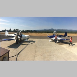
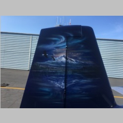
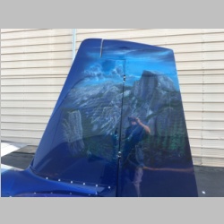
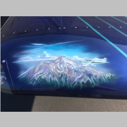
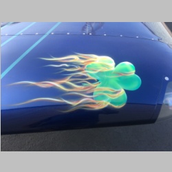
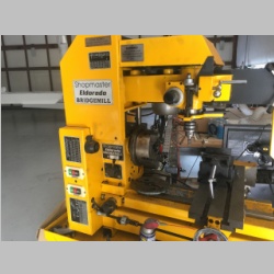
The next day after departing Johnson Creek we topped off both planes at Cascade (U70) and headed direct to Hillsboro (KHIO), excited to see Ed and his family. He had arranged a hangar for both of our airplanes while we were there. One of them was in his hangar neighbor's hangar, where we were parked next to a beautiful RV-7. Check out these airbrushed pieces of tail and wingtip art from that airplane! Below is a picture of a real nice little mill that I took...some day I just have to get me one of those! |
||||||||||||
 |
 |
 |
 |
|||||||||
 |
 |
 |
 |
|||||||||
 |
 |
 |
 |
|||||||||
 |
 |
 |
 |
|||||||||
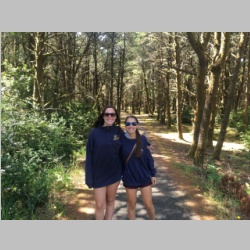
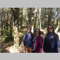
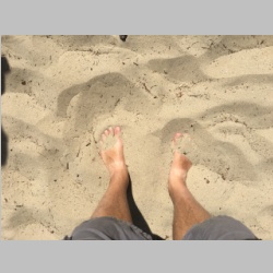
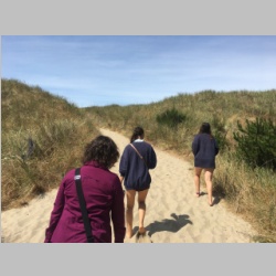
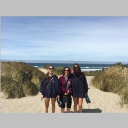
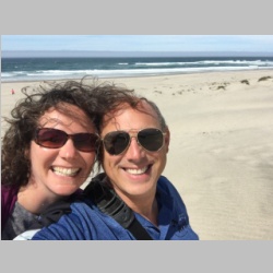
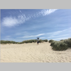
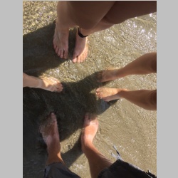
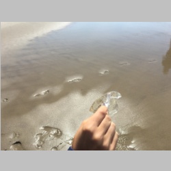
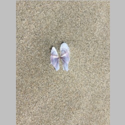
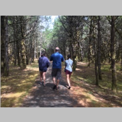
We quickly filled our first day in Hillsboro and before long it was time to turn in. The second day there, we decided to take the morning and head to Nahalem Bay (3S7) and see the ocean, since Crater Lake was out of the question. Here you can see the beach access from the campground area...an easy walk from the airfield. There were also some very huge and tasty blackberries along the road while walking to the campground. On the beach we found some interesting jelly creatures of some sort. Not exactly sure what they were. The path thru the woods to the campground was also spectacularly beautiful, with moss covering the ground and trees. It looked like something out of a movie. From Nahalem Bay we went to Scappoose (KSPB), but traveled there by first going North along the shoreline to Astoria, and then following the Columbia River to Scappoose. It was just a fuel stop, but it was nostalgic for me, because that's where I had my first pre-briefing when doing RV-10 transition training back in January 2006. |
||||||||||||
 |
 |
 |
 |
|||||||||
 |
 |
 |
 |
|||||||||
Eclipse Time!
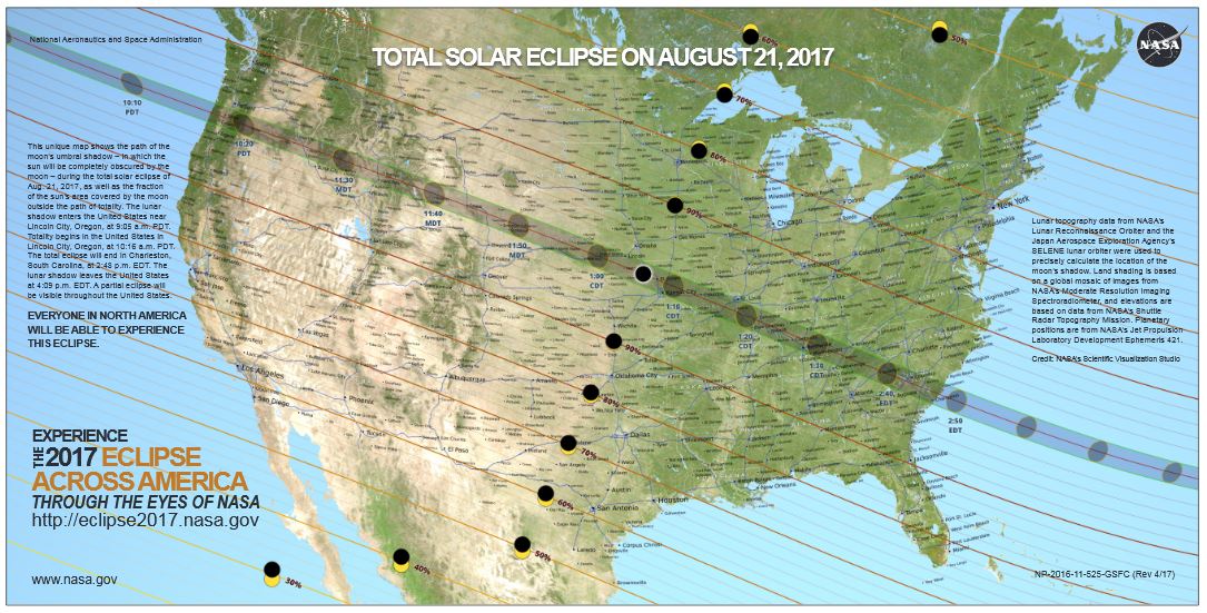
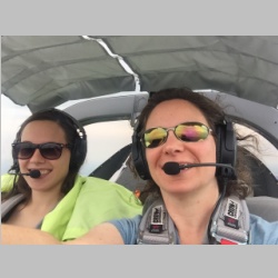
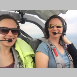
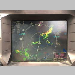
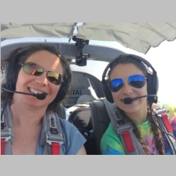
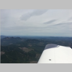
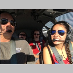
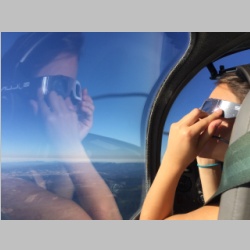
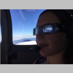
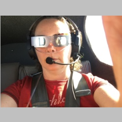
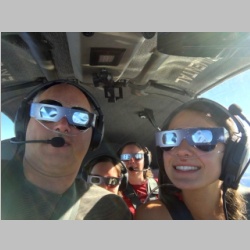
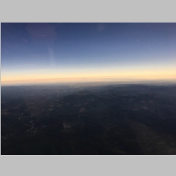
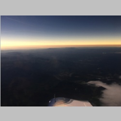
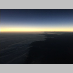
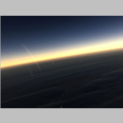
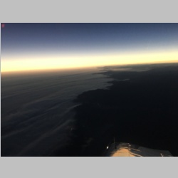
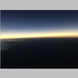
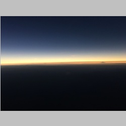
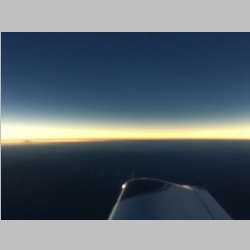
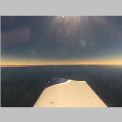
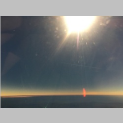
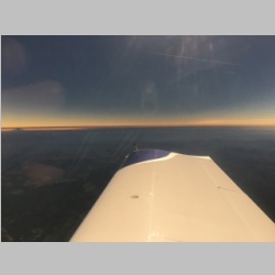
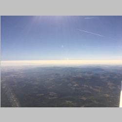
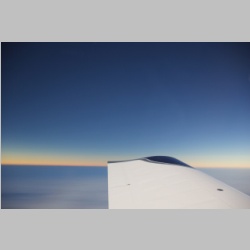
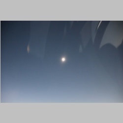
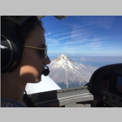
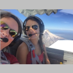
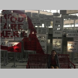
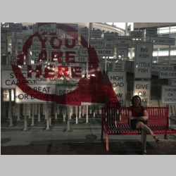
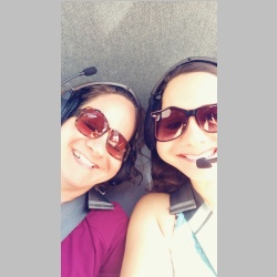
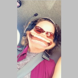
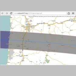
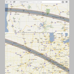
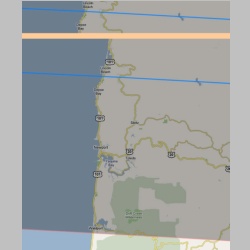
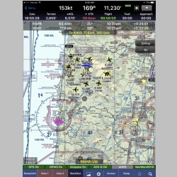
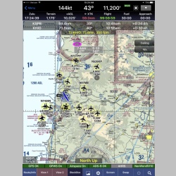
The next day was the day of the eclipse. In Oregon, this meant setting the alarm and waking up "early"...well, early for teenagers anyway, to make sure we had breakfast and were off the ground by 9:00am. The totality time was 10:18am, and we had about 20-30 minutes to fly to the area that would experience totality. Above and below you can see everyone playing with their eclipse glasses. We had bought them ahead of time, which was good because prices rose drastically once they became hot items. Oregon was all in eclipse frenzy. You could even buy glasses at McDonalds out there, and basically every town near the line of totality was experiencing backed up traffic of many hours, as every person in that area of the country was planning to watch the eclipse, many getting as close to the line as possible. Here are some pictures showing where the line of totality was going to be for that portion of the United States.
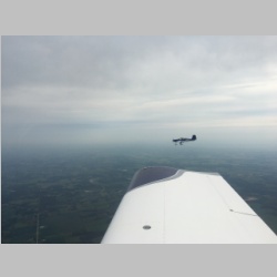
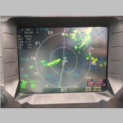
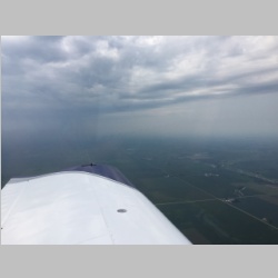
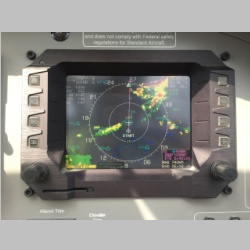
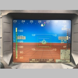
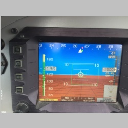
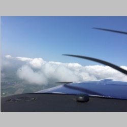
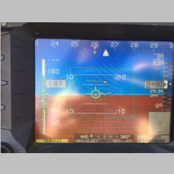
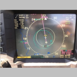
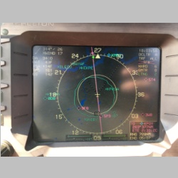
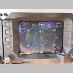
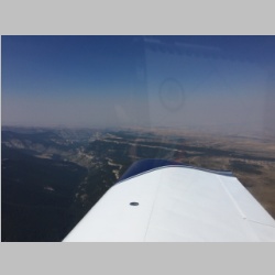
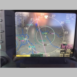
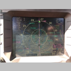
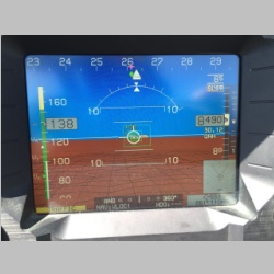
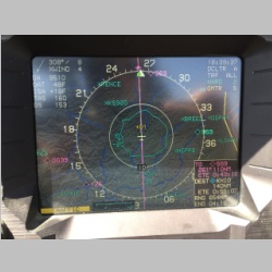
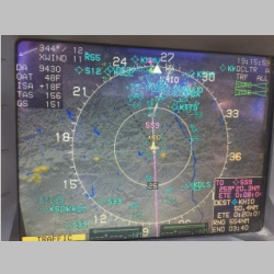
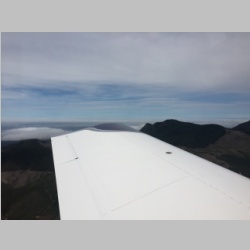
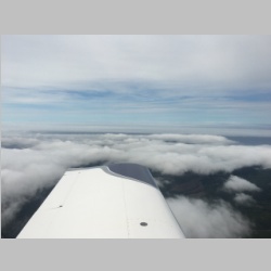
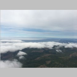
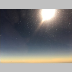
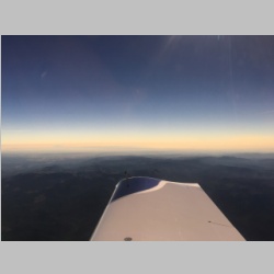
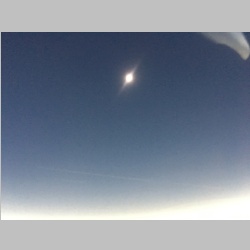
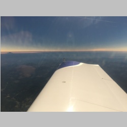
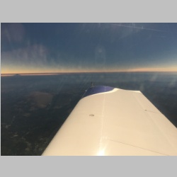
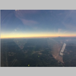
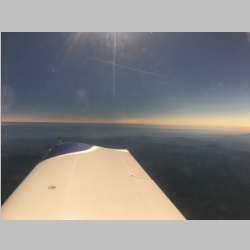
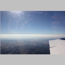
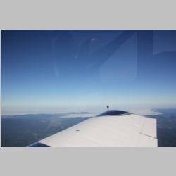
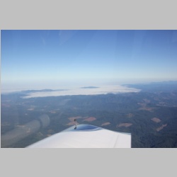
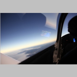
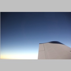
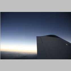
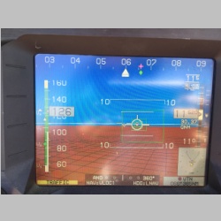
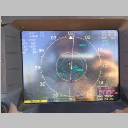
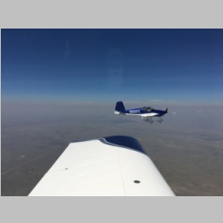
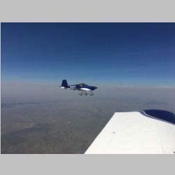
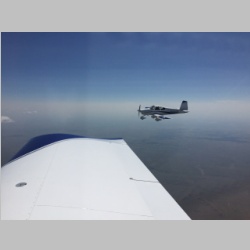
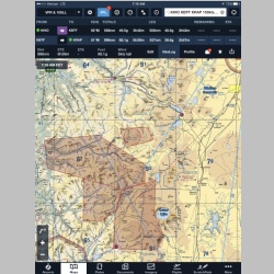
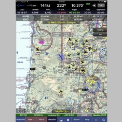
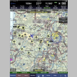
We had brought Oxygen on the trip, and with the number of airplanes that were going to be flying in the area, we decided to be as safe as possible. This meant donning the Oxygen and climbing over 10,000' so that we would be away from the lower-leveled masses that didn't bring Oxygen along. I will really be happy when ADS-B is fully required in 2020 (in some areas), so that most planes are equipped. My screenshots do not do justice to the amount of traffic that was flying along the line of totality. There were others I've seen in news articles that have many more targets showing. My system is set up to I think show the 12 nearest targets or so. As we arrived at 10,500' over the line of totality, I initially was going to try to program in user waypoints and fly a box or triangle pattern in the sky, using the autopilot, so that I could scan for traffic rather than any of us having to fly by hand AND watch for planes. I realized soon that the easiest way to do this whole thing would be to set ONE user waypoint and then use the IFR capabilities of the EFIS to fly a "Hold" from that position. I set to 1.2 to 1.8 minute legs which I will not do next time. Next time I will do 30 second legs instead. We originally didn't want to be turning all the time, but, as I was to find out, when totality hit, it hit QUICK! Had I known that, I would have wanted to keep the legs short to give everyone the most time to see the total eclipse while we revolved. Originally we did our hold more inland, but there were a LOT of planes around us. 2 of them were not showing on ADS-B...and one of those came within maybe 100-150' of our altitude and maybe 1/4 mile or less of our position. We watched him like a hawk as he approached. Looking at my screen I saw traffic ALL around me, above and below, and we saw less over the coastline. I started to think that maybe we would be better going over the ocean, because many people would not want to fly over the water if they could avoid it. So, I headed West over the shoreline. The funny thing was, once we were there, our plane was just as surrounded by airplanes. I realized then that since I was only showing the 12 nearest targets, that I had just moved into a DIFFERENT group of airplanes. Oh well, it was plenty comfortable when you could see them on your EFIS and know where most of them were. So we did our HOLD there and waited. Then the amazement happened... For a long time the sky starts to dim, but even when there is a sliver of light coming thru, it's FAR FAR brighter out there than when you have totality and the sun is mostly covered. That part comes on SUPER quick, and we were caught fully unprepared. On second it was light, the next it was dark, and we were scrambling for our phones and cameras. The darkness was darker than I had imagined in being, but still also plenty light to safely navigate the skies without losing references. We also had our Position and Strobe lights, and landing lights on so that anyone could see us. As we flew around in the darkness of the eclipse we were all completely amazed by the sights, as you can see from the video below. I clipped a few short segments from it, but most of the totality is on the video, and it only really lasted a couple of minutes. One of the most interesting things is that the ocean was one of the most phenomenal views, with it's cloud cover, that we could see. That and the cascade mountains and volcano mountains in the East. Also, while we were real dark during totality, since we were high in the sky, we were lit up by the emerging light before the ground around us was light up, once the sun started peeking out. That cast a beam of light on our airplane that made it look like someone above us had a spotlight on the wings. It was truly incredible. I cannot imagine that a total eclipse would be anywhere NEAR as spectacular from the ground as it is from the air, because while the eclipse is neat to look at, the REAL incredible views are of the land AROUND you. And in our case, we were in some really truly fantastic looking scenery. It really made the trip to Oregon worthwhile. I think anywhere that you could be around oceans and/or mountains, would be your best scenery for something like this. And then as fast as it started, it was over...and everything started to turn light. |
||||||||||||
 |
 |
 |
 |
|||||||||
 |
 |
 |
 |
|||||||||
 |
 |
 |
 |
|||||||||
 |
 |
 |
 |
|||||||||
 |
 |
 |
 |
|||||||||
 |
 |
 |
 |
|||||||||
 |
 |
 |
 |
|||||||||
 |
 |
 |
 |
|||||||||
 |
 |
 |
 |
|||||||||
With the eclipse behind us, we made tracks for Twin Oaks for fuel, then a short hop to KHIO to load and top off both planes and blast off for the East. We wanted to ensure that weather would not become a factor for us in getting home, and that generally means getting past the rockies. We didn't want a long day, so we opted to head to Salt Lake City, specifically to KBTF, to spend the night. No reservations, but we could figure it out once we got there. Idaho was also an option, but being anywhere on that line of totality for the night might mean crowded hotels, lack of rental cars, or who knows what. In fact, we found out that even though Salt Lake City was not on the line, they were out of rental cars due to people renting them to drive to Idaho to see the eclipse. Sean came to our rescue, and we were able to meet up with him and his wife, and we were soon set up with a car and a hotel for the night. We got to spend a nice evening having dinner in SLC, and walk around the downtown a bit before turning in. In the a.m. we had a spectacular breakfast at the Sunshine Cafe in North Salt Lake...truly perfect breakfast there, and then headed to the airport to get out of town before noon. Once you get to noon or 1pm, the clouds can build over the mountains. Additionally, we could end up with another bumpy ride over Wyoming. |
||||||||||||
 |
 |
 |
 |
|||||||||
 |
 |
 |
 |
|||||||||
 |
 |
 |
 |
|||||||||
 |
 |
 |
 |
|||||||||
 |
 |
|||||||||||
As it turned out, we were able to stay at 11,500' nearly all the way from KBTF to home, getting only a few segments with some bumps, but using Oxygen for the entire day's flying. We stopped at one of our common fuel stops...KVTN, Valentine, NE. There they have nice runways, 2 of them in fact, and have a couple of courtesy cars with restaurants within a mile of the airport. It makes a perfect place to stop and top off on the way East or West.
Later that evening we ended up back at home. I had a fantastic trip, and the ladies got to complete a very good sized cross-country flight in the RV-14. It was good experience for everyone. Now we're not sure where our next adventure will be.
One thing I can tell you for sure though...in 2024, when there is another total eclipse on April 8th, I will definitely be flying and filming...perhaps this time it'll be over Maine or Vermont or by Niagara Falls!
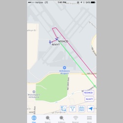
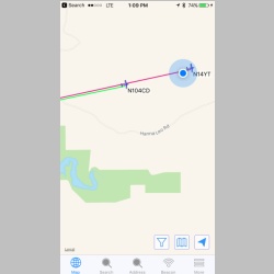
One side note on apps: I've been using the APRS.fi app on the iphone and ipad. It does a great job tracking our APRS tracks, and can even show the 2 airplanes simultaneously. Pretty neat indeed.
 |
 |
 |
MyRV10.com Home | N104CD Home | MyRV14.com Home