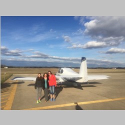
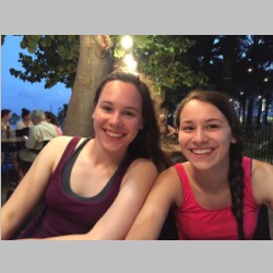
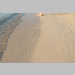
Cayman Islands 2016
Completed 3/2016
After last year's disappointing year of poor diving weather in
the Bahamas, I was really interested in making 2016 the year for
a great SCUBA diving vacation. The Bahamas has some
fantastic diving, but I wanted to get somewhere that would
definitely be warm in March, and offer year-round good
diving. Having been to the Cayman Islands 27 years ago, I
knew that the Caymans offered some pretty great diving.
And being a pilot, I've always heard of the "Cayman Caravan",
which means that small GA airplanes actually can get there, so I
decided that should be it. I waited far too long into 2016
to even book anything on this trip. I had been busy at
work all day and busy building the RV-14 many nights, so I
hadn't had any real amount of time to research the trip.
It got so hard to get time to plan that I almost threw in the
towel and went to the Bahamas again...something that I'm now
confident that I can throw together pretty easily. But
what turned it around for me was when I took a half hour to
check out Caribbean
Flying Adventures. If you are doing any googling of
terms like "Cuban Overflight" or almost anything related to
flying GA airplanes in the Caribbean, you will end up on that
website. It's run by a guy named Jim that was very helpful
for me. Keep in mind that when I was planning this trip,
it was January, and we flew there in March...so I had no idea if
hotels, dive operators, or anything else would be available with
the Spring Break rush. This was also the first year that
our kids have ever had a true "Spring Break". Our school
system is great, but they are ignorant...they don't realize that
if you don't plan a week off in the spring, people will pull
their kids out at random times. This year they finally did
it, which gave us one single target week for the spring.
(and sadly, next year they are not doing it again)
At any rate, I decided to call Jim at Caribbean Flying
Adventures, and just ask some questions. He usually runs
Cayman Caravan trips, and also does trips to Bahamas, Dominican
Republic, Puerto Rico, and more recently, Cuba. So if
there is anyone who knows their way around, it's Jim. He
assured me that flying to the Caymans would be easy, and fairly
hassle free. He also offers a huge benefit that is very
worthwhile. If you pay the $40 annual fee for his website's
members area, he will give you for $Free$, one Cuban Overflight
permit. Although I'm not sure if the permit actually costs
any money if you're a private, recreational GA pilot, flying
your own plane, and it's < 6,600lbs gross weight, he will get
you one round trip permit per year if you are a member. If
you fall into any of the categories that require a paid-for
permit, it requires a wire transfer in Euros to a bank in Panama
through a bank in Germany, and wire transfer frees alone can add
a lot of cost to the permit. As I said though, I don't
know if my permit would have had any fees, but by paying my $40,
I felt good to be able to get my free permit, and call Jim a few
times with my dumb questions. So if you're going, just get
the membership and make it easy on yourself.
Although we've done the Bahamas many times now without a life raft, we thought it would be a good idea for this trip. First of all, the Bahamas are maybe 90 miles max between mainland and islands. Shorter if you count the island of Bimini which is right under you as you cross. So maybe 50 miles is about all you have to really be, away form land, at any point. For the crossing to the caymans, you have maybe 90 miles to Cuba, and then after crossing Cuba's mainland, there's one small island you hop over to, but then it's a bit over 130nm to the Caymans, with nothing out there. And when you think about it, for the initial portion of the trip to Cuba, you are still at least near where the U.S. Coast Guard would potentially look for you. Once you cross Cuba, you're probably going to be dealt with by Cuban Coast Guard, or maybe Caymans, and they may not have quite the level of equipment to get there as quickly and accurately. So you need to be ready to be in the water for a while. (Incidentally, one of the dive operators told us that the week that we were in Caymans, a family on a boat "went missing" and hasn't yet been found. The Cayman police boats are Hurricane capable boats, capable of being flipped upside down and righting themselves again, traveling into hurricane seas....yet he said they refused to go out and find the family because the water was too rough. And when we were there, it was barely rough at all, even on the worst side of the island it was not that large for waves...so you can't necessarily trust the Police or Coast Guard to get you in some countries. In fact, even in the U.S. I have been stranded in Lake Superior, 35 miles from the mainland, and the U.S. Coast Guard refused to come help...because we were stranded, but alive and our life wasn't yet in danger. Why do we pay taxes for their support if they aren't willing to help us unless our lives are in imminent danger?
The normal solution to this "keep yourself afloat" is to 1) have life vests (which we always do on water trips), and 2) carry a life raft. This is much more complicated and expensive than you would think. Do the research and you'll find out. The smallest and lightest life raft we could buy, was $1200, and was the Revere Coastal Compact 4, designed NOT for open seas but calm coastal waters and lakes. It was un-covered, and less heavy duty. It was also 16lbs (if you get it with no canopy) and is 16.5"x13"x5" (Roughly the size of 2 briefcases taped together) Keep in mind that this is the LIGHTEST and smallest you can buy, and also one of the very cheapest. If you truly went up to a model that was covered, and double tubed, rated for open ocean, you're looking at a raft that will probably cost $5000-6000 minimum and will be much larger and weigh more like 60-70lbs. Given that we had 4 people, with SCUBA gear for 4, and the most minimal luggage we ever packed, this just wasn't going to work. To be accessible, you'd have to carry the raft on someone lap. If it were in the back seat, you'd have to consider "How am I going to get this out of the plane?" if you need it. So it would have to be kept up front. I mocked up a block of foam the size of the $1200 raft with 16lbs of lead in it, and handed it to my wife, and said "Hold this once.". She got the point immediately that it wasn't something that she'd want to carry on her lap the whole way.
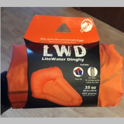
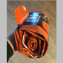
So what then? I mean, if you think about it, your #1 goal is to stay afloat. #2, stay out of the water so you don't get cold. After that it's still life-threatening, but less urgent...you have things like 3) Keep out of the sun, and 4) keep hydrated, and 5) have food available, and 6) have communication. Break it down and your mind starts to think it through further. I mean, if you had a $20 kids life raft, would that not keep you afloat? Or even your queen sized air bed at home...? Honestly, for small GA airplanes, I'm not so sure that "certification" of a life raft is a worthwhile, or even a desirable thing. Just as certified planes add an enormous additional cost over experimental planes, yet often provide LESS performance and safety than what a brand new well-built homebuilt would provide, I had to think there was another option for rafts as well. Something that could keep you alive, yet trim off the frills. Considering that we already will be wearing life vests (if we survived the crash), I'm plenty happy to spend my many hours of waiting for help, blowing up by mouth...which saves a bunch of added weight in the inflator mechanism. And, I am ok to live without ballast like some rafts have. If you've been to a water park, you know that an un-ballasted waterslide raft would be better than nothing while on the ocean. I started googling "lightweight raft" and came across a new term to me. "Pack Raft". Yes, this was what I was looking for. A lightweight, back-packable, raft! Something that a person could use to stay afloat, but at minimal weight and size. We read reviews, looked at prices, and decided to go with these...much more bang for the buck. These are the Klymit Light Water Dinghy...a 35oz raft that is about 10" long, in a 5-6" diameter roll. That's just over 2lbs per person if you bought 4, and, we're pretty sure that we could put 2 people in one, in a pinch, at least for the small people. They're made for class 2 rapids or calmer, for getting down or across rivers while you backpack. Having spent some of my youth hanging on to a tube behind a boat that was trying to throw me off, I knew that this would be good enough for me to stay afloat on the open ocean. So we bought 3 of them. They were approximately $150 each. If this company only made a 4 person, no frills, round raft, I would buy it in a heartbeat. I'm sure it would be cheap, light, and work just fine. It gives you the ability to have something small enough that you can put one in each lap, and have everyone take their own raft with them as they exit the plane. Now you won't have the situation where maybe 2 or 3 people survive the crash, but the 4th person was required in order to get the one raft out of the plane, also. And, they came in orange, to be easily spotted by air.
 |
 |
 |
 |
 |
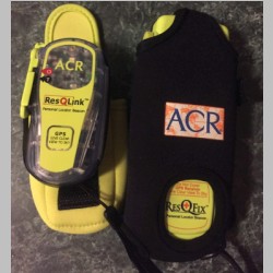 |
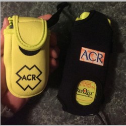
With the raft out of the way, it was time to dig up my ACR PLB from 2007. It's been in the plane since we bought it. The batteries are supposed to be changed every 5 years (although being long-life lithium CR123A batteries, I'm guessing that if you don't use it, it'll last longer than that in a pinch...at least it's not likely to be useless). I had never replaced the batteries, and these days there are smaller/lighter units available, so I decided since I'm going to have 2 planes anyway, I'd buy a new one for the RV-10. I got the ACR ResQlink...the NON-Plus model. The Plus model advertises as "floating", but some users say the non-plus also floats (although maybe it depends on fresh vs. salt water), and it's thinner and smaller packing. Also, they have neoprene cases to make them float, and I figured I wouldn't want to be without the case anyway, because these are going to get tossed in the baggage area, and I want them protected. So I opted for the smaller/lighter non-plus model, with a bright yellow pouch to protect it and float it. As for my old one, battery replacement is an obscene $135-150. It's just 2 packs of 3 CR123A batteries, with spot-weld tabs making a stick of 3 batteries. I can have 2 packs custom made for about $50-60. Too bad I can't spot-weld them, because the batteries themselves I can buy for about $15 for all. Once I get fresh batteries in that one, it'll be ready to go into the RV-14...but I think PLB's are definitely something to have. Just remember, you MUST register them every 2 years. I still have my SPOT, but I refuse to pay their price of $100 for something I may want to use one week a year. I'd gladly pay $25 a month though, if I could go in one month subscriptions, for a trip like this. Too bad SPOT just doesn't get that. APRS won't be of much use once you get away from the mainland, as it relies on HAM radio's being able to hear your transmission...so we don't expect that to work on Bahamas flights.
One more note about ditching and survival...
This trip did mess me up a little at times, when pondering the
whole water-landing thing in an RV-10, I kept picturing it over
and over, trying to figure out how in the heck all 4 people
could easily survive in an RV-10 water crash. It's almost
a guarantee that you'd be upside down after you hit the
water. And with that, you now have 2 kids in the back seat
and 2 people up front, who are instantly hanging from seat
belts. If everyone is lucky and conscious, great,
but... Consider the doors. If you DID open the doors
before you crashed, the water will flood the cabin almost
immediately. So you may be conscious, upside down, with your
head under water, unable to see your PLB or life raft or other
people. Now you have to unbuckle and exit, which is easy
if you're up front. But if you're in the back you have to find
your way thru the little gap behind the front seats, or figure
out where the seat release is, while you're upside down, so you
can tilt it forward....IF the fat guy up front is out of your
way. So being in the back could be a real challenge.
Now, you COULD try to kick out the windows, but from what I've
seen of that window sealant, that won't be easy. You COULD
carry an escape hammer with a pointed tip to break the plex, but
are you going to get one for each person in the back
seats? So I just am not so confident that those in the
back would survive, without a lot of luck. And, being a
parent in the front seat, you know how it goes...there's no way
I'm leaving the plane without knowing that the kids in the back
are coming out too. In fact, I'd say that if I didn't know
the kids would make it, I'd probably rather stay with the plane
anyway...it would be easier on me that way. The RV-14
should be a little friendlier from an escape standpoint,
provided you do carry an escape hammer. The bubble canopy
would be pretty easy to break thru I bet. Now, if you
could keep the RV-10 upright in the water, that changes
everything. But from everything I've read, that will be
tough. All in all, I hate to throw these comments in
there, but, if you travel with kids, you should probably take an
honest thought about it and try to use your thoughts to plan and
train accordingly. We've always explained the exit process
(upside down and under water) to the kids, and had them
visualize it. But for some reason on this trip, being the
only plane, it was just more important to me that it goes right.
And one last note about Cuban Overflight and the
Caymans...
One thing caught me off guard on this trip, right off the
bat. Whereas in the Bahamas, we've never really had to do
IFR flights, and VFR is always an option, when overflying Cuba
you are required to file an IFR flight plan. Sure, you
say, this is just the flight plan you file...but, keep in mind
that an IFR flight plan means you are expected to be able to fly
in IMC and take routing directions precisely from Cuban
ATC. This means nearly 300nm of non-US based ATC. I
found out for sure that Cuban controllers are not nearly as
understanding of anything you may request. It is much
easier to have mis-communication with these foreign controllers,
and you should NOT count on being able to do the flight without
encountering IMC. They will want you high, and level, and
you will very likely have times when you will penetrate either
layers, or individual clouds. This definitely turned out
to be the case for us. Additionally, Grand Cayman has one
runway, and it is very busy. There are, in fact, higher landing
fees for landing during some portions of the day, due to
traffic. As we flew over, we were constantly hearing large
airliners flying the IFR arrival and approaches into Grand
Cayman...and you should be prepared to fly IFR Arrivals (a.k.a.
STARs), and IFR Departures (a.k.a. SIDs), and instrument
approaches into Grand Cayman. In our case, we were still
required to fly to one of the IFR approach fixes for the flight
in, even though by that time we were VFR and in eyesight of the
island.
Now on to the trip!
 |
 |
 |
 |
|||||||||||||||||||||||||||||||||||||||||||||||||||||||||||||||||||||
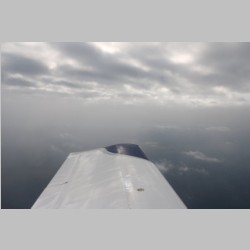
Being March, it was clear early on that we were not going to have this be one of the easiest trips. Luckily for us, the absolute worst weather of the trip was the first 30 minutes from home in Wisconsin, and the last 1 hour of the trip as we came back home. It's nice to have the really nasty stuff be near your home turf. One other complication was that in order to beat the impending weather, we left after school on Friday, meaning we'd be doing a lot of night flying later. As we departed, the weather was turning bad fast, and it got into low, drizzly, icy clouds. Luckily we were able to bust out and away from it over by LSE and head down the Mississippi river valley and get away from the worst of it. With the low-altitude flying we decided to take a fuel stop early on, to give us more fuel reserve when flying IFR at night. |
||||||||||||||||||||||||||||||||||||||||||||||||||||||||||||||||||||||||
 |
 |
 |
 |
|||||||||||||||||||||||||||||||||||||||||||||||||||||||||||||||||||||
 |
 |
 |
 |
|||||||||||||||||||||||||||||||||||||||||||||||||||||||||||||||||||||
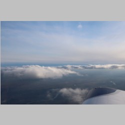
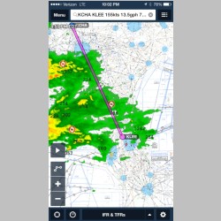
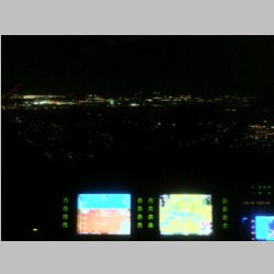
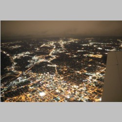
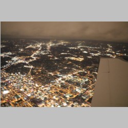
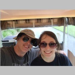
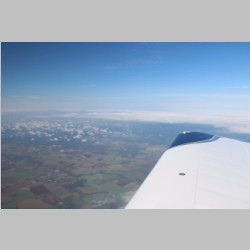
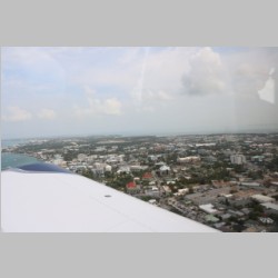
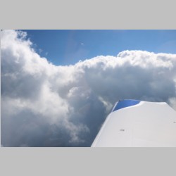
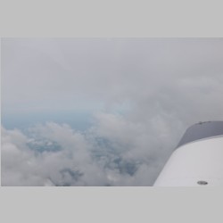
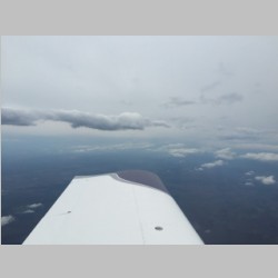
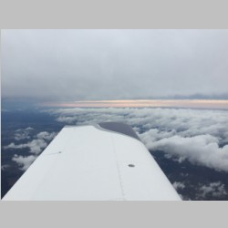
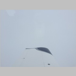
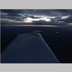
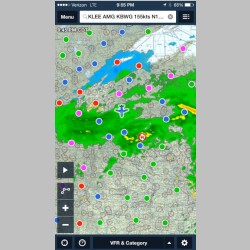
These pictures are going to be sometimes out of sequence, as we were using 2 cameras, and the one in my iphone was changing timezones as we went from West to East and then back to CST timezone in the Caymans since they don't apparently observe Daylight Savings Time changes. We hit Indiana in the dark, and had a couple of different weather systems to deal with on the way down. The first was in Wisconsin, then a bit in IL/IN, and then again in the place that ALWAYS has bad weather...Atlanta and most of Georgia. I included some Chelton and iphone screenshots of the weather along the way. We decided to do a fuel stop at KCHA (Chattanooga, TN) because it's a first-class FBO at Wilson Air, and fuel and services would be a guarantee, in case we decided to end the trip there. We had no idea if the weather in Georgia would hold for us to be able to get around it. As we flew along in Indiana, it was well below freezing and it was precipitating, but we couldn't tell if it was liquid or solid. It sure looked like rain, but while we were on an IFR plan, we were in VMC with good visibility thru it, and could see we were no icing up, so it was ok. The plan was to descend to warmer temps (by cancelling IFR) if we needed to, but hope to reach Chattanooga with no reason to descend. Once we made it that far, the freezing level would be high enough (hopefully) to clear the mountains without being at the freezing level. As we came into the Chattanooga area, our OAT was 35F at altitude, so we were ok to file IFR for the rest of the trip too. As you can see below, there was quite a bit of rain showing for our remaining leg into Florida. The lights below are when we were flying over Atlanta. We were just below some of the higher bases, and in and out of clouds the whole time. The headlights flashed and lit up the clouds every time we passed thru, and it made for a very entertaining trip. Once past the metro area, the lights outside disappeared, and it was then really Night IFR all the way until nearing KLEE in central Florida. We could see through random holes in clouds, and see some small lights below at times, but it was IMC most of the way...ending in a VFR approach into Leesburg. Luckily it was VFR, because it was a LOOOONG Day. We started flying at 4pm, and we were just wrapping it up at 1:30am EST. |
||||||||||||||||||||||||||||||||||||||||||||||||||||||||||||||||||||||||
 |
 |
 |
 |
|||||||||||||||||||||||||||||||||||||||||||||||||||||||||||||||||||||
 |
 |
 |
 |
|||||||||||||||||||||||||||||||||||||||||||||||||||||||||||||||||||||
 |
 |
 |
 |
|||||||||||||||||||||||||||||||||||||||||||||||||||||||||||||||||||||
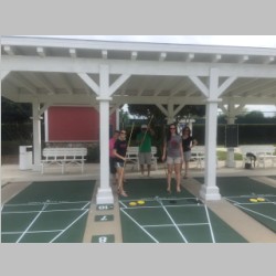
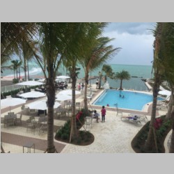
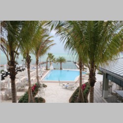
Having made it successfully to Florida, the pressure was off, as our Cuban overflight permit didn't take effect until Monday. So we stayed with family and "did as the old folks do" and played Shuffleboard and Bocce ball. A short while later we were piled into the plane for yet another weather challenging flight down to Marathon Key, which was our ultimate departure point for Monday's overwater flight to the Caymans. We had contacted Marathon GA, the FBO at KMTH airport, and the nice people there hooked us up with a BRAND NEW Mariott hotel that just opened on Marathon Key. It was less than 3 weeks old, so we got brand new everything in our rooms. It had a nice pool and hot tub area, and was walking distance from good food. They also offered airport shuttle service. A good place to stay if you ever get the chance. We made it there a couple hours before a storm hit Marathon Key, which was great. I didn't want anything holding us up from the big trip. |
||||||||||||||||||||||||||||||||||||||||||||||||||||||||||||||||||||||||
 |
 |
 |
 |
|||||||||||||||||||||||||||||||||||||||||||||||||||||||||||||||||||||
 |
 |
 |
 |
|||||||||||||||||||||||||||||||||||||||||||||||||||||||||||||||||||||
 |
 |
 |
 |
|||||||||||||||||||||||||||||||||||||||||||||||||||||||||||||||||||||
 |
 |
 |
 |
|||||||||||||||||||||||||||||||||||||||||||||||||||||||||||||||||||||
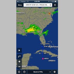
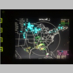
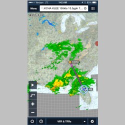
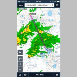
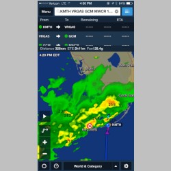
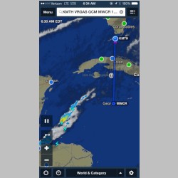
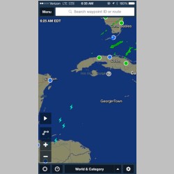
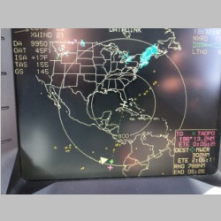
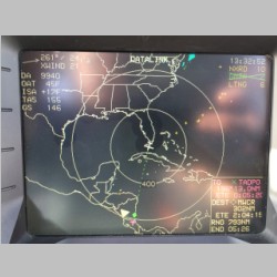
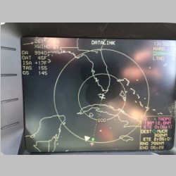
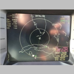
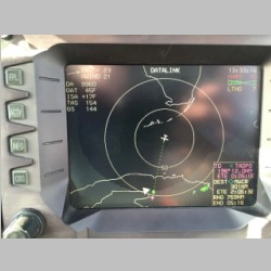
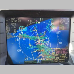
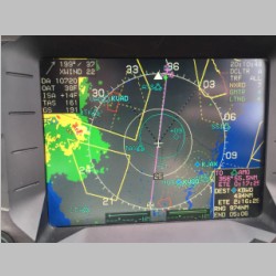
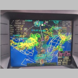
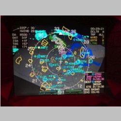
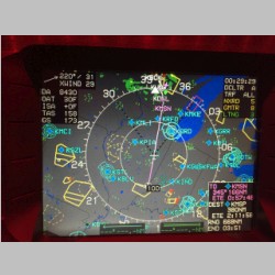
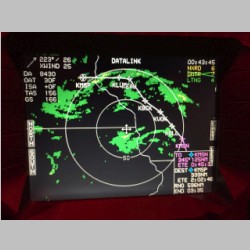
Now is where it got a lot less comfortable in planning the flight. Here we were, in Marathon Key, knowing we would be taking an IFR flight to the Caymans. This meant potentially routing THROUGH weather that we may not want. And would we even HAVE weather in the cockpit? As it turns out, we were actually better prepared IN cockipt than OUT!! No, ADS-B won't have coverage in either the Bahamas or the flight to the Caymans. (Nor in Canada if you're headed to Alaska). So ADS-B certainly isn't the weather solution for me. But, WSI's satellite coverage does include at least down to South America, if not more, and does cover Canada, and Alaska and Bahamas as well. This was an extreme comfort for us, because now we knew we could, on our own, avoid the worst of any storm cells, should ATC route us through weather we didn't want. It really was a great relief! EFB Fail
The harder part was looking at the
weather from my hotel room, before we
departed.
Looking at my 3 EFB Apps, I can tell you that NONE of them
are yet what I'd call adequate for me, sadly. First
of all, WingX and FlyQ both did not even include the
waypoints for MWCR (Grand Cayman Airport) or any of the
Caribbean airways or VOR's. So these are just
totally inadequate. FlyQ does at least provide chart
coverage for the Caymans and Bahamas and much of the
Caribbean. None, however, included IFR approaches or
arrivals. Foreflight, on the other hand, does
include many fixes and VOR's and airports, so it was
better in that respect, but, where it falls flat on it's
face is weather. If you used Foreflight's weather
you can use their lightning tool and see lightning in the
caribbean, and you can see some satellite imagery, but
their radar coverage does not cover the Caribbean.
The first 2 photos below show all that you can get.
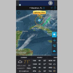
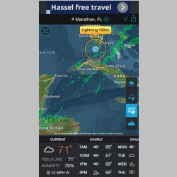
So I was forced to use the "Storm" app instead. Now
this, you could toggle between Radar, which, like
Foreflight, ended in Cuba, or you could turn on "Enhanced
Global Radar" and see the Caribbean also. Much
better....just too bad you can't get LTE while
flying! The other place where Foreflight (And Storm)
both suck as weather planning tools is in providing you
the REAL picture of the radar. It happened to me
again on this trip, as it has on many many
others... If you look at weather on WSI, and
you see greens and yellows, you know that when you hit
green you will get precip, and when you hit yellow it will
be falling harder...probably audible on your
windshield. Foreflight and Storm and others, must
not use the same type of radar, or filtering, because the
areas shown in green are always MUCH MUCH larger, and the
areas shown in yellow often cover all the areas that would
be green on WSI. WSI is really "true to actual" type
weather from what I see in the cockpit. Foreflight
will always make things look worse than it is.
Below, the 2nd 2 shots of the Storm app, show in our
path. It really wasn't like that. So while I
appreciate the general picture the apps provide, you have
to know that you can't truly trust the picture will be
accurate. This is kind of spooky when you're about
to launch for a flight that puts you in almost the middle
of the Sea, where your must hit one small piece of land
and get there successfully, or your day will go downhill
quickly. One other thing as well...some of the data
in the Foreflight database was messed up, so there were a
couple of missing waypoints, and ones that didn't display
your route correctly if you entered them normally.
The only workaround was to use the rubberbanding to create
the route. |
||||||||||||||||||||||||||||||||||||||||||||||||||||||||||||||||||||||||
 |
 |
 |
 |
|||||||||||||||||||||||||||||||||||||||||||||||||||||||||||||||||||||
 |
 |
 |
 |
|||||||||||||||||||||||||||||||||||||||||||||||||||||||||||||||||||||
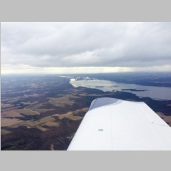
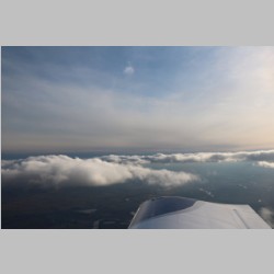
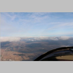
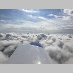
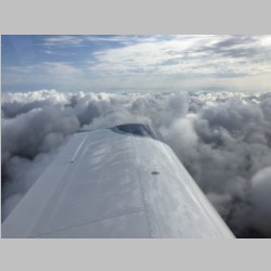
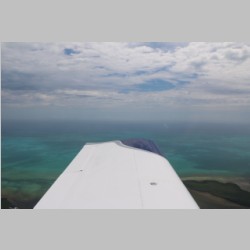
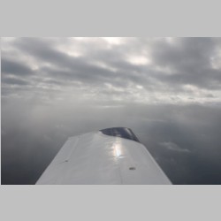
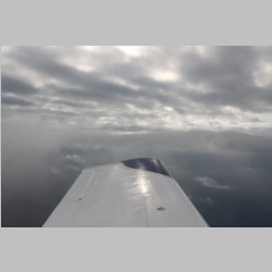
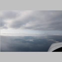
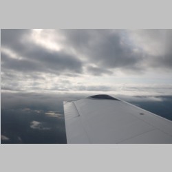
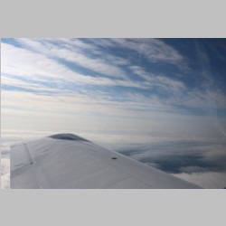
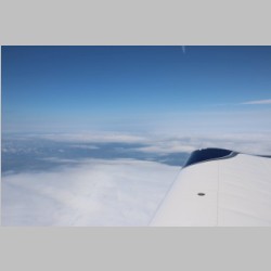
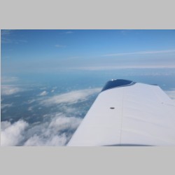
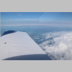
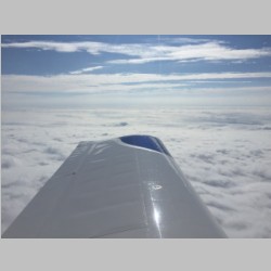
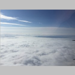
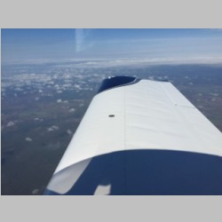
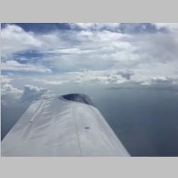
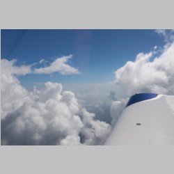
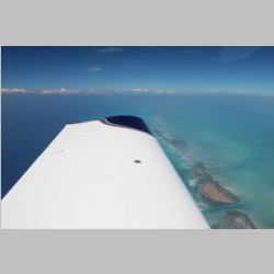
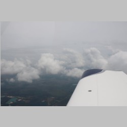
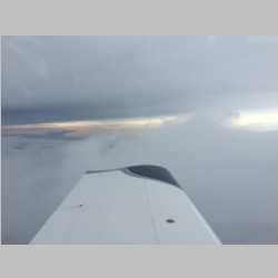
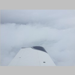
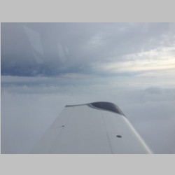
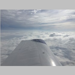
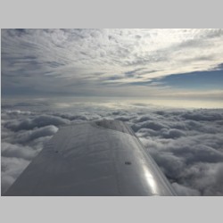
Most pleasingly though, the flight turned out to be pretty good. Being IFR, it was no real problem climbing thru the clouds, and once we were on top it was calm and peaceful. We didn't get as much of a look at Cuba as I'd have liked, because it was undercast much of the way down. When it did break up for a short time you could see the land of Cuba below. There's a lot of non-populated space on Cuba. There are also many farm fields, just like Wisconsin. There is one stark difference though. Whereas in Wisconsin, the farmers are attempting to drain our drinking water aquifer by sucking as much irrigation water out of the ground as possible, there is virtually no irrigation in Cuba. |
||||||||||||||||||||||||||||||||||||||||||||||||||||||||||||||||||||||||
 |
 |
 |
 |
|||||||||||||||||||||||||||||||||||||||||||||||||||||||||||||||||||||
 |
 |
 |
 |
|||||||||||||||||||||||||||||||||||||||||||||||||||||||||||||||||||||
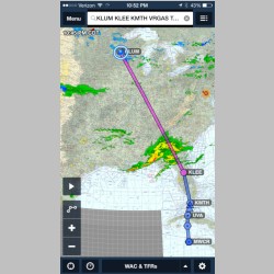
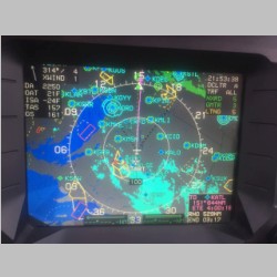
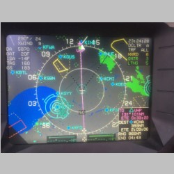
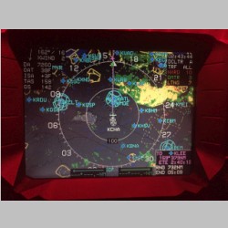
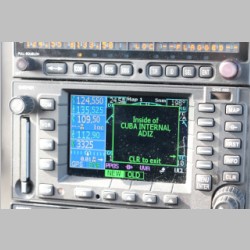
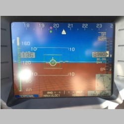
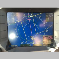
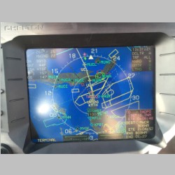
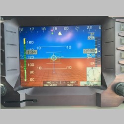
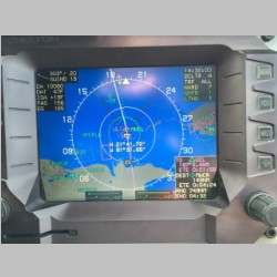
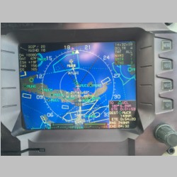
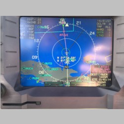
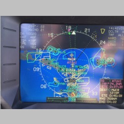
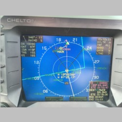
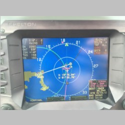
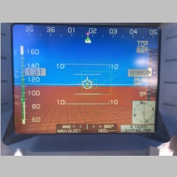
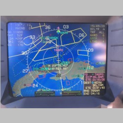
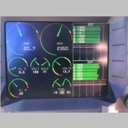
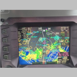
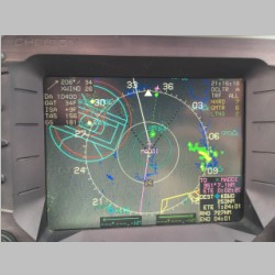
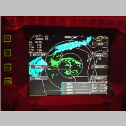
I took some screenshots of the Chelton screens on the way down, to show some of the weather picture. You could see a couple of lightning sports on the map, butother than a couple of small areas, no rain was showing. Once we had that picture, we knew the flight would be reasonably nice and stable. Also, the Chelton did have the entire database in it, so MWCR aiport and all the other fixes were there, and to top it all off, it did even include the SIDs and STARs for MWCR, and the instrument approaches as well. I was glad to have a navigator that was prepared. One other hack that I did, you can see below if you look. The standard Chelton terrain database (which consists mostly of blue water down in these regions) was only good into the 19's or 20's for degrees North Latitude. This meant that while we would have airspace depictions and data over Grand Cayman, we would not have Terrain (not much more than a picture of the island surrounded by Blue). Luckily I like studying and understanding things, because I was able to hack the terrain database format and found a way to combine South American's terrain data (I only did the top few degrees of latitude) into the North America terrain database. That way I had continuous terrain coverage all the way to Grand Cayman and a bit beyond. |
||||||||||||||||||||||||||||||||||||||||||||||||||||||||||||||||||||||||
 |
 |
 |
 |
|||||||||||||||||||||||||||||||||||||||||||||||||||||||||||||||||||||
 |
 |
 |
 |
|||||||||||||||||||||||||||||||||||||||||||||||||||||||||||||||||||||
 |
 |
 |
 |
|||||||||||||||||||||||||||||||||||||||||||||||||||||||||||||||||||||
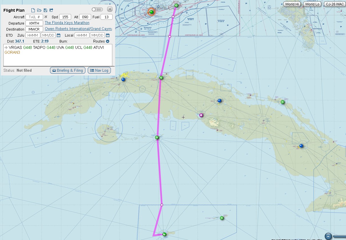
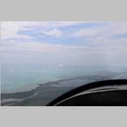
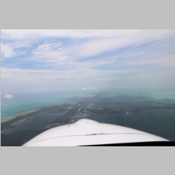
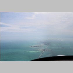
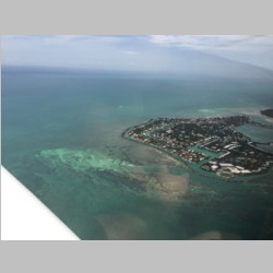
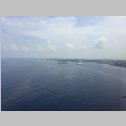
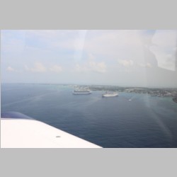
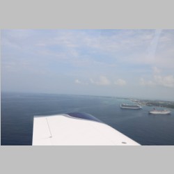
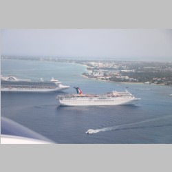
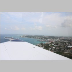
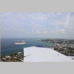
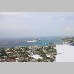
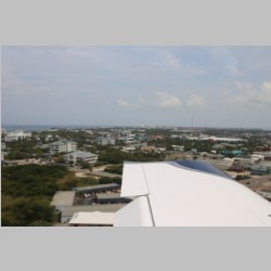
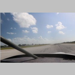
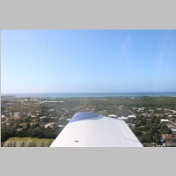
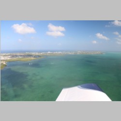
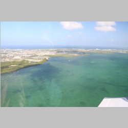
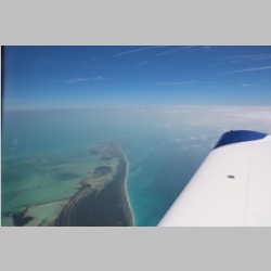
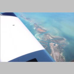
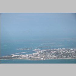
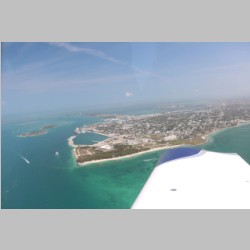
As we approached the island, they gave us descents and we could hear airline traffic coming up behind and in front of us. I do not think there is much or maybe any radar coverage down there, as they asked us to give position reports along the way many times, so that they could keep airplanes at separated altitudes. We were cleared for one of the arrivals but then given direct GORAN for the approach. This takes you out further from the island, but puts you in position to fly an instrument approach to the island. While we were flying this, we could hear airline traffic that was coming behind us, so we kept our speed up so we wouldn't be in the way and hold up their approach. As we approached the island, we got the view of the cruise ships in the harbor, and a look at the island. We did our taxi to Island Air, and went through Customs and Immigration, and then tied the plane down in the grass. They told us before we came that we would not have tiedows (just chocks) on the ramp, but would probably be moved into the grass while we were there. Rather than let them move the plane, I decided to bring our own tiedowns (more weight!) and move it ourselves to the grass for the week. |
||||||||||||||||||||||||||||||||||||||||||||||||||||||||||||||||||||||||
 |
 |
 |
 |
|||||||||||||||||||||||||||||||||||||||||||||||||||||||||||||||||||||
 |
 |
 |
 |
|||||||||||||||||||||||||||||||||||||||||||||||||||||||||||||||||||||
 |
 |
 |
 |
|||||||||||||||||||||||||||||||||||||||||||||||||||||||||||||||||||||
 |
 |
 |
 |
|||||||||||||||||||||||||||||||||||||||||||||||||||||||||||||||||||||
 |
 |
 |
 |
|||||||||||||||||||||||||||||||||||||||||||||||||||||||||||||||||||||
 |
 |
 |
 |
|||||||||||||||||||||||||||||||||||||||||||||||||||||||||||||||||||||
 |
 |
 |
 |
|||||||||||||||||||||||||||||||||||||||||||||||||||||||||||||||||||||
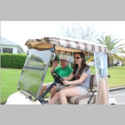
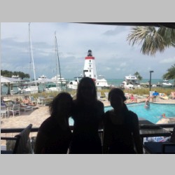
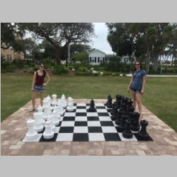
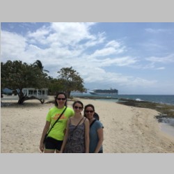
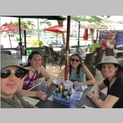
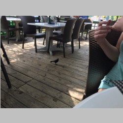
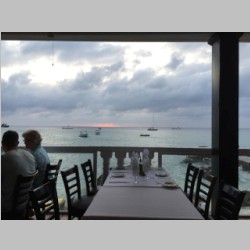
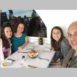
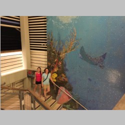
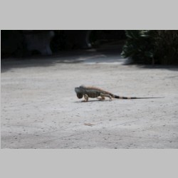
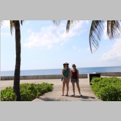
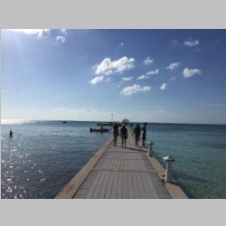
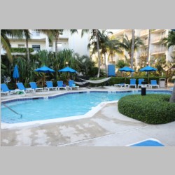
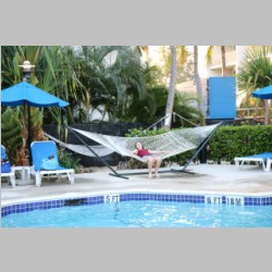
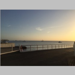
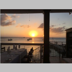
We stayed at one of the cheapest places on the island, the Comfort Suites hotel. It turned out to be a pretty nice place, and great for the money. However, they had horrible wifi service. Today I filled out my customer survey on them and let them know that, and they apologized, and said their options are limited and they are trying to make it better. Food is a real variable on the island. On one hand, there is no shortage of great tasting food. On the other, you can go for a lunch and have it cost $100 for 4 people if you just randomly go somewhere. Luckily all places let you preview their menu. And, for the truly conservative spender, they have Wendy's, Burger King, Subway, and Pizza Hut, where you can still feed people for $5-7 per person. The only place we ate twice on the trip was "Casanova's By the Sea"....a truly phenomenal italian place that is...by the sea. If I could eat there every day, I would, and I would be F-A-T(er). Other than that, most places we ate had Seafood, burgers, chicken, and much more. One of them even had a black bird (Coco Joe's) that happened to love attacking Danielle's hair. Needless to say, you won't starve on this island. You can get anywhere up and down 7 mile beach for $2.50 US per person by taking a bus, or you can pay more and take a cab. Renting a car may cost you $90 per day or so, which we did for one day so we could explore a bit further. |
||||||||||||||||||||||||||||||||||||||||||||||||||||||||||||||||||||||||
 |
 |
 |
 |
|||||||||||||||||||||||||||||||||||||||||||||||||||||||||||||||||||||
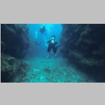
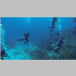
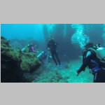
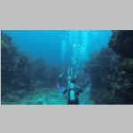
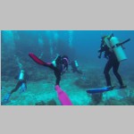
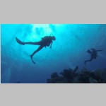
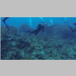
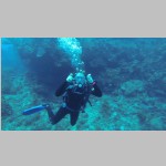
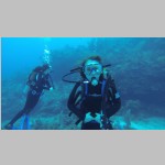
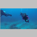
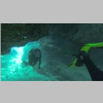
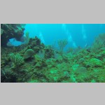
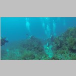
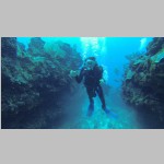
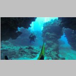
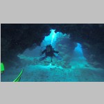
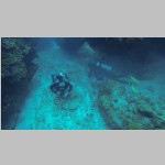
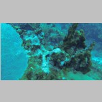
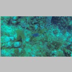
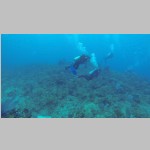
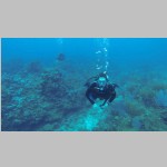
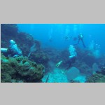
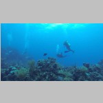
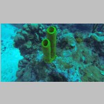
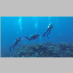
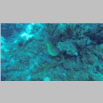
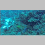
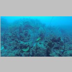
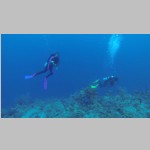
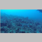
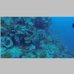
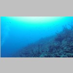
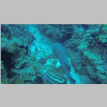
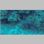
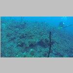
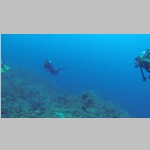
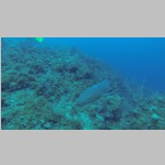
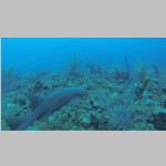
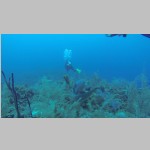
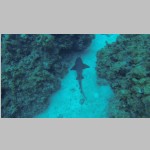
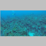
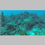
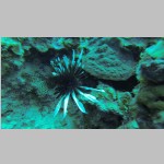
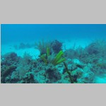
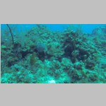
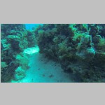
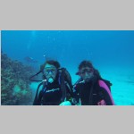
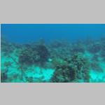
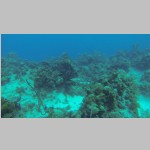
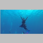
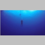
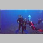
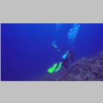
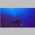
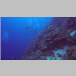
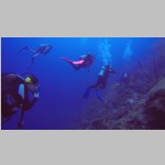
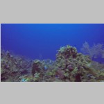
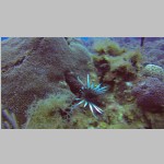
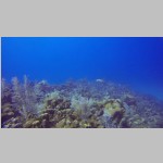
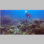
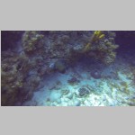
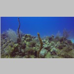
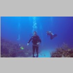
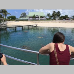
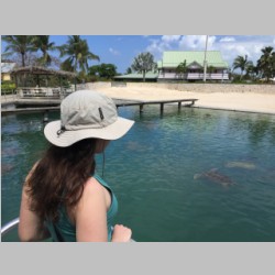
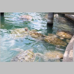
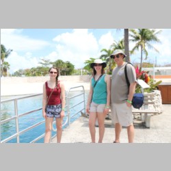
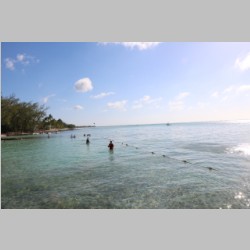
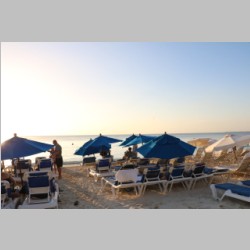
The primary goal of our trip was to get in some SCUBA diving, so I had that all booked in advance. 3 days of diving, followed by one day to Stingray City. The first day of diving, the weather had shifted and we were forced into a rare event...diving on the South side of the island. That turned out to be fantastic diving! That was my favorite day of them all. The 2nd day we did a wall and a reef off 7 mile beach. The 3rd day I started to be a bit disappointed, because the dive boat took us to basically a repeat experience of the 2nd day, and although it was nice, it wasn't as nice as day 1. We dove with Ambassador divers, who has a great boat, and nice people. I get the feeling though with any dive operator, that they get in a rut and just want to take you out for a dive to get the job done. I didn't sense any high level of motivation to ensure we were taken to great dive sites...and when I gave input, it was ignored. They just went out to the reef and tried to pick a site that wasn't in use and get it done as quickly as possible. On the up side, with their boat, and the nearby reefs, it was as easy and comfortable of a dive boat trip as anyone could ever have. But, if I were to do it all over again, I'd pick a dive operator that would limit the boat size even further and take us to the best places they could. Ambassador divers is located right at the Comfort Suites, which did make it EXTREMELY convenient for us. The day we arrived we gave them our gear and we didn't have to haul it at all, any day. The day we finished diving we just picked it back up and took it to our room. So you can't beat the convenience. So I can still recommend them as a dive operator...it's just that you'll have to realize you're not going to get the ultimate selection of dive sites with them. In retrospect, let me just say that I will probably not choose Grand Cayman Island in the future, but rather if I return, I will go to Cayman Brac, a much smaller and less busy island in the Caymans. Cayman Brac would give (probably) a much closer feel to our Bahamas out-island trips, with much less busy traffic, many fewer people, and Cayman Brac actually has more dive reefs, also all near shore, and I hear the reefs are even better. So if I'm looking for another major dive trip, I'd look to Cayman Brac first. Grand Cayman is better for those who just want to go to the beach and ride jet skis, parasail or just about any water activity. They even had those jet-ski mounted hoses that you can stand on and fly like you're in a jet pack. Below you can see pictures of our dives. Sadly I forgot to use the red filter the first 2 days, so the colors do not stand out in the photos at all on those days. We saw many things though...Turtles, sharks, lobster, crabs, lionfish, eels, and many many more things.
|
||||||||||||||||||||||||||||||||||||||||||||||||||||||||||||||||||||||||
 |
 |
 |
 |
|||||||||||||||||||||||||||||||||||||||||||||||||||||||||||||||||||||
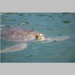
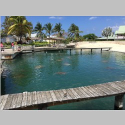
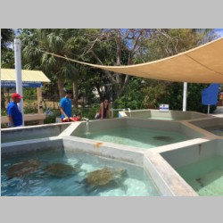
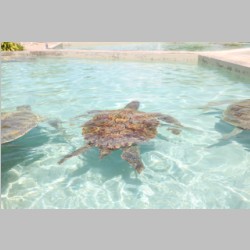
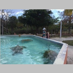
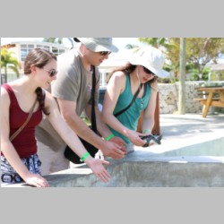
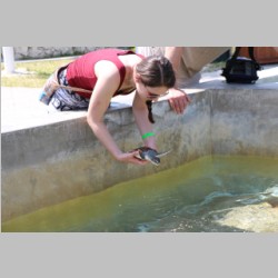
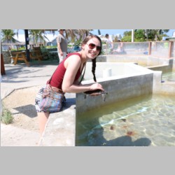
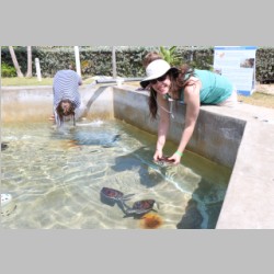
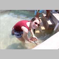
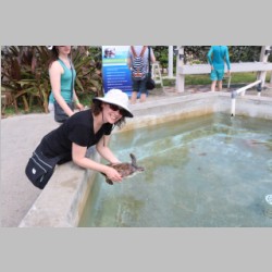
On our day touring the island, we also stopped at the Cayman Islands Turtle Farm. The kids loved it. You can pick up and hold sea turtles just like the ones we saw while diving. There is also the small community of "Hell" that we drove thru, so now I've been to Hell and back twice. |
||||||||||||||||||||||||||||||||||||||||||||||||||||||||||||||||||||||||
 |
 |
 |
 |
|||||||||||||||||||||||||||||||||||||||||||||||||||||||||||||||||||||
 |
 |
 |
 |
|||||||||||||||||||||||||||||||||||||||||||||||||||||||||||||||||||||
 |
 |
 |
 |
|||||||||||||||||||||||||||||||||||||||||||||||||||||||||||||||||||||
 |
 |
 |
 |
|||||||||||||||||||||||||||||||||||||||||||||||||||||||||||||||||||||
 |
 |
 |
 |
|||||||||||||||||||||||||||||||||||||||||||||||||||||||||||||||||||||
 |
 |
 |
 |
|||||||||||||||||||||||||||||||||||||||||||||||||||||||||||||||||||||
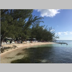
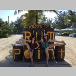
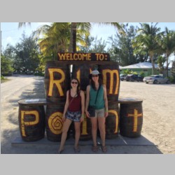
Out on the North central bay of the island is Rum Point...another popular and less congested place to be on the island. It's a nice place to hit the beach, play volleyball, or relax with a drink. |
||||||||||||||||||||||||||||||||||||||||||||||||||||||||||||||||||||||||
 |
 |
 |
 |
|||||||||||||||||||||||||||||||||||||||||||||||||||||||||||||||||||||
 |
 |
 |
 |
|||||||||||||||||||||||||||||||||||||||||||||||||||||||||||||||||||||
 |
 |
 |
 |
|||||||||||||||||||||||||||||||||||||||||||||||||||||||||||||||||||||
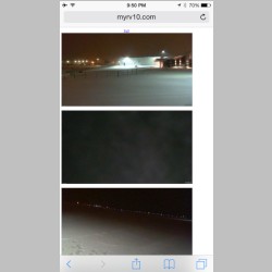
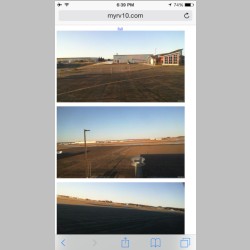
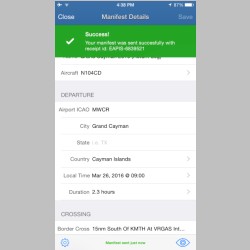
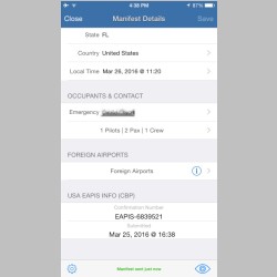
A few more notes and things from the trip... First, while we were gone, our home area got 6-10" of snow one day. I grabbed pictures from my hangar camera that night. But, interestingly, by afternoon the next day, the airport was melted clear. Now that's the best kind of storm..one that happens when you're gone and is completely cleaned up before you're home. :) Also, being an international flight you do have to deal with filing your eAPIS manifest with U.S. customs. Previously I had used a now-defunct app called iAPIS, which I really liked. When they went away, I used the "free for the first month" app "Flashpass" which offered the same functionality. Well, not completely the same. iAPIS was all done right on the iphone using a native app. Flashpass is more of an iPhone app that relies on the web to centrally cloud-store your information. If you don't have wifi or cell data service available, it can be less convenient because the app is useless without. But you'd need it to file anyway. You can fill in your pilot, crew, and passengers and info and it's available to be used on future trips. If you use the U.S. Customs website, it's free, but you can't save passenger data, so it's a real pain again on future trips. Flashpass has 2 ways to go. $60 unlimited for a year, or if you use iPhone, you can get a 5 pack of filings for $39, which is what I did...using one on my way and one on my way back. I'm now ready for next year's vacation, as I have 3 in credit. Once you file your eAPIS it gets your confirmation number, and you also get an email with all of the manifest info. It's a handy app. |
||||||||||||||||||||||||||||||||||||||||||||||||||||||||||||||||||||||||
 |
 |
 |
 |
|||||||||||||||||||||||||||||||||||||||||||||||||||||||||||||||||||||
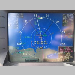
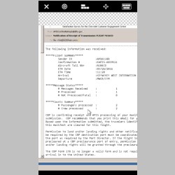
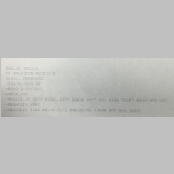
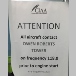
The Caymans turned out to be kind of in between the Bahamas and Mexico for policies and fees and such. You don't really pay anything when you land, but when you depart it's $65 per person (crew not included so with Andrea as a pilot, we only had 2 to pay for). That said, I don't remember even paying that bill...not sure what's up with that. But, in order to depart, you are required to file your flight plan with Caymans flight service. They have a flight office with weather and everything right at the terminal by customs and security, next to the FBO. You give the person your ICAO plan info and he enters it into the computer. Above is a copy of my routing I received. They make you sign a copy of your flight plan, and then they give you a copy. Then you pay the fees. My fees, in Cayman dollars ($1 CI = $1.25 US) were: $5 for Air Navigation (Flight Planning) (as a side note, for some reason they had the RV-10 listed as gross wt of 4400lbs). Landing fee: $10, Environment Fee: $8.00, Travel Tax 2@$26 for each Passenger, Parking Fee $5/day, Passenger facility charge 2@$13/passenger, Security Tax 2@$8/passenger, Terminal Charge 2@$1/passenger. Total in fees was $175.61 US or $144 CI. None of the charges are very high...but it's funny that they apply to the 2 kids but not the crew, and with so many various fees it just makes you roll your eyes....like "Terminal Charge of $1" Really? Oh well. Personally I'd rather just have a single fee that was like $40 per person that covered it all, but these foreign governments seem to like to justify their existence by charging fees. The funny one was the sign below...."ATTENTION All Aircraft Contact Owen Robers Tower on frequency 118.0 prior to engine start" that was posted in the flight office. I did this. Over and over I did this. With no reply. So then I called the FBO and they told me to call the tower on 120.2. When I did, they were surprised that I was already started. Well, then make sure your signs are accurate. ;) |
||||||||||||||||||||||||||||||||||||||||||||||||||||||||||||||||||||||||
 |
 |
 |
 |
|||||||||||||||||||||||||||||||||||||||||||||||||||||||||||||||||||||
 |
 |
 |
 |
|||||||||||||||||||||||||||||||||||||||||||||||||||||||||||||||||||||
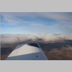
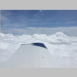
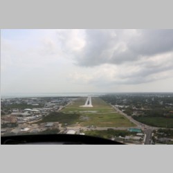
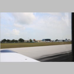
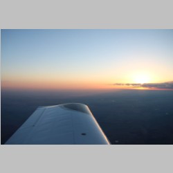
Takeoff and climbout went well, but with a filed altitude of 10,000', it gave us some adventure. There was a layer of clouds in our way, and although not giant, they were Cumulus clouds with convection, and they were damp inside. So as we were climbing we got jostled around a lot with lots of turbulence, in complete IMC, in a climb, unable to maintain steady altitude with the ups and downs. It was rougher IMC than I'd had for a while. We leveled the climb once to penetrate some without climbing, and then later we penetrated one using the lift in the cloud to help us climb. Eventually we arrived on top at 10,000' and had smooth skies and a tailwind for the rest of the trip back. We got a glimpse of Cuba again, and then arrived at Key West. Key West had a very nice, but busy customs office to check in thru. A tip...if you use Key West, park on the East end of their 2 parking spaces....they simply watch out the window and look for planes there once in a while. We parked on the West end and they weren't aware of us for a few extra minutes. Tip #2...KMTH says they'll be getting customs in April....if I had my choice, I'd use KMTH for this trip...it would be more convenient and the fuel and everything is cheaper. |
||||||||||||||||||||||||||||||||||||||||||||||||||||||||||||||||||||||||
 |
 |
 |
 |
|||||||||||||||||||||||||||||||||||||||||||||||||||||||||||||||||||||
 |
 |
 |
 |
|||||||||||||||||||||||||||||||||||||||||||||||||||||||||||||||||||||
 |
 |
 |
 |
|||||||||||||||||||||||||||||||||||||||||||||||||||||||||||||||||||||
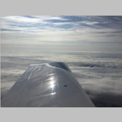
Once back on U.S. Soil,we didn't stay soil-bound for long. Without topping the tanks, we headed North over the gulf to Leesburg for their cheap fuel. We were on-top again, knowing that the skies were more clear in Leesburg than in South Florida. A quick sandwich and fuel and we were airborne again, for another IFR flight up Florida. And, guess where the worst weather was....AGAIN....yep, Georgia. See below for some screen shots to prove it. If you live in Georgia, I'm wondering...do you EVER get to see blue skies?? The trip thru Northern Florida and Georgia was a lot of IMC time, some of it on top again, and then the clouds started to lower and fall away and eventually everything turned clear for our fuel stop. We had planned to stop at KBWG (Bowling Green, KY), because they have a great FBO and lots of stuff nearby. But with weather approaching in Wisconsin, we wanted to keep moving, so we stopped at 3M7 for super reasonable fuel prices and were quickly back in the air. |
||||||||||||||||||||||||||||||||||||||||||||||||||||||||||||||||||||||||
 |
 |
 |
 |
|||||||||||||||||||||||||||||||||||||||||||||||||||||||||||||||||||||
 |
 |
 |
 |
|||||||||||||||||||||||||||||||||||||||||||||||||||||||||||||||||||||
 |
 |
 |
 |
|||||||||||||||||||||||||||||||||||||||||||||||||||||||||||||||||||||
 |
 |
 |
 |
|||||||||||||||||||||||||||||||||||||||||||||||||||||||||||||||||||||
 |
 |
 |
 |
|||||||||||||||||||||||||||||||||||||||||||||||||||||||||||||||||||||
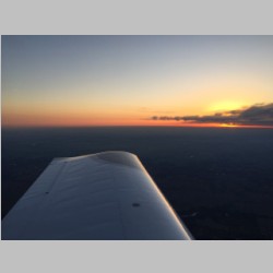
We flew from 3M7 to home all as VFR, so that we could choose to fly lower and lower again as we approached the freezing temps at altitude and the low ceilings and rain and drizzle. Let me just say, I hate the thought of ice, so I'll always choose to stay low when it's that cold and ice is likely. Luckily we were VFR the whole way, keeping 8,500' all the way to Madison, WI. Prior to getting to Madison, we kept track of the weather. I spent time doing the math on the celsius temp vs altitude and realized that although ceilings may be 3000-3500' up there, we would likely have to be between 1000' and 2000' AGL to stay above the freezing level. And it was Rain showing on the radar, not snow or ice, which meant that if we got into freezing temps, it would build ice quickly. My strategy was this... fly a path direct to Madison, where we ended up descending to 5500' to stay below the overcast. Then I punched in KDLL, KVOK, KBCK, KEAU, KLUM, and KMSP into the flight plan. This allowed me to see if the airport was VFR or MVFR or IFR with a quick glance. It also was a route that roughly (almost exactly, actually) followed I-94 up thru Wisconsin. I've used this strategy at night in less-than-perfect conditions before, because it gives you a headlight-lit highway to refer to for direction, and also serves as a good landing spot if your engine quits. With the airport weather available at our fingertips, and WSI weather keeping us informed all the way, we flew the highway home. As we got closer and closer to home, the temps kept dropping, always keeping us descending just that little bit more. I kept the OAT trying to always read at least 33 degrees all the time, and we watched for ice, as we flew under the falling precip. Visibility was good, at 10 miles. From each aiport we could nearly see the next airport along our route, and we could clearly see the highways and cities. Eventually we ended up at maybe 1500-1800' AGL as we neared home, and we lined up for a completely visual approach in rain to our home airport. It's actually easier to fly in rain at night than daytime, because whereas the water droplets block your view in the daytime, the ground lights seem to be more visible even with the rain. Minutes later we were unloaded, and driving home from the airport...and I was surprised at how constant the rain was. We had just flown home from Grand Cayman, departing at 9:15 CST to home, landing at about 9:30 pm CST...a distance of over 1600nm, in one day. I love it when a trip comes together and you get home on time! |
||||||||||||||||||||||||||||||||||||||||||||||||||||||||||||||||||||||||
 |
 |
 |
 |
|||||||||||||||||||||||||||||||||||||||||||||||||||||||||||||||||||||