Alaska 2012 - Day 15
To Ketchikan 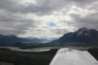
|
|
|
|
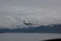
Once again we hit a flying day, and the weather didn't quite cooperate. The night before, we had a pre-briefing and were told that everyone should probably go IFR if you can go IFR, because the ceilings were going to be tough, and it wasn't sure that we would make it to Ketchikan. The weather near Whittier and South along the coast wasn't looking good. The problem I saw with it was that IFR meant ice. The standard lapse rate told me. I just knew that wasn't going to work. So, I stayed up late at night mulling it over and basically had resigned myself to giving up the last stop (Ketchikan) of the trip if it meant IFR, and just head back inland and back home via the inland route. The weather more inland was looking better, and I knew I couldn't delay too long my trip home, so that was the compromise plan I came up with. In a discussion with another pilot, we talked about going IFR. I write this because it's good thinking for anyone who thinks they want to get and use an instrument rating... They felt that IFR would be a good option, even with terrain and unfamiliar airports, if it could be done without ice. However, they felt they would only go IFR if they could get a 1500' ceiling at the destination. That led me right into a good discussion. The weather changes pretty darn fast in Alaska, and especially in the areas along the coast. Along with that, the Southern coasts get some of the highest amounts of IFR days of anywhere in the place. So I said, "what if the ceiling is going to be 1200' overcast?" They said, "Well, I guess I'd go." I said, "What if the ceiling ends up going down to 800'?" Again, "Well, I suppose I could do that." "How about 500' or even 200'?", I asked. This time I got "Well, I guess I'd divert." Well, that's where I stopped and said...."Divert to WHERE!?!?!" You see, flying along many of these routes in Alaska, whether IFR or VFR, there simply isn't any place to divert. Or, in the case of this leg, sure, you can divert to another airport, but that will mean climbing or staying up or above more ice, for who knows how long, and, all of the airports along the route are likely to have the same or similar weather. So diverting is not really the option it's all cracked up to be. My comment back was, "If you're going to go IFR, you need to be prepared to go IFR and fly ALL THE WAY TO MINIMUMS....because you can't be assured that you won't have to." That is the thing about the IFR ticket. It's a great thing to have, and it gives you some awesome skill and experience. But, there is no such thing as "light IFR", and even if the ceilings were 2000', you can find all sorts of trouble awating you if you venture IFR and aren't prepared to do everything that you trained for. |
|||
 |
 |
 |
 |
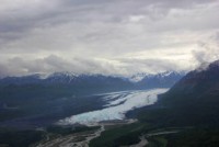
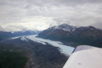
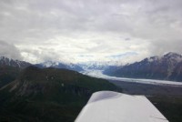
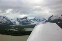
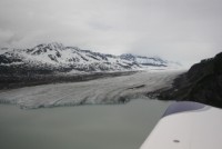
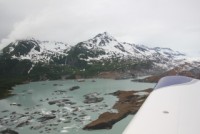
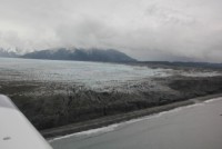
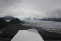
In the morning, the group met again and got the bad news... The weather was worse than planned, and IFR wasn't an option anyway, because everyone would be in the ice, and the ice would be bad. So, we had 2 choices. 1 choice, given a 45-55% success rate, was to try the original flight, making the pass near Whittier, and continuing down the coast. The other was to fly up to Gulkana and more inland, and circle back down along the Copper river, coming out along the shorline near Valdez. My vote was "Let's just do whichever one has the best chance of actually getting there.", but everyone wanted to give the first way a shot. So, we burned up half and hour of fuel to the pass, only to find it impassable, and then burned another half hour returning past Anchorage and continuing on to Gulkana. Flying up to Gulkana let us fly directly over the Matanuska Glacier and Lion's head, shown in the photos above, and we happened to see a group of Nova's whitewater rafters in the river, too! |
|||
 |
 |
 |
 |
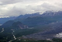
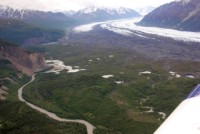
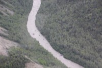
Gulkana was a decent fuel stop, and then it was back in the skies towards the Copper river. Along the way we passed a large mud volcano, so I dropped down low for a better look. A few minutes later we were entering the copper river valley, headed downstream to sea. |
|||
 |
 |
 |
 |
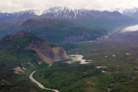
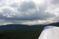
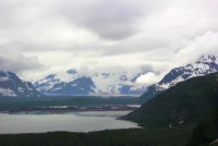
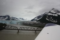
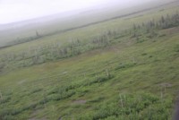
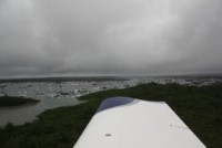
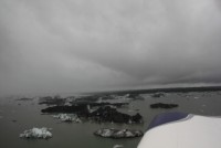
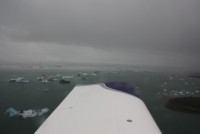
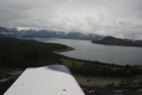
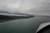
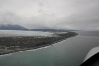
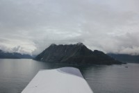
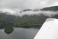
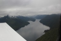
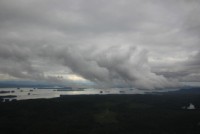
After flying the valley for a while, I commented to the lead that this really shouldn't be an alternate route, but a PRIMARY route. It was stunningly beautiful in this valley! He replied that while this was beautiful, we also did miss out on some other real beautiful things, so it's a give and take. The glaciers in this river were awesome, with lots of big ice bergs calving off from them. Also, the further downstream we went towards the sea, the ceiling got lower and lower. We knew the ceiling along the sea was likely in the 400-700' range, so with luck, we could fly this entire canyon down to the ocean and stay under the ceiling the whole time. |
|||
 |
 |
 |
 |
 |
 |
 |
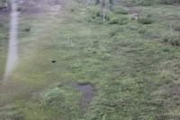 |
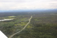
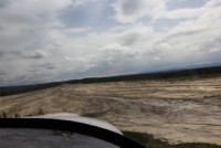
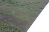
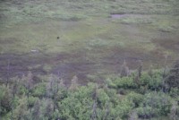
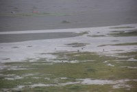
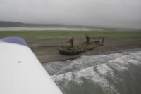
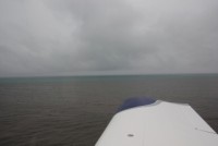
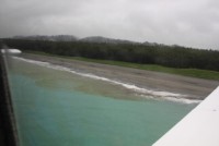
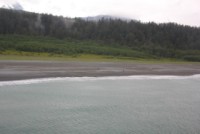
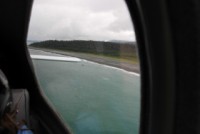
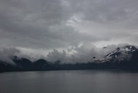
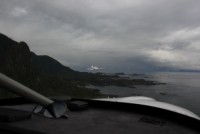
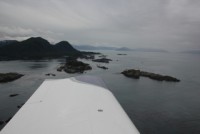
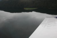
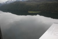
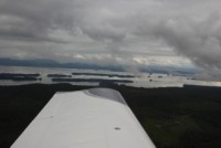
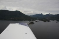
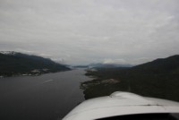
Indeed as we got near the sea, the ceiling had dropped significantly, and we were once again skimming low over the land at maybe 5-700' or less. We saw another black bear in a clearing and made a circle around him for some photos, and then continued down to the coast. Once on the coast, we were pushed lower yet, under 500' for sure, but the visibility opened up for a while. As we flew, we'd hop from rain shower to rain shower, with periods of good visibility between, but the ceiling had come down to maybe 300', so we stuck to the coastline for the most part, and kept our altitude between 50' and 150' most of the way. One thing about ceilings...you do NOT want to be right up against the raggedy ceiling. The forward visibility gets HORRIBLE the closer to the ceiling you get. So you're often far better being well under the ceiling, and you can end up getting much greater forward visibility. We did run through some areas that maybe got down to 2 mile viz or so, but for the most part, we flew at under 100' AGL, and had 5 to 10 mile viz at least. This was plenty doable, despite the ceilings. We did, however, have to pay very close attention to birds. There were eagles sitting on logs basically every 200' as we zipped down the shoreline. But the seagulls were the ones that were tough....they would hear the first plane, and take off in flocks, leaving the remaining planes a little dodging to do at times. This was our sole issue as we headed down the shore. This leg along the shoreline actually ran into the hundreds of miles, so we did this for a long long time, but it was very very comfortable for the most part....except for the couple of times we had to cross the open water of a bay. |
|||
 |
 |
 |
 |
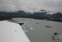
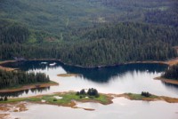
This day not only gave us awesome flying, with smooth air, but some really cool scenery and animal life as well. We passed some HUMUNGOUS glaciers, with giant fields of ice bergs. In one berg field, there was a very odd berg that instead of being a snowy blue, was a very bright blue like a gemstone...and a clear blue at that. I did get it on video, so if I get my videos added to this write-up I'll try to include it there. |
|||
 |
 |
 |
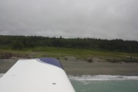 |
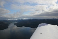
Continuing down the coast we saw more wildlife on this trip than probably any other day. We saw packs of wolves, bears with cubs, eagles, whales, and many more things. Zipping down the coast at low altitude may seem like it would be pretty scary, but one thing we had a lot of the time was a halfway decent spot to land. Many of the beaches were clear enough of debris to make an emergency landing if need be. We stoped at Yakutat for fuel, and then continued down the coast towards Ketchikan again. Again we flew by some huge glaciers, and in the area of the glacier the ceilings dropped again, likely due to the temperature of the ice. |
|||
 |
 |
 |
 |
 |
 |
 |
 |
 |
 |
 |
 |
 |
 |
 |
 |
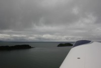
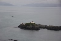
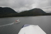
Pressing further on, the ceilings finally started to lift. We also finally started to see signs of human existance! There was a lighthouse, and then as we flew up a long finger bay of a large island, we spotted some whales swimming below us, and passed a boat full of people. Later on there were cabins appearing, and finally it almost looked like there were areas of "community" with a few cabins in one area. |
|||
 |
 |
 |
 |
 |
 |
 |
 |
 |
 |
 |
 |
 |
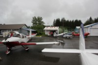
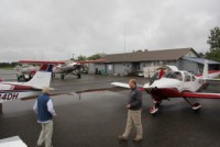
Ketchikan is a cool little airport. It's located on an island across the water from the town. This is the city that the "bridge to nowhere" was going to be built in, and let me tell you, after being there, I think they should fund it. Presently you have to take a water taxi only a couple hundred yards, just to get from one shore to the other. They can't be cheap to operate and they make it more complex to get to the airport. A small bridge, even a 1 lane bridge, would vastly simplify things. But, the ferry boat was a cool and quick trip, so it worked out for us. |
||