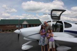
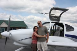
Segwaying Up the East Coast
Completed 6/17/2011This year we had set aside some vacation time for June, after school was out, and had planned the ultimate trip...Alaska, but due to a bunch of issues we had to postpone that trip, so we started to make alternate plans. Originally we had thought we'd head out to Seattle, Montana, and Idaho, because we loved camping so much at Yellow Pine (Johnsons Creek, ID), have never been to Glacier National Park, and we wanted to see the San Juan Islands in the RV-10. The week before, the temps in our area hit 99 degrees, and we were really suffering in the heat, so we thought for sure this plan would be a great idea to beat the heat and go somewhere comfortable. You may have read my writings before and heard that my philosophy is basically to never travel South or to hot places in the summer season. Why? Well, when you have an RV-10, you have the flexibility to choose where and when you want to go, and why spend time in hellish conditions when just a change in course is all it takes to get comfortable. The Great Lakes region gives some great locations for flying destinations in the summer, where you can be very comfortable, as are many of the higher regions in the West.
But once again, as the day to depart approached, we kept our eyes on the weather and things had taken quite a turn! The temperature in our area dropped almost 50 degrees in 24 hours, and we had days in the 50's, and the average daily temp was going to change to the 60's and 70's for our area and out East, and the 40's to 60's out West. Seeing that it snowed at Johnson Creek, that week, we decided that we'd forego the trip West, because a new opportunity had arose.
For a long time, now that the kids are out of the grade school years, we've been wanting to get them out to Washington D.C., and we've also been wanting to get to the East Coast to fly the RV-10 to the remaining states out there that we haven't yet been. As it turned out, the weather was to be perfect for such a trip...only slight chances of rain, temps in the 60's and 70's and maybe low 80's, all with good flying weather. So once again the night before the trip, we recalculated our plans and headed in a different direction. No plans, no reservations, just the knowledge that an RV-10 can get you somewhere else if you don't like where you are, without a lot of work.
Day 1 - Heading to Charleston, SC
 |
 |
 |
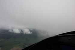 |
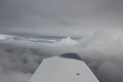
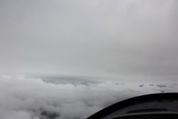
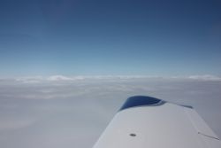
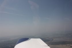
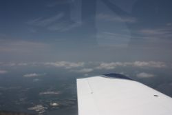
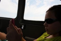
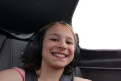
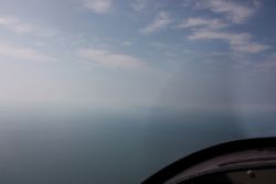
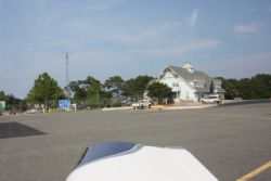
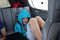
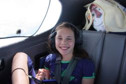
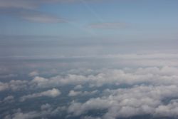
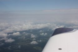
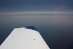
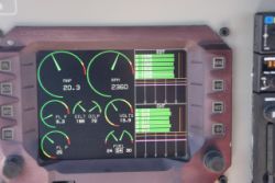
On departure day, we slept in, and took off late, not wanting to be rushed, and packed our minimal baggage. The change in plans meant not bringing sleeping bags and cold-weather clothes, so for once we were only packed to the top of the rear seats, and had plenty of extra space. The ceilings were maybe 1500-2000' and overcast, with layers, which is what I personally consider ideal flying weather, as I love to be able to get a little IMC time in on either the beginning or end of the trip. IMC is much more comfortable when it's enroute, or in your home area. Soon after taking off, we were in the clouds and talking to Minneapolis Center, enjoying a perfectly smooth flight. We popped up into a gap in the layers and then a bit later, popped right out the top into blue skies. We were cleared to 9000' where we could relax and enjoy the bump free skies. |
|||
 |
 |
 |
 |
 |
 |
 |
 |
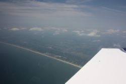
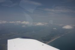
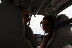
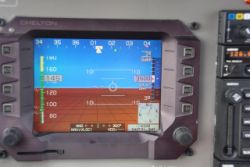
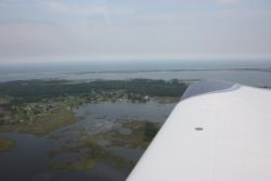
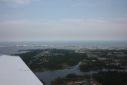
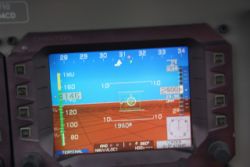
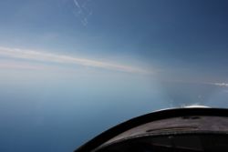
On trips to the East, we often have one big obstacle....Lake Michigan. We were given the choice to route around Chicago, or go direct over the lake, and we chose the direct route. The RV-10 is very nice in that you can climb if you want to, and get enough altitude to put you more closely to gliding range to each shore. Our other favorite way around the lake is to drop down and fly VFR, under the Chicago Class Bravo, right along the lake shore, but today, that would put us in the clouds as the ceilings were lower in that area, and it would mean slowing our trip down. With everything looking good, we were cleared to "BRAVE", which is an overwater fix over the lake, used to keep you out of the Chicago approach area. We saw numerous small and large jets pass near by us, both called out by approach, and displayed by our NavWorx ADS600B. I'll let you in on the ADS-B report for the East Coast right now....we basically had ADS-B coverage on most all of our trip...we never saw any airplanes that weren't displayed, and we were rarely in an active area that we didn't have traffic displayed many miles away. So ADS-B implementation looks really good out East. |
|||
 |
 |
 |
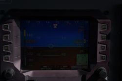 |
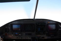
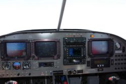
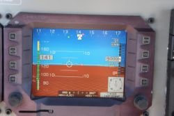
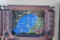
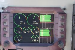
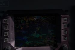
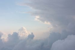
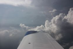
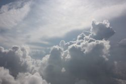
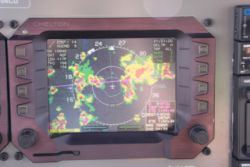
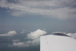
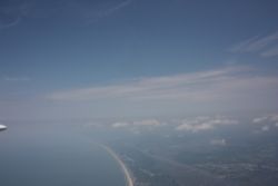
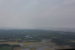
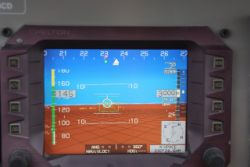
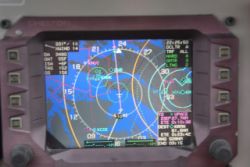
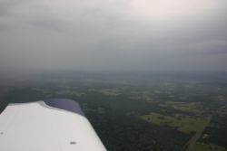
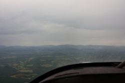
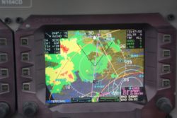
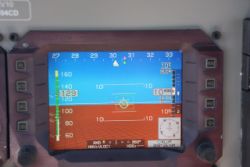
Our first stop was KHOC, Hillsboro Ohio, for some lesser-priced 100LL. It was a quiet airport and was VFR by the time we got there. Nothing was open, other than the self-serve fuel, so we quickly hopped back in and headed out. From here on, as you can see from these really dim screenshots, things got to be more interesting. We stayed VFR, due to the scattered but peppered coverage of thunderstorms. In all the X/C flying we've been able to do, with WSI in-flight WX at our side, I've gotten to really know what to expect from looking at NexRad images, and how they may affect our flight. Looking at this picture, I knew we definitely didn't want to bother going IFR, unless we were willing to do lots and lots of course diversions, and I knew that IFR might mean that we'd have to fly through some minor convection that would mean dealing with some bumps. So VFR was our plan, where we could steer clear of any storms and stay above or around any buildups. Using a combination of Eyes + WSI, you can easily navigate around these storms, whereas if you only have one of those tools at your disposal, you're severely handicapped and you may (or often should) just call it a day and stay on the ground. But with a good picture of what was happening, and a good view out the window, it was no problem at all. We started at 7,500', and then moved up to 9,500', even letting ourselves climb to over 10,000' a few times to maintain some good VFR cloud clearances or to ride some rising air without attempting to maintain strict altitude...allowing for a smoother ride. In the dim photos below you can see the scattered popcorn storms all over the place. |
|||
 |
 |
 |
 |
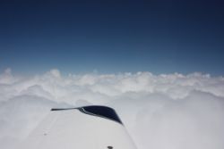
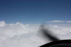
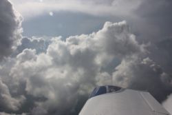
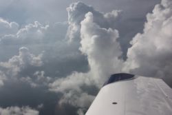
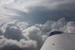
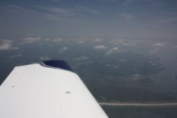
As we flew along, we could see the ground below, through the towering cloud gaps. It was like flying in valleys that were 9,000' tall...VFR all around you, as long as you avoided the pillars. The gaps weren't wide enough to follow the general very good advice to avoid storms by 20 miles, but there were a bunch of positives that made it possible. First, the skies were blue and clear between the cells, and you could see if anything were rising up that could form into anything. So avoiding the cells and anything that could be falling from overhanging clouds was easy. Next, with a VFR descent possible at any time, and plenty of airports in the area, there was always an "out" to go to if necessary. Then there was the benefit that most of these storms, while heavy rain, weren't full of lightning and hail, and they weren't extremely tall. If there had been only a few storms, and they turned large, they would grow higher and more intense with lots of lightning, but these were just scattered popcorn buildups, and the smooth ride we had was indicitave of a certain amount of stability in the air where the cells were not. So, we just stayed VFR, stayed away from the pillars, and weaved our way through. Every turn we made, we could see far in the distance that the picture out the window matched the picture on the screen, so all was good. Our intention was to stop at KFDW, Winnsboro Fairfield County for cheap fuel before we went into KCHS (Charleston, SC), but when we arrived, we found out that their low fuel price was low enough that they had sold more fuel in the past few days than a month before, so they were out of fuel for a few more days...we didn't even get to shut down, and we were taxiing back to take off. A quick check of fuel prices using Foreflight showed that nearby Orangeburg, KOGB, had similarly priced lower-cost fuel, so we punched in KOGB and headed off. At Orangeburg, we filled up, and then quickly launched again for Charleston. At KCHS, we stayed with Atlantic Aviation, as they were able to get us an on-site enterprise rental car, and an awesome hotel "Aloft", a newer chain with a real cool updated design. They were very nice and accomodating. The only sad thing was the $10/night tiedown fee, a $40 facility fee (that would have been waived if we bought some expensively priced 100LL), and a $5 security fee....so $65 in total fees for 2 night of stay. When you considered the great hotel we got, and a car on the spot though, it was very worth while and I'd probably go back to them if I ever were in the area again. |
|||
 |
 |
 |
 |
 |
 |
 |
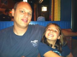 |
After a short, long day of flying, where we left at noon, we were happily checked in to our hotel in Charleston, and headed downtown for a late supper in the Market square area. We had some good food at "The Noisy Oyster". That area of town is super scenic with tons to do. There were thousands of people out walking on the streets, many of them dressed up fairly nicely and all in a celebratory mood. It was almost like walking around Disney World at night. |
|||
Day 2 - Touring Charleston, SC
 |
 |
 |
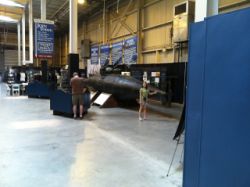 |
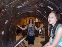
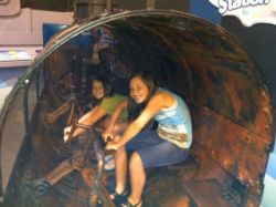
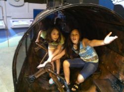
We really didn't have any plans for our first few stops, but it didn't take long after looking at the map from the FBO, and watching the road signs, to know that we had plenty of options in Charleston! We had contemplated just staying overnight, seeing a few things, and then heading out in the afternoon, to go up a state to North Carolina. The only intermediate stop we knew we just HAD to stop at was in North Carolina, so we had plenty of time and no schedule to follow. One of the things in the past that I've really enjoyed are the books by Clive Cussler, featuring Dirk Pitt...a character that I love to relate to. I'd previously read his writings in his non-fiction book "The Sea Hunters", regarding the Confederate Submarine, the H.L. Hunley, and when I saw that one of the things you can see in Charleston is the Hunley, I knew that had to be a stop to make! We started our 2nd day with a stop at the Hunley exhibit, and the kids were fascinated by the story. You can see in the above pictures that they have the submarine mockup (it was hand cranked) that you can go inside. There are many little facts to the story of the sub that prove really interesting to hear about, so we all loved the stop. |
|||
 |
 |
 |
 |
 |
 |
 |
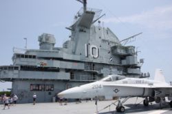 |
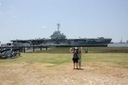
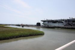
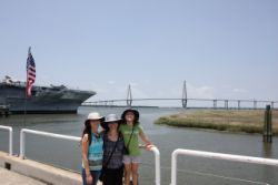
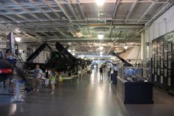
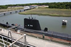
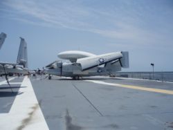
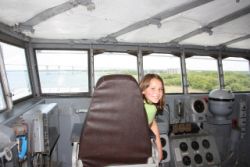
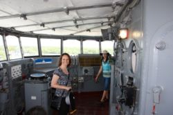
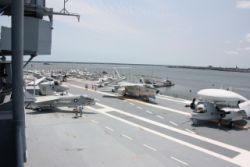
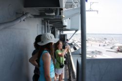
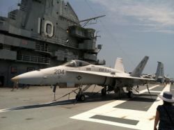
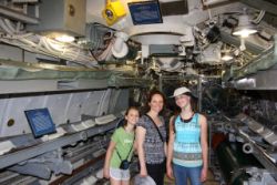
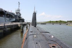
After the Hunley, we were driving across a real cool suspension bridge (seen in the background of one of the pictures above), and we saw that there was a naval museum of the USS Yorktown (CV-10) aircraft carrier, and the USS Clamagore submarine, and the kids right away jumped at the opportunity to tour them both. It turned out to be absolutely fascinating! The ships were open to completely self-guided tours, where you could walk most of the halls of the ships, on pre-defined tour routes if you should so choose, taking you into most all of the areas of the boats. We walked the flight deck and bridge, toured the engine rooms, and covered most of the areas in between. It was very very interesting to see how shipboard life was for people, and with the many exhibits, and placards inside, you could see real life photos and history that went along with these and many other famous ships of their day. I'd never seen anything like it before. I'd highly recommend this stop to anyone with kids in the less-than-teen years...they'd be enthralled. |
|||
 |
 |
 |
 |
 |
 |
 |
 |
 |
 |
 |
 |
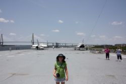
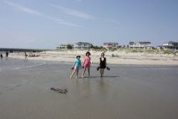
After touring around for the earlier 2/3 of the day, we wanted to get outside by the water. The kids always love a beach, so we headed out to the Isle of Palms public beach for a little swim in the waves. People were doing lots of kite boarding and it was awesome to watch, and we did some body surfing in the waves. A local warned us that in the afternoon/evening, the sharks come in to feed, but we swam (and so did many others) anyway. After a long day of fun, we gladly called the FBO and had them arrange the same hotel, and signed on for the same car, for a 2nd night, deciding to leave in the morning to start our trip up the coast. |
|||
Day 3 - Cool stops in lots of states
 |
 |
 |
 |
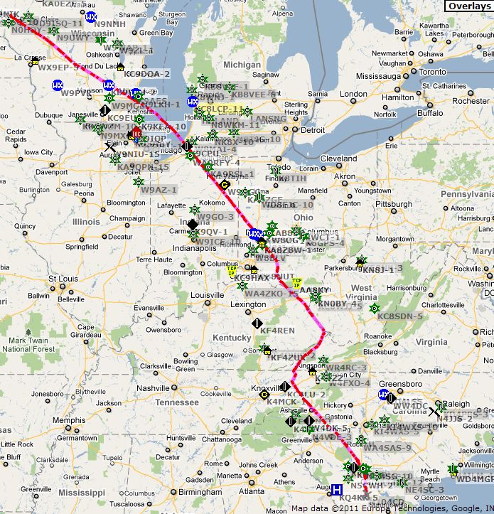
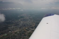
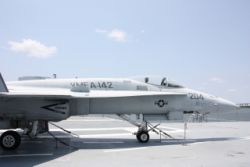
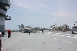
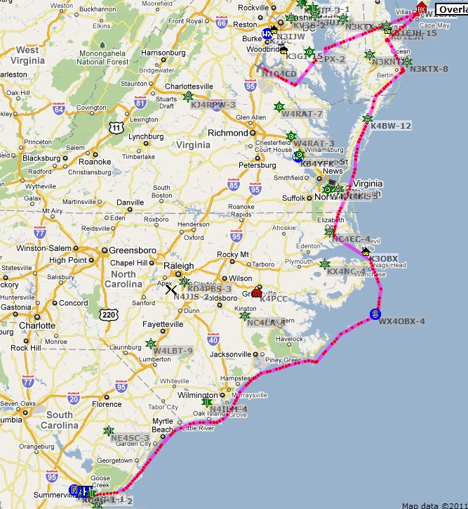
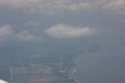
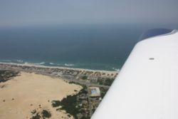
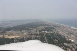
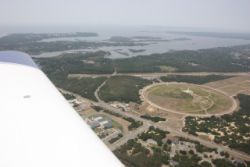
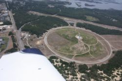
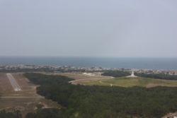
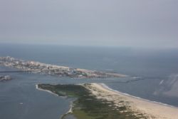
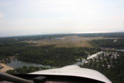
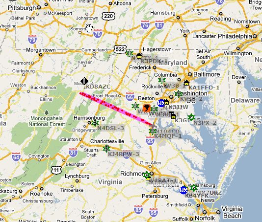
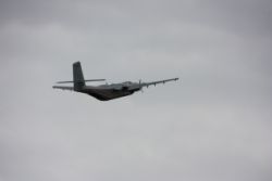
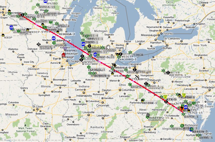
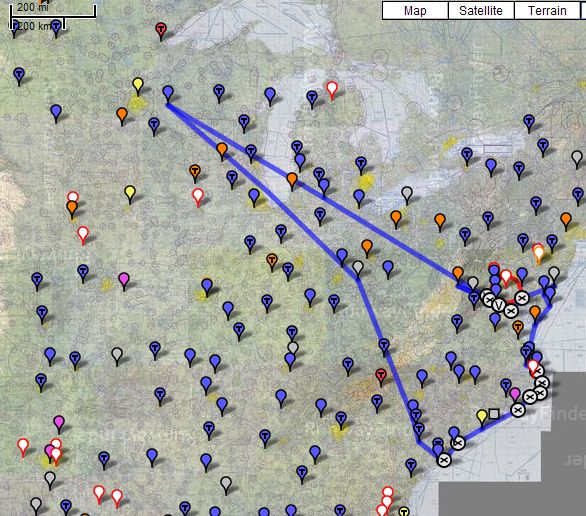
One thing about Charleston that is also really cool is that KCHS is, or is one of, the biggest C-17 bases in the US. In the photo above you can see in the background a bunch of C-17's. They were taking off and landing constantly as we prepared to leave, and we had to wait for a few carrier aircraft to depart before we could leave. One of the points of contention that I had up until now is exactly how to fly up the coast. There is a lot of Restricted, and MOA airspace on the way up the coast, due to the large amount of military activity and numerous bases on the coast. We wanted to get up to Washington D.C. for the next day, so we planned some routes that would take us there. Some of them flew inland of the coastal Restricted areas, and some of them flew through MOA's along the coast, with a couple inland trips for circumnavigating restricted areas. I don't like to rely on flight following sometimes...mainly if I don't really have a plan. They want you to enter a destination, and hey, sometimes I really don't have a destination, but that answer doesn't work for them. ;) But when I'm flying near lots of airspace, I often find it's much easier just to get flight following so you always know you're doing well, and you can let the controllers figure out if airspace is active or not. Another thing about our final destination, the D.C. area, is the SFRA (used to be ADIZ) that we have to deal with. To fly within 100nm of the SFRA (I've also seen it shown as 65miles, and there is a 60 mile ring around the airspace) you're supposed to have special SFRA training, so I got on the FAAsafety site and took the course, got the certificate, and made myself fully prepared to fly in to one of the airports within the SFRA. I was ready to go. After lots of contemplation on the routing though, I finally decided on this rough route below: You can go to http://runwayfinder.com and enter the route to see it first hand. KCHS; VPNPO; VPRRS; SUT; VPATO; VPOKY; VPGHI; VPUMO; VPWZO; KFFA; KECG; KMFV; KOXB; KGED; KWWD; VPAXI; VPACE; KRMN This route would take us up the coast, with flight following, and if I could get clearance through a couple restricted areas, it would give us a great coastal tour and a fairly quick route of about 685nm for the day. |
|||
 |
 |
 |
 |
 |
 |
 |
 |
 |
 |
 |
 |
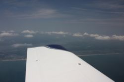
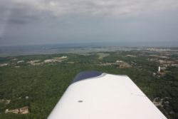
Our intention was to stay low, like 1000agl, but due to the many marine sanctuaries, we'd have to change that to 2000agl (2500 was what we started at). As we got flying, the heat buildup over land was bad enough to cause some bumps, that quickly subside when you fly over water, but we decided to work our way up to 4500' for the trip, giving us some good gliding range, and cooler air. |
|||
 |
 |
 |
 |
 |
 |
 |
 |
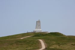
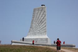
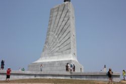
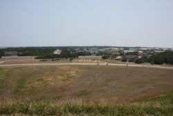
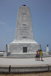
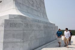
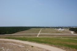
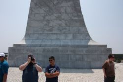
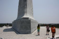
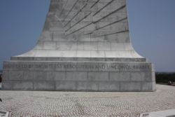
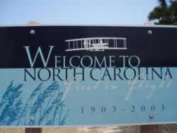
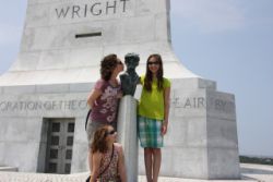
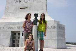
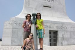
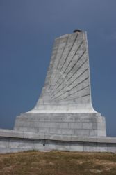
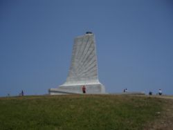
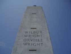
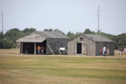
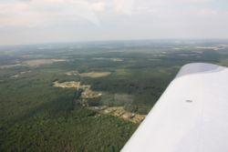
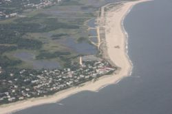
After passing by most of the military airspace and successfully getting cleared through everything, we got to our first stop, and our second new state for the trip....Kill Devil Hills, (Kitty Hawk) NC. This was a beautiful stop that anyone with aviation in their blood should go. The Wright Brothers monument was simple yet elegant, and looking down from the hill gave you goose bumps as you soaked in the history that was made on that hill. I said a silent prayer that the marvel of flight that the Wrights worked so hard to bring, would not be ruined by the fear mongering and politics of the day. We took many pictures, and relaxed in the steady breeze. It was easy to see why they picked this place in hopes for steady winds. |
|||
 |
 |
 |
 |
 |
 |
 |
 |
 |
 |
 |
 |
 |
 |
 |
 |
 |
 |
 |
 |
 |
 |
 |
 |
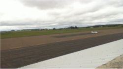
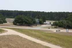
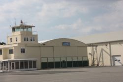
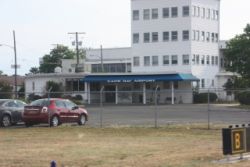
After soaking in the sights at Kitty Hawk, it was time for a gas stop before we got into the more intensive airspace that we would have later in the trip. My motto is that when going into busy or complicated settings, you're best to do it with full tanks, and empty bladders, so we hopped up the short to Elizabeth City Coast Guard Air Station Regional Airport, in Elizabeth City, NC. KECG. Here we got reasonably priced fuel, great service, a courtesy car to a great deli sandwhich stop, and everything we needed. The people that run the FBO were wonderful to talk to, and it's a stop I'd recommend if you're in the area. |
|||
 |
 |
 |
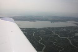 |
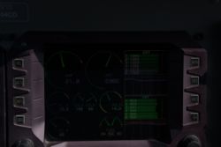
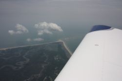
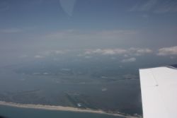
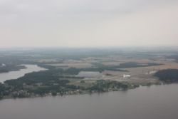
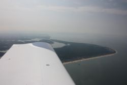
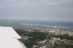
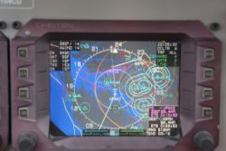
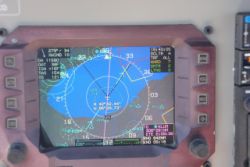
Heading up the shore again I got flight following for a bit, so that we could easily fly right over top of Norfolk and the military bases there. It cut some miles off our trip and was really convenient. We had a small stretch of overwater time as we crossed Chesapeake Bay, enroute to some additional stops in other states, and there was a tremendous amount of air traffic in the area, all pointed out with ADS-B, though we didn't get up close enough to see them all visually. You can see the traffic in the screenshots below. The marshy shoreline around the bay was very interesting and scenic. |
|||
 |
 |
 |
 |
 |
 |
 |
 |
We took a quick stop in Ocean City Beach, MD, KOXB...a destination that we had set as an alternative overnight place, due to it's carnival rides and fun things to do. We missed out on stopping at Ocracoke Island along the way, but I'm sure some day we'll be back for that stop too. With a reasonable fuel price, we decided to quick top off again and get back in the air. |
|||
 |
 |
 |
 |
 |
 |
 |
 |
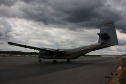
Our next two stops were rapid fire....We stopped in Georgetown, DE (KGED) for a quick stop in Delaware, and then headed off across the Delaware Bay, North to Cape May, NJ for a stop in New Jersey. Cape May was kind of an interesting stop. It was a nice airport, but they had a large number of Caribou's (large aircraft) on field. I couldn't tell if any were flying, but they had plenty of them there. |
|||
 |
 |
 |
 |
 |
 |
 |
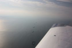 |
Flying back across the back towards D.C., as we crossed the bay, there was a long line of ships lined up. We were flying VFR, without any flight following, about to be near some of the highest restricted airspace around. I had a couple of VFR waypoints plugged in, used to keep me out of the SFRA until such a time that I actually had the proper plan filed and preparation done. I had been hoping to get to Leesburg, VA as my entry point for seeing D.C., but wanting to get on the ground in plenty of time before dusk, and arrange a hotel, we decided to stop at Stafford County Airport KRMN, between Stafford and Fredericksburg, VA. I had noted their operational hours, and knew we'd be there near closing time, and that if I continued on, I would not be able to make my stop in West Virgina that day, so KRMN would be a good overnight spot, and the plan was to re-position in the morning, after a flight over to West Virgina and back. By the end of the day, we had been in South Carolina, North Carolina, Maryland, Delaware, New Jersey, and Virgina....not bad for a half day of flying! |
|||
 |
 |
 |
 |
 |
|||
Day 4 - One More State and then in to D.C.
 |
 |
 |
 |
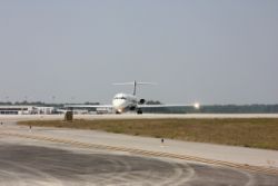
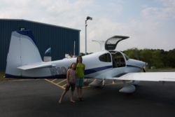
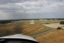
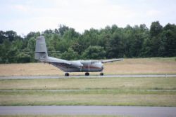
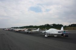
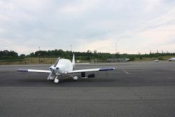
During the evening, we had checked into the hotel situation in Leesburg, and around Dulles (yes, we thought we may just fly to Dulles itself and land there for the couple of days!), and even into town from there. Turns out that the U.S. Open was happening this week, and all of the hotels were booked. Actually, we did find 2 rooms out by Leesburg, but by the time I could actually book them on the phone call, they were gone. Looking at the map, the only thing that kept us from just staying in Fredericksburg was the fact that I would then not get a chance to fly into the SFRA. The hotel price was less than 1/2 the price of the Leesburg hotel, the one we were at had an awesome pool, we had a great deal on a rental car, and so I decided that flying into the SFRA to stay, just for the sake of being there, wasn't a smart way to go. We could see everything just as easily if not easier if we just stayed where we were. So, we booked the car for 3 days and the hotel for 3 additional nights! The next day we got up and still wanted to get a flight into the mountains of West Virginal before we saw D.C., so we headed to the airport. When we were there, we saw a Caribou fire up and take off, and the FBO lineman said that this caribou was the ONLY Caribou actually flying. So we witnessed a special flight! The trip to West Virgina was very pretty...the mountains and the houses atop them were very scenic. We flew to W99, Grant County Airport, in Petersburg, WV. The airport itself is kind of in a valley, and the scenery around it is very cool. |
|||
 |
 |
 |
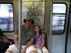 |
One of the benefits of staying in Fredericksburg is that we had the option of either going to town riding the VRE (Virgina Railway Express) right from Fredericksburg, or driving in to Springfield and riding the Metro in. We chose the Springfield stop, as it was only $4.50 to park at the Metro station, and we could then conveniently ride the Metro and hop between railways as needed, to see the things we wanted to see. The D.C. Metro is pretty organized, but it still took us a couple trips before we really saw how everything worked exactly, down to the smaller details. If you plan to hop the metro, you may want to just buy daily passes...that simplifies the fee calculation a lot. I downloaded a great iPhone app (DC Rider) that gave station status's for the trains, and had a great map, so it was simple and quick to drive in to Springfield, hop the Metro, and head right into town, landing right on the Mall. I told the kids that we were about to tour the city with the most crime and corruption, that commits the most murders worldwide every year, of any city in the United States....and most of the crime, corruption, and murder is done by our own elected officials. |
|||
 |
 |
 |
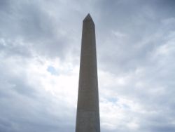 |
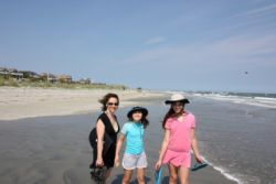
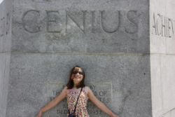
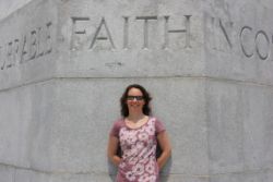
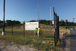
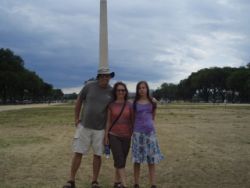
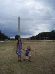
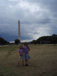
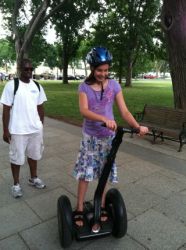
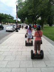
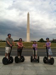
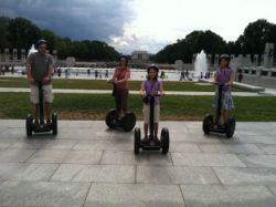
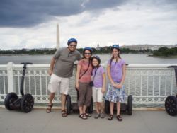
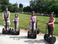
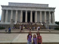
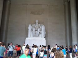
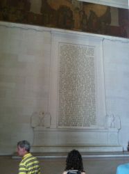
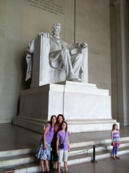
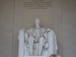
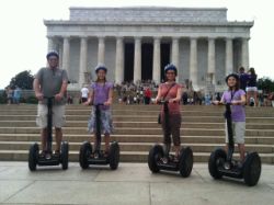
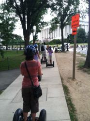
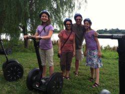
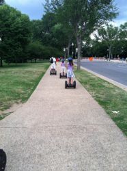
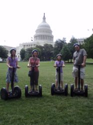
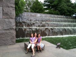
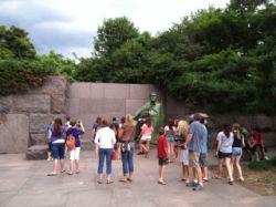
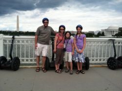
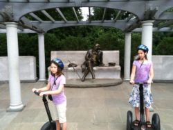
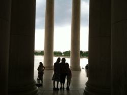
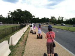
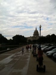
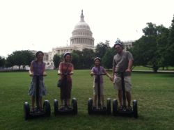
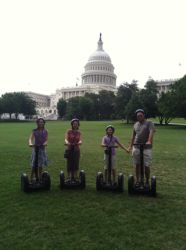
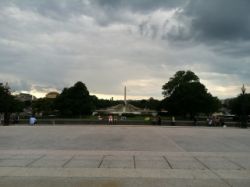
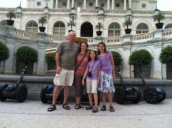
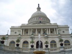
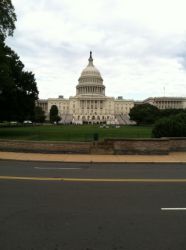
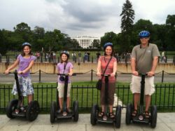
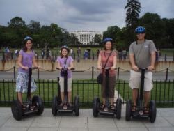
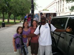
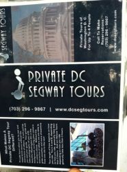
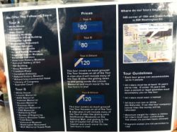
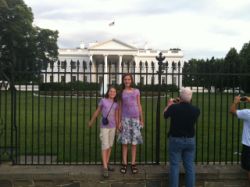
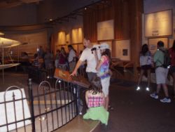
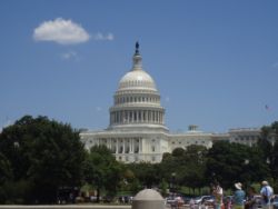
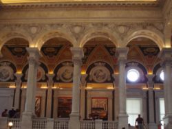
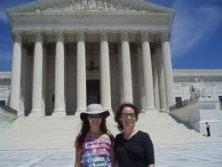
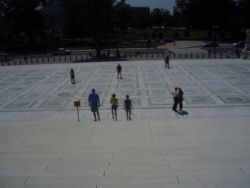
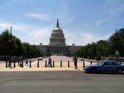
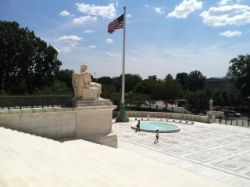
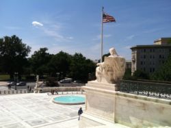
We got off the Metro, took the escalator up, and soon we were staring down the mall with the Washington Monument at one end, and the US Capitol at the other end. The first thing the kids wanted to see was the White House, so we set off on foot to go there. We ended up getting sidetracked almost immediately. We ran across a guy in a van, lined up with some sidewalk van/truck vendors, that had 5 Segway's sitting there. Andrea had checked into Segway tours previously, but age restrictions made us think it was impossible...but this guy, his name is Cory, was happy to show us the Segway's and give a little driving test, and if all was well, he'd take care of us. This turned out to be the best thing that could have happened on this trip! Cory was amazing. I would highly, highly recommend him as a tour guide. See below in this section for a couple of photos of their flyer, and the places they take you to. We signed up for the Tour #2, but 1/2 way through it, we knew that this was 100% PERFECT for seeing Washington DC, and we told him we would pay the upcharge for the complete 2 tour package. Yes, it isn't cheap, but if you have any clue as to how fast and smooth and easy a segway tour is, you wouldn't even question the cost...and Washington D.C. is about the most ideal place you could ever use a Segway. The Segway gives you the ability to cover a LOT of ground, very very fast, but still see everything just as if you were walking. We toured nearly all the major monuments and buildings, stopping often for photos and to go inside and tour the monuments on the inside. Cory was very accomodating, and gave us a lot of the in-depth, lesser known details behind many of the things we saw in D.C. To see a couple of videos of riding the segways, click HERE and HERE. (These are .mov files, taken by my iPhone) |
|||
 |
 |
 |
 |
 |
 |
 |
 |
 |
 |
 |
 |
 |
 |
 |
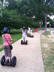 |
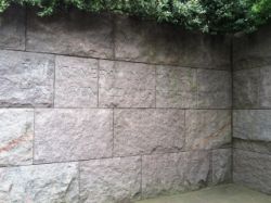
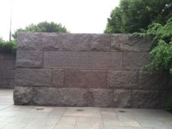
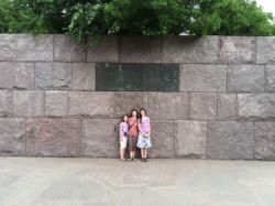
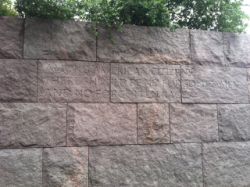
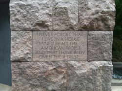
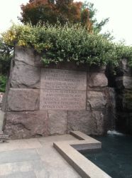
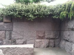
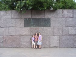
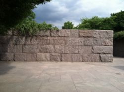
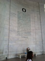
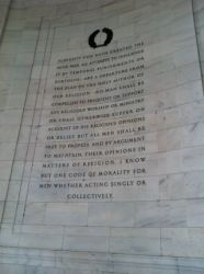
As we toured around, people all gawked, and many people asked where you can go to get a segway tour. The thing I remember most about Washington D.C. from when I was a kid, was how miserable it was to walk and walk and walk to see everything. I mean, there are tons of cool things to see, but if you actually have to WALK to them all, you actually NEED to take many days, and spread it out, only doing a couple or a few things a day. It's tiring, especially if it's hot outside. But with a segway, we hit all of the major attractions, all within the first few hours of being in D.C. It really took a load off of what we had to do for the next 2 days! We even got to memorials that we would have skipped completely, had we not known, like the F.D.R. monument, shown below, which showed how truly a well intentioned president he was. They sure don't make presidents like that anymore! Actually, that's one of the things that was the most interesting to see along the way....all of these written statements by famous past presidents, and how we still say many of these things today, but it's clear that the government which we actually live under, is almost completely filled with hipocrisy, and the actual function of the way things work today, is far from what was stated by the forefathers. Seeing the F.D.R. monument at least you got the feeling that he actually believed those great things he said. |
|||
 |
 |
 |
 |
 |
 |
 |
 |
 |
 |
 |
 |
 |
 |
 |
 |
 |
 |
 |
 |
 |
 |
 |
 |
 |
 |
 |
 |
 |
 |
 |
 |
 |
 |
 |
 |
As we concluded our tour, we had to take some photos of Cory, and the brochure (above), and then we set out with huge smiles on our faces, to go get a bite to eat before leaving town for the night. We got a surprise right after dinner...Cory had known that the kids were thrilled with the idea of seeing the president...and on the trip we had only seen the first dog. He called us to let us know that due to things going on around the streets, he knew the President's motorcade was about to come through. We ran down the sidewalks towards the White House entrance, and arrived just in time to see him go by in his car, from about a block away. On our last day in town, we were hanging out in the area of the White House again, when I saw some signs of things indicating something was about to happen too. We rushed back to the corner by the White House driveway entrance gate, and he passed right in front of us again, only a few feet away, on the way back to the White House. The kids thought that was the coolest thing...well, next to a segway tour, anyway. :) |
|||
 |
|||
Day 5 & 6 - Touring D.C.
 |
 |
 |
 |
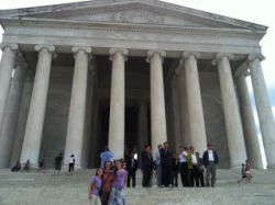
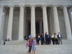
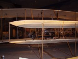
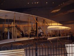
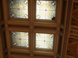
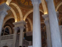
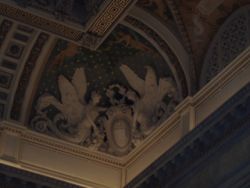
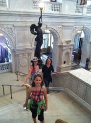
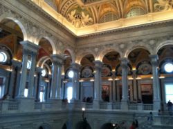
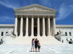
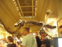
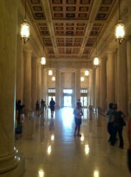
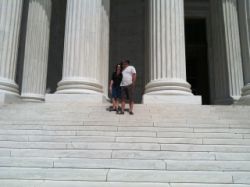
The next 2 days we did a partial repeat of the day before....we drove to Springfield, took the Metro, and then saw all the sights around D.C. We of course went to the Air and Space museum and saw the actual original Wright Brothers airplane that flew at Kitty Hawk, we went to the Library of Congress building, we swung through the Supreme Court building, which has a great cafeteria, by the way. We stopped by the National Archives, the Museum of Natural History, and a few more things. Washington D.C. is just filled with history and things that will keep the kids occupied. Oh, and the National Archives has a great cafeteria too, just as a tip on where to get food while you're there. After 2.5 days in D.C. though, we didn't have much interest in walking around another day. D.C. has too much to do to see it all in a couple days, but staying more than 3 days will just plain wear you out, so we decided to call it a week and head home the next day, and save the other things for a future trip. The segway tour had given us such a great view of so many attractions that we didn't feel like we missed much of what we would have wanted to see...it's truly the ideal way to see D.C. |
|||
 |
 |
 |
 |
 |
 |
 |
 |
 |
 |
 |
 |
 |
 |
 |
 |
Day 7 - Returning Home
 |
 |
 |
 |
It looked like we were just going to get out of town at the right time. A small-ish storm cell was headed right for the area, so we headed to the airport to try to beat it out. The airports were VFR, with some IFR along the middle of our trip home, but everything forecast to become VFR throughout the day. We started the trip down low, staying below the overcast, not talking to anyone...just trying to put 30 minutes behind us that would get us completely past the rain and storm cell. It worked like a charm...we got some sprinkels but didn't hardly get much for precipitation, so we always maintained 10 or more miles of visibility. In no time we were climbing up above a scattered layer, and headed for our mid-trip fuel stop in Michigan. Our intended fuel stop was KOEB, Branch Co. Michigan, where I finally got bit by Foreflight's use of 100LL.com's fuel pricing not being accurate or updated recently. I felt pretty robbed after topping off with 40+ gallons, only to find that the (I think) $4.99 that was listed on 100LL.com was actually $6.10/gal. I mean, it was a nice airport, with a nice building, but $6.10 was the most I've ever paid for gas, and this was the kind of fuel pricing that you'd normally find at a large airport with Jet traffic, not your little average county airport. In fact, on this trip, the average price I had to pay for fuel (excluding this stop) was probably in the very low $5's....with a couple of the stops being UNDER $5, and the others being just over. So, I can say if you need a convenient stop, with a courtesy car and nice terminal building, stop here...but if you're needing fuel, pass up KOEB and head elsewhere. |
|||
 |
 |
 |
 |
 |
 |
 |
 |
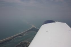
After KOEB, we climbed up high for this trip back across Lake Michigan, since this time we had a headwind that would give us additional time over water. We kept a watch for ship/boat traffic in case we needed to ditch where we couldn't make a shoreline, but everything was running so good and in only a few minutes we were again able to glide to the far shore. As we continued along, we had to fly through the many MOA's that fill the center of Wisconsin. It's a pain because any time we fly East...ANYtime, we have to fly either WAY around a MOA, or through them. It's constant enough that I can't even care if it's hot or not....I'm not gonna fly all the way around it and they don't leave any kind of corridor through it. It's insane that they block that much of the state's airspace. But anyway, as I was traversing the MOA, I could see some interesting traffic on the ADS-B, about 10 miles ahead. I picked up one, and then 2, side-by-side targets, just over 10 miles off the nose, coming out of one of the small restricted areas. The targets were moving VERY fast...I could tell it wasn't a small plane, and carrier class traffic is much higher...this was only +2,000' off our altitude. I watched as they flew past about 10 miles off our right wing, doing maneuvers, and then as fast as they came, they were gone, off to the rear. We saw them visually, and it was cool to see such fast moving planes....and here I thought I'd have to worry about the F-16's near D.C.... |
|||
 |
 |
 |
 |
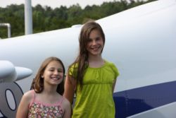
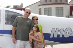
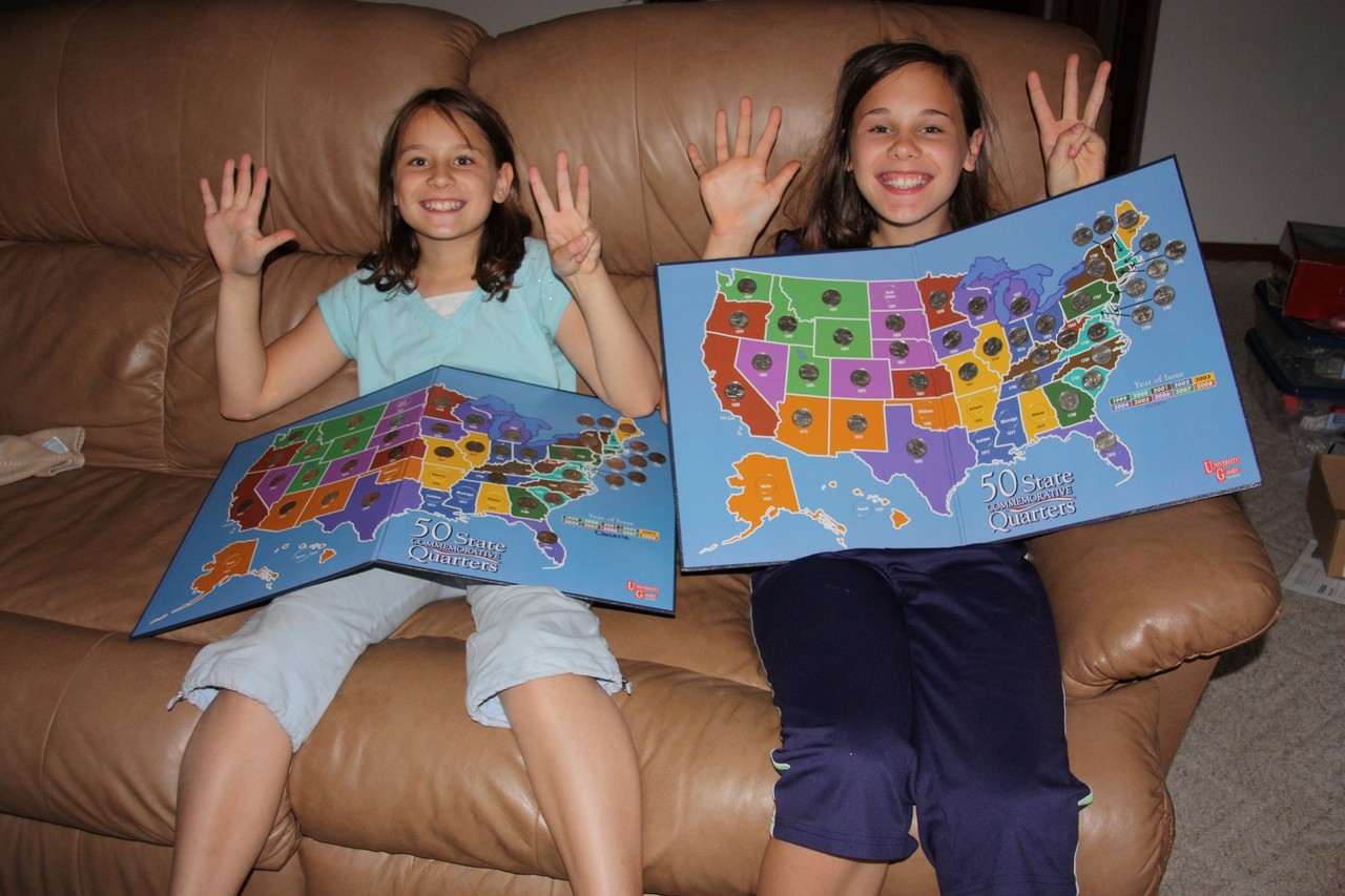
At the end of this trip, we tallied up our new milestones. The Kids have now traveled to 42 of the 50 states...most of them were by RV-10.
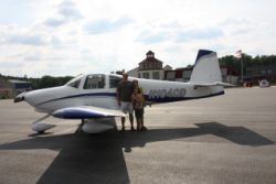
(The kids drove from Portland, OR into Washington State, otherwise they'd be equal to the plane). In fact, RV-10 N104CD has now landed in 41 states, and 3 countries! We're closing in on the goal of 49 of the 50 states with the RV-10, for sure before the kids are out of High School and on to their own fun things.
I don't think I'll bother with Hawaii...if N104CD wants to get to Hawaii, it'll probably just be a piece of it that makes it, packed away in our luggage. :)
Our complete route for this trip was just over 2,500nm as flown, taking 13.0 hours of flight time hangar to hangar.
Site Home | N104CD Home