|
|
|
|
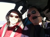
The timing wasn't working out perfectly for our trip South
over Christmas, either...there were some pretty wet snow
and rain storms that were working their way across that
area of the country for quite a few days, so we got to
spend Christmas at home with the kids, which ended up
being very nice. Then we still had another couple
days to wait for the storms to pass so we could finally
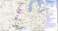
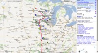
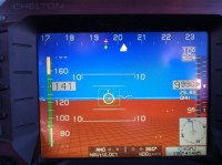
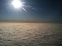
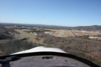
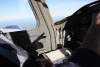
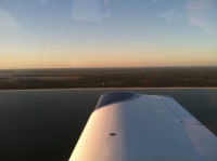
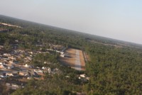
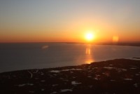
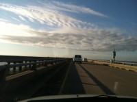
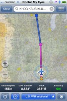
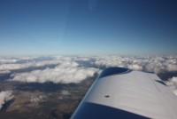
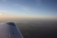
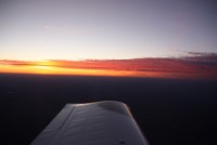
plan a route down South. The morning we left, I had
the plan figured out on the iPad and you can see above we
just cleared the weather. From our hangar security
cameras you could see the clouds were overcast, and it was
cold, so we had a little worry about icing. I spent
a lot of time flight planning that a.m. before I left, so
I'd know exactly how long the bad weather would last, and
I tried to get a good idea of how thick the clouds would
be. I had intended to not file, and go VFR, staying
below the clouds, but I decided I'd throw in an IFR plan
anyway and if I took off and it looked as thin as I
thought it would be, I'd go IFR. Sure enough, the
bottoms were in the mid-3000' range, and the tops were in
the mid-5000's, so with a call to ARTCC, we had our direct
clearance to 10,000' and we climbed right up through
it. I completely forgot to get some HD video of the
takeoff, or any photos either. We picked up only
trace icing on the windshield and wing as we climbed and
within minutes it was all gone.
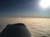
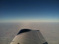
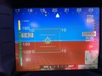
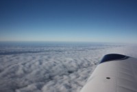
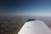
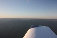
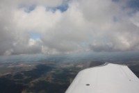
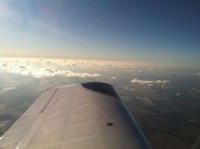
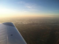
On top, at 10,000', crusing along in the mid-160Kt range
(true), we had some great tail winds, and pushed between
195-220kts of groundspeed! We headed for Grove,OK
where the fuel price wasn't bad, and with fuel flows in
the low-10's we had plenty of range....we actually could
have made it direct to New Orleans with no real issue.
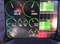
With some cold temps outside, I had CHT's around the
280's, and my oil temp wanted to stay in the 160's, so I
had to pull my new oil air control and raise my oil temps
until I could sustain the 190's. That sure was a
great addition.
|
|
|
|
|
|
|
|
|
|
|
|
|
|
|
|
|
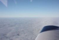
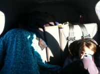
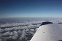
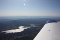
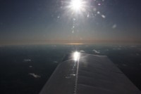
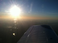
We cruised along on top, in the bright sun. You can see
the kids buried themselves under jackets some of the time
to get out of the sun. Another cool thing that
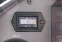
happened along the way is that N104CD turned over 800
hours, which means I've been putting some pretty good time
on her. That's probably about 1/3 of my engine gone
already! At Grove municipal, the people were very
very nice, and we got the courtesy car for some quick
food, and then piled back in for our next leg.
|
|
|
|
|
|
|
|
|
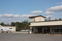
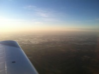
Still maintaining our tailwind, we had a quick flight to
Hot Springs, Arkansas (KHOT) which was also a nice FBO,
but we didn't stay long. We'd really like to go back
there though as it looks to be a very scenic town, and
spend some more time. We jumped back in after a
quick stop and climbed back up to head to
Alabama....making shadow figures on the walls to pass the
time.
|
|
|
|
|
|
|
|
|
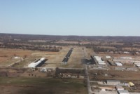
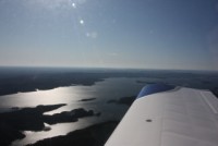
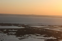
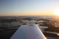
In no time we were landing at St. Elmo, AL (2R5) and were
now within view of the Gulf of Mexico. We took back off
and headed West along the shore to Ocean Springs, MS
(5R2). This airport was VERY hard to spot until we
were RIGHT on top of it. There are high trees on all
sides, and if you fly in at night, they say you can't see
the runway lights until you're right over it either.
Pretty neat little strip...almost reminds you of being an
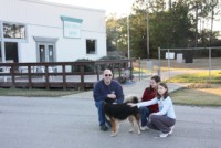
air park. The guy there was super friendly and came
out to talk for a while. He had a dog named "chance"
because it got a second chance after Hurricane
Katrina...it was found just as a tiny puppy, all alone,
with no home. It was a beautiful and friendly
dog. The airport itself is in need of some air
traffic...it sounds as if the economy has hit it pretty
hard, and flight schools closed. Hopefully it will
be around for many more years. After a bit of chatting, we
boarded back up and headed West again.
|
|
|
|
|
|
|
|
|
|
|
|
|
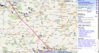
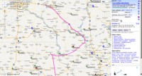
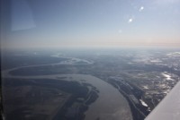
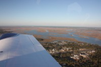
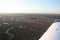
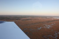
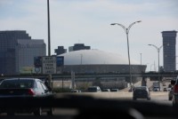
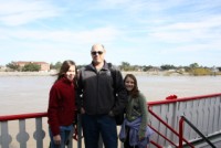
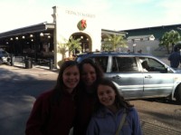
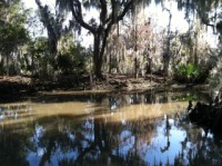
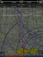
As we neared New Orleans, we started to see the Bayou's
and swamps below, which were very cool. Our plan was
to fly to Hammond, LA (KHDC) and stay there because out
good friends Ed and Sheila had stayed there in the past
and had a great time. We touched down before dark,
and after starting off at maybe 10am that day, we were now
done with all 5 states in the South!
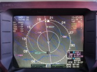
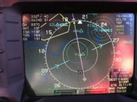
Here's our track log of our trip down
|

|

|
|
|
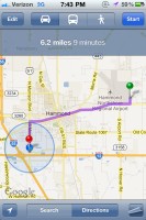
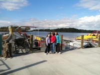
Once we got in, our first order of business was to get our
car which the FBO had arranged through enterprize, and
then find a good hotel with an indoor pool. Only 6
miles from the airport was an excellent place....the
Quality Inn, which was fairly newly remodeled and priced
really well too! The people there were
fantastic...especially the manager and front desk
clerk. They had a happy hour with free drinks that
was just wrapping up and they made sure to get us included
in that! Right across the road was Don's seafood
where we could get some great dinner, too.
The next day we got up, hoping to get on an airboat
adventure, but found out that with the Christmas week, we
were too late that day since we slept in. So, we
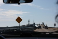
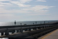
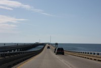
headed to town via the Causeway (the longest continuous
over-water bridge in the World!) with our iPad as our Map
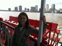
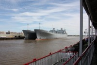
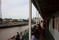
and decided to get on the Steamboat Natchez, (Natchez
number 9, the only one that hasn't ever lost a race) which
is a REAL steam powered paddlewheel steamer. We
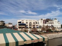
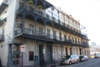
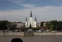
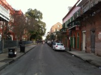
headed down to the French Quarter and parked right near
the dock and walked right up and on to the boat. The
kids were pretty impressed by the boat, and the tour of
the river was fun and relaxing.
|
|
|
|
|

|
|
|
|
|
|
|
|
|

|
|
|
After the Steamboat, we walked down to the French Market
and had Biegnets at Cafe Du Monde, and after perusing the
markets for a bit, we headed back into the French Quarter
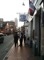
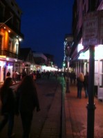
towards Bourbon street to see that aspect of New Orleans
as well. There are so many really cool buildings to see,
and so many restaurants it's amazing. Bourbon St.
has some of it's legendary adult-only places too, but the
kids weren't overly phased by that, as we've always taught
them that there are a variety of extremes and situations
around the country and that in their travels they will
come across some real oddities...so they aren't sheltered,
and they know what's what, but they know right and wrong
too. After a full day, it was now dark and we headed
back to the hotel.
|
|
|
|
|
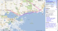
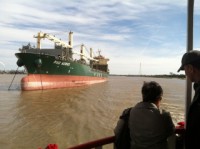
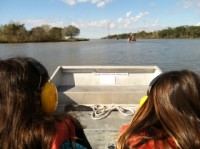
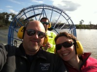
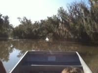
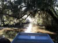
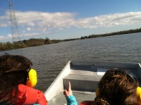
The next day we acted much quicker and the day before had
pre-arranged an airboat tour, so we headed way South
again, retracing the steps from the day before, but
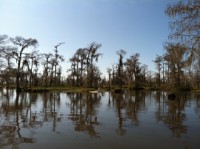
continued on to the Jean Lefitte preserve area for our
Airboat tour. We booked the smallest airboat, which
is also the fastest and most able to get in to all the
tight spaces...it was a very cool trip! The boat
goes over 60mph, and within minutes you're cruising
through the Bayou's. We saw many birds, some deer,
and one Alligator. The cold temps had kept many of
the Alligators hiding in the warm mud, but we did see one,
so it wasn't a bust.
|
|
|
|
|
|
|
|
|
|
|
|
|
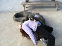
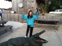
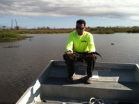
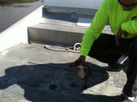
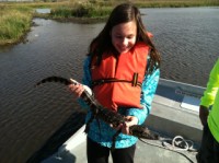
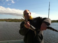
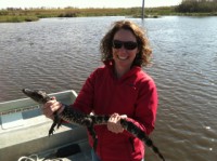
Then as we stopped out in the lake area, we were in for a
real suprise. The boat captain Craig (a very nice
guy) from Airboat Adventures, LLC, had brought along a
small alligator in a cooler for us to actually hold!
We spent some time handling and checking out Gator-zilla
and then we handed him off to another boat to see.
Back at the shop, they also had a white albino Alligator
to see...that really was something freaky!
|
|
|

|
|
|
|
|
|
Always with an eye on the weather, we looked and saw that
some snowstorm weather was headed in, so we got done with
the airboat ride and headed North to the airport to depart
for home. The trip home started out excellent, with
<10kts of headwind component, often only slowing us
down by 5kts or so, and perfectly smooth skies
again. Passing near Memphis you could look out the
windows and see all of the flooded farm fields. It looked
devistating...they got SO MUCH rain down there that fields
were all flooded like swimming pools. Amazing.
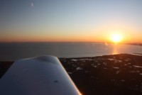
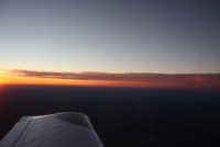
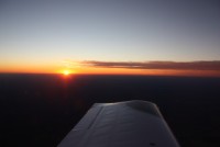
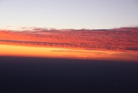
Soon we were looking at a great sunset, and then it was
dark as we headed to St. Louis to AeroCharter FBO (a great
bunch of guys). There was MVFR and some IFR
conditions around home, with incoming rain and snow
storms, so we didn't know if we'd get in or not. St.
Louis seemed like a great place to stop if we had
to. We had enterprise drop a car, figuring we'd have
to stay. But, as we had been flying, we kept updated
on the weather and it was clear that the next day was
going to be worse. If we got stuck in St. Louis, we
may be there for TWO nights. So we decided to plug
along and get as close to home as possible. We knew
we could probably get within 45 minutes of home before the
real bad stuff hit. The sad thing was, it was now
night time...so far less comfortable. You can't see
the cloud layers, you can't see roads to land on.
All we could rely on was city and country lights. We
flew along always watching for moving cars, to show us
roads we could land on, and ALWAYS keeping forward areas
of city lights in view. If we ever lost forward view of
lights, our plan was to descend and/or turn around so that
we ALWAYS had good ground contact.
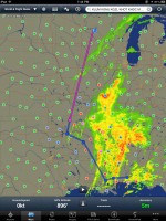
Our home airport and those around it was surprisingly
reporting SKC (Sky Clear) but the ones a 30-45 minutes
South were 1300-1700 OVC or SCT....all MVFR. Sure
enough, right on schedule we hit the area of MVFR. We had
been crusing at 6500' with 70-100 mile vizibility, but now
we couldn't see city lights anymore, and none out on the
horizon. We could tell there was a cloud layer over
the last city in front of us, and probably layers up
higher too, but with the darkness we couldn't see for
sure. We decided to turn and head towards KMSN,
which we knew would put us 1 hour from home and they'd
have a car and hotel easily. As we flew East on our
"turn and run", we REALLY preferred to head to KDLL
(Wisconsin Dells) because if you're going to be stuck for
2 days, THAT'S the place to get stuck! They had
reported MVFR 1700' OVC before, but once we pointed the
nose in that direction, we could see all the lights in
front of us and could see Wisconsin Dells in the distance,
so we knew we could make it in there. The landing
was uneventful and we had plenty of visibility under the
clouds. But, there was a haze above, a high
dewpoint, and temps in the high 20's
Fahrenheit. No ice had accumulated, despite
the hazy conditions, and as we landed we could see it was
a thin overcast or scattered layer that was above.
That gave the opportunity for one last move, that if it
worked, could save us a few hundred in hotel bills, and
get us home that same night...before the worse weather
hit. Sadly, with haze and clouds of unknown
thickness, there was NO WAY I was going to file IFR and
fly at night to go home. Had it been either A) above
freezing by 10-15 degrees, or B) daytime, this would have
been much easier, and IFR would have been the way to
go. But without those conditions, it was far safer
to go VFR...provided we used a great tool....the
interstate (I-94). The interstate goes right from
Wisconsin Dells right past our airport. That would
give us not only a constant string of lights to follow all
the way home, but a constant emergency landing spot if the
engine quit. Also, the visibility was always at
least 7-8 miles....a really nice clear night below the
haze at 1300-1700', so we could see all the nearby cities
and things really well. Flying at low altitudes we
did have to be very aware of obstructions, but we could
easily see all lit towers and where we had unlit towers,
we could fly directly over the interstate and not have to
worry. The Cheltons have a great obstruction display
and warning and by flying at about 1000-1200' we never eve
had an obstruction alert the whole trip.
Almost sadly, as we plugged along, I could constantly look
up and out the window and see the moon through the haze,
or in most cases see the stars above...indicating that the
layer being reported really was very very thin with
nothing above it. DEFINITELY had this been daytime,
it would have been an EASY trip to just climb and be on
top, but it was far better to just maintain ground contact
for us. Keep in mind that we live in flat
lands. Had we lived in the mountains, this would
have been much less easy. In no time though we were
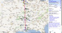
pulling in to our home airport and putting the plane away
for the night. The track log below shows the
interstate route, which was pretty neat.
|
|
|
|
|
|
|
|
|
One other side note...on this trip we used both Foreflight
(for planning) and WingX Pro 7 (in-flight). It's
really becoming apparent that this is the strength of
each. Foreflight really can't be beat as a
pre-flight planning tool. It's the crispest and prettiest
display of them all, with wonderful useability for
preflight planning and filing. REAL nice
software. But, once you're airborne, I think WingX
has them significantly whipped. WingX just keeps
impressing me with what it can do and how it can do
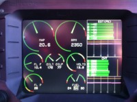
it. Below is a screenshot of a dimmed night display
on our iPad, leaving St. Louis. They even display airspace
data in the lower right corner as we're under shelves of
the Class B. It really is fantastic software.
I don't know how I'd do without each one, but my strategy
is this: For 2012, I'm going to DROP the
georeferencing from Foreflight...go with the cheaper
non-Pro package to save money. But, I've already
renewed my WingX and have lifetime georeferenced data with
them. So that's what I'm going to stick with.
Also, WingX just beat Foreflight in another way. It
used to be that with Foreflight, you could have one iPhone
and on iPad per subscription. That's fine, but my
wife and I each have an iPhone and we own 2 iPad's.
So, it costs a bunch to get both of us Foreflight (sadly)
because we have to get a multiple subscription, and that
only gives us 2 phones and 1 iPad. That kind of
sucks.
With WingX they just released their unified app so I have
similar functionality on my iPhone as their iPad app...and
it doesn't care how many you install. So, I have my
iPad with it on for primary use...the kids iPad has it
just as a backup. Then, I have it on both mine and
my wife's iphone....all for one subscription. Now
really, software vendors, what's the big deal with
that? We only use it heavily on ONE iPad. The others
are more of a backup, only. If it were better for
pre-flight planning, maybe we'd use it on 2 iPhones more
often....but as it is today, I rarely use it on the
iPhone...only as a backup. If Foreflight would wake
up and just let you install it on all of your devices as
WingX does, I'd probably splurge for the PRO version and
buy it for my wife again too. As it is, I think this year
they're going to lose out on that subscription because I'm
cutting PRO, and I may not put it on her phone either.
They still have the best pre-flight planning, though.
|
|
|