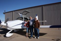
Baja Adventure 2011
Added 4/14/2011We had a bit of a surprise this spring! We were originally not planning to take a winter or spring trip anywhere, because we have a bigger trip planned for after school is out, until Scott and Family invited us to join them for a Baja Mexico trip. Having read his write-up of his previous trip, I was pretty excited for the journey. We didn't have all that much to prepare, because we already purchased our 2011 customs sticker for U.S. re-entry, and I had all of the normal required paperwork for cross-border travel...and there isn't much to do but eAPIS filing. The biggest difference was trying to understand the requirements for Mexican insurance.
In Mexico, the rules used to say that in order to fly there, you had to purchase insurance from a MEXICAN company, and some agents in the U.S. could sell you a policy. It isn't expensive...I think Scott said he paid $65-80 for a policy. If you google the requirments, your results will be all over the map, because some websites have dated info, and some pilots only know and tell the dated info, and things have changed in the past 3 years or so. I called NationAir, my insurance broker, and they said that you don't need Mexican insurance anymore, but you do need to be covered for liability in Mexico, and that my current policy from Global Aerospace already covers me any many different countries including Mexico. You are required to bring an original and 2 copies of your insurance policy with you (yes, upon entry they did page through the policy and look it over), so they sent me an original and the .pdf to print more. Jenny Estes (my agent) also offered to send me 2 letters, one in english and one in spanish, explaining the rule, and where to find the information within my policy that shows I'm covered in Mexico. I took her up on that and brought it with me. Other than that, we brought my Radio Station License, and Radio Operators License, passports, and anything else that we thought we'd need. Additionally, RaNae was nice enough to go get us some Mexican Peso's, as our local banks don't stock them around here. We got $250 in Pesos, (exchange rate is $1 USD = 9.2 pesos approx.) which in the end wasn't nearly enough. In mexico, some stores and people will take dollars at about 10% for a ratio, and the more finicky places will want 11.5% for the exchange rate, so it's hard to pin down exactly what the exchange rate will be. Either way, Mexican Pesos are what they want for you to pay your immigration fees for your permit, they want you to pay for fuel in Pesos, although when pushed they will often take cash or AmEx, and the regular customs stuff will be paid in Pesos.
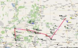
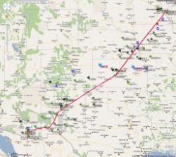
Loaded with some dive gear, a few changes of clothes, and a bunch of other little things, we started planning the trip. Our original route plan was to fly to Salt Lake and meet Scott and RaNae and family at home, and fly along with them down to Mexico. Our actual routing looked more like this...
(all pictures are clickable)
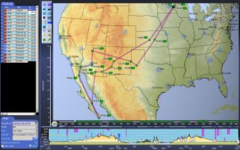 |
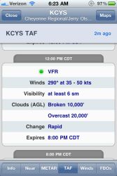
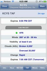
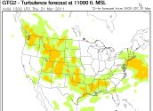
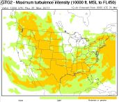
The problem is this unpredictable spring weather we have all over the place. Take a peek at these airmets, turbulence charts, wind charts, and especially the Cheyenne, WY TAF's that we saw for the day we planned to head out. I don't know about you, but that white box on the airmets, when over mountainous areas, really doesn't look fun. And when ground winds are calling for 35-50kts, I don't really care if it's going to be VFR...I don't think I'm interested in flying over mountain tops! It was horrendous weather, ONLY for the 2nd half of the trip to their house from Wisconsin, and once we made it there it would be OK.
 |
 |
 |
 |
 |
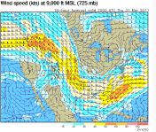 |
We decided to bite the bullet and just change plans at the last minute. High winds over the plains don't bother me, as long as they aren't accompanied by lots of turbulence. I hate bumps! But, a positive aspect of the winds above is that we'd have a partial quartering tailwind for some of the trip down.
 |
 |
 |
We actually took the kids out of school for this vacation. Scott and RaNae had rented a house in Mexico for a specific week, and it didn't coincide with our spring break long weekend that the kid's school has, but we knew we couldn't miss out on this fun, so the kids took 6 days off school for the vacation. Thursday we picked them up straight from school and went to the airport to head out....sadly that meant that we'd have less hours that day we could fly, but it would put us closer to the destination before the even worse weather would hit our area. The day after we left, our area got dumped on by miserable snow storms.
 |
 |
 |
 |
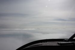
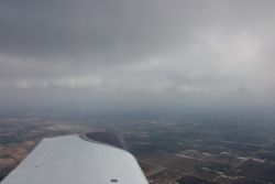
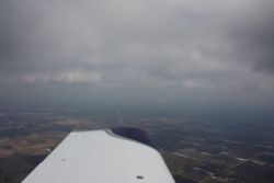
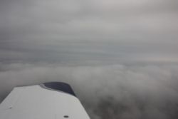
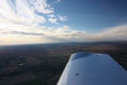
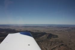
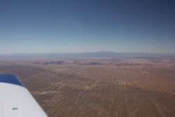
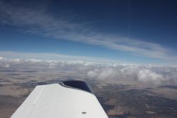
There was some weather mid-country that extended past Omaha and caused us to not be able to head directly towards Albuquerque like we'd have preferred....hoping to get as far West as we could to clear that area of wind and turbulence as quickly as possible. We departed and climbed through broken clouds and got on top VFR, having a pretty normal and good flight. That didn't last too long though. After maybe a half hour or hour, we were forced to pop back down through a hole before the sky went overcast. The problem was the temperature....we were below freezing, and these were high moisture clouds. I wasn't interested in filing IFR and flying into potential ice, so I wanted to remain clear of clouds and do the trip VFR. So we were pushed down. |
|||
 |
 |
 |
 |
 |
 |
 |
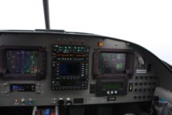 |
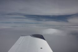
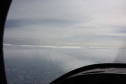
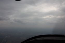
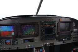
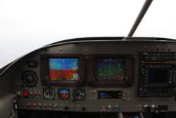
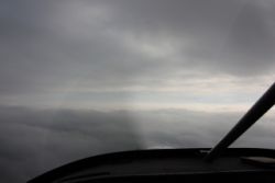
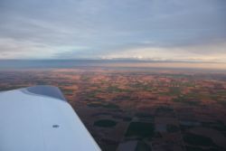
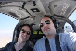
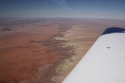
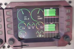
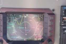
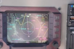
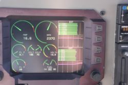
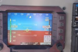
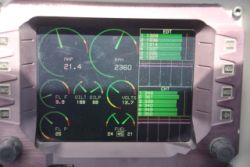
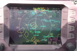
Just a few misc. pictures of the panel...from time to time I like to refer to them to remember where I placed things...in the above pictures, this would be my first trip where I had an oil cooler valve control knob, located right next to my alternate air valve. As we flew along and approached the front, there was precipitation (rain type) falling in a line North to South across the center of the country, with a gap maybe 150 miles wide. The line of rain was very narrow....you could completely fly an RV-10 from side to side of the front in about 20-30 minutes. So we kept heading South until we passed the green precip returns, and then turned West to cut through the front as quickly as possible. We got pushed lower and lower and lower, watching the WSI weather on the Cheltons for current airport conditions in front of us, knowing that conditions would improve in a very short time. Still, it was no fun getting pushed real low, with ceilings for a while coming down to under 1000 ft, and viz down to 2-3 miles, we pushed on. I'm not a fan of scud running, but we had enough forward viz to see obstructions, we were under 1200AGL so we met the class G airspace requirements, and we had in-flight weather info, so we aimed from airport to airport as we flew SouthWest, so that if the conditions got worse, we could either land at an airport right in front of us, or turn around and land at one we just flew past and be there within 5 minutes. The clouds were low, but they were fairly stable....so they weren't coming down, we were just flying through the front, knowing it would improve. And, I'd rather be zipping along low and be out of the ice than up in the precip trying to figure out how to stay aloft. The OAT was between 31F and 33F for most of this portion of the trip. |
|||
 |
 |
 |
 |
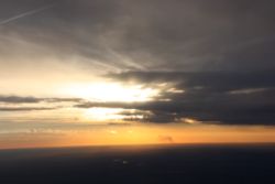
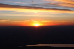
Like clockwork, and exactly as the WSI weather had showed, we were past the front in maybe 20 minute, and after I could see that we had holes in the clouds directly over our heads, and could perhaps be between layers, I decided to pop up quick and try to get back up to 2500-3000ft. Sure enough, we were between layers, having a very nice smooth ride, and could see blue sky and sun ahead! Another 10 mintues later and as you can see in the couple of photos above, the skies cleared right up! I'd have to tell you that the NUMBER ONE thing that I love about aviating in the 2000's and beyond, is in-flight weather. Nothing comes close to giving us the benefit of safety, and information we need to safely complete flights on less than ideal days. Here we had maybe 30 minutes of pretty miserable weather, but were able to make the trip. Without in-flight weather we'd either have cancelled the trip, landed all the time to get weather info, or worse, gotten stuck in places we didn't want to. We stopped at McPherson, KS KMPR for fuel....a stop we've made before, and tried to figure out which city we'd end up in for the night. Knowing that Russ Daves, a very nice RV-10 Builder from Lubbock, TX would know where to go for lodging in that regionn, I gave him a call for advice....and he gave me much more than that. Russ told us to fly straight to KLBB, Lubbock Intl, and not even pay for parking and gas....just park there and he'd put us up for the night and deliver us back in the a.m. right away so we could continue on. We wanted to fly early before heat and winds picked up. Russ and Ann were very accomodating and we had a nice visit with them...thanks a million Russ! |
|||
 |
 |
 |
|
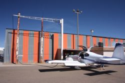
The next a.m. we awoke to great weather in Texas, and we had a great breakfast at the "Daves Cafe", and headed out. We needed some fuel as we were headed toward Phoenix, AZ, but didn't have any definite timeline other than we needed to be there before 5 or 6 pm to get a rental car from the FBO before they closed. We ended up stopping at one of the most miserable gas stops I've ever had in my life!
I'll warn you right now...KCVN, Clovis NM, is a pretty frustrating place to get fuel. If you do everything just right, it can go fine. If not, you're going to have a royal pain. Check out the big boom over the orange and silver hangar below....that fuel hose goes all the way up, over, down, and across the ground...and it's very long. The sign on the pump said that you should turn on the pump and wait 30 seconds before you start fueling, and if it doesn't pump for you, release the handle for 45 seconds and then try again. It says it's to "build up pressure". Well, despite me waiting 60 seconds or more, we were trickling fuel at a rate of maybe probably around 1 gallon per minute or maybe even less. I got on the phone to pass the time, and 20 minute later I was still fueling. I had Andrea run and talk to the FBO guys, and they said that the ACTUAL reason you have to wait is that there's a leak-safety pressure switch that you have to overcome...and the pump won't kick on high until it builds enough pressure to trip that switch, and to wait 2 to 3 full minutes for it to build pressure. Yes, 2 to 3 minutes! Sure as heck, after relasing the handle for maybe 3 minutes, I squeezed it and within a minute or two I had the tanks topped off.
So yes, the fuel pump works ok if you know the trick, but I would just highly recommend you go somewhere else where they actually care enough to have a normal fuel system. That one just stinks!
 |
 |
 |
 |
 |
 |
 |
 |
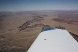
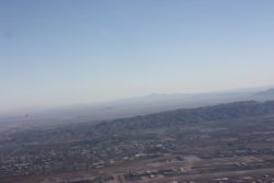
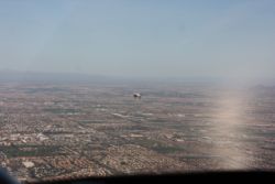
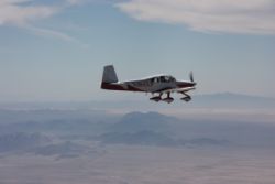
Once again we were headed West, passing into mountainous country. Through the miracles of modern technology, despite being in turbulent skies at 10,500', we were able to communicate with Scott and RaNae and find out that they weren't going to be headed out until later in the afternoon, so we may as well enjoy our day a bit. Flying from Lubbock to Phoenix is a pretty easy direct flight of just over 3 hours or so, but, with a slight diversion to the North, we could do something we've never done before....actually stand at the edge of the Grand Canyon! Yes, we've flown over it 3 times now, but I've never actually stood at the rim and looked down into it. So everyone got pretty excited about that stop, and we aimed the plane at KGCN, Grand Canyon airport. |
|||
 |
 |
 |
 |
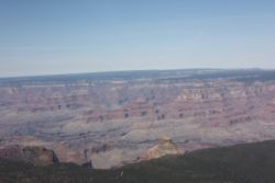
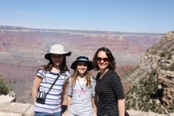
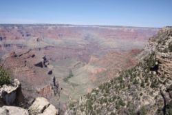
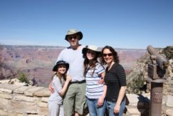
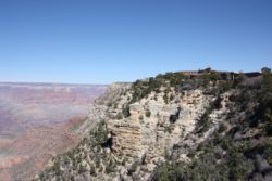
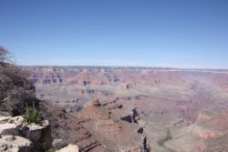
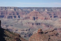
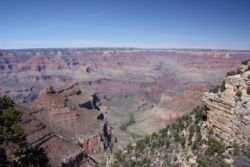
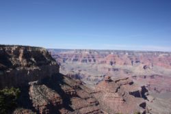
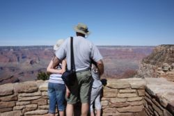
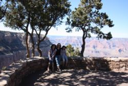
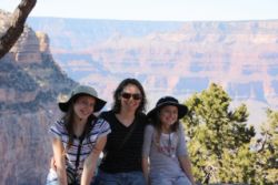
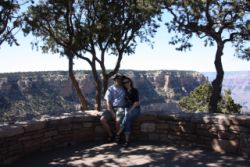
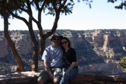
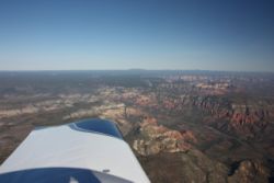
Grand Canyon Airport turned out to be an awesome stop. For a little cash, you can grab a taxi into town. It's a nice airport, but don't plan to buy fuel there at the super high price they charge. The taxi will take you right to a restaurant and all the tourist stuff in that general area, and then bring you back again. It's a quick ride and we were having a great lunch, and then out walking around the canyon edge enjoying the day. The Grand Canyon is one of the more beautiful things I've seen, with so many different colors, and variety of terrain. |
|||
 |
 |
 |
 |
 |
 |
 |
 |
 |
 |
||
New toys for the trip
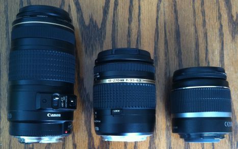
Before this trip, I had been interested in buying a new camera lens. I like taking aerial photos in formation with friends of mine, and I like taking pictures on trips in general. The problem is, I bought the 18-55mm standard lens with my Canon EOS Rebel XTi when I got the camera. The lens is Image Stabilized and works well. Later, I bought a nice but pricey Canon 70-300mm lens for zoom, which was also an Image Stabilized lens, so it was also very nice. The problem with them is, especially when doing aerial photos, I was constantly having to switch between lenses because the standard lens didn't zoom far enough, and the zoom lens didn't do a good enough job when things got too close for it's range. Even when shooting photos of things like band concerts, I was constantly switching lenses.
Well, if I had only known then what I found now, I'd have never bought EITHER of those 2 lenses!
I went to my favorite photo equipment seller, BH Photo, and called them about getting a more capable lens. They suggested one made by Tamron. The Tamron AF18-270mm f/3.5-6.3 Di II VC PZD AF Lens. It's a brand new lens, and they do have older models that aren't quite as nice...make sure you look for the B0008 lens.... B&H p/n is TA18270CAF, and the Tamron p/n is AFB008C700. This lens is very sweet!
As you can see from the photo below, it's not a huge amount longer (when retracted) than my 18-55, but it has nearly the zoom range of both my 18-55 and 70-300 lenses, without the missing range gap in the middle. This lens is 18-270mm, and will work absolutely great as a single lens to bring along on vacations. It also is absolutely perfect for use in the plane for aerial photos. If I'd have bought this lens originally, I'd have saved money and had a much better time. Sadly though, 2 years ago this particular lens version wasn't available, so in a way it's nice that I just happened to get it now. The autofocus was slower on the older versions, among other things.
There is only one down side to the lens. My original lenses were 58mm filter threads on the front, and the new one is 62mm, so my previously purchased Circular Polarizer CPL filters and spare lens caps couldn't be used. The 62mm CPL is a little more money (not much) more than the 58mm, also, but I threw one on the order with it, as in-cockpit photos are just useless without a CPL to cut the glare.
 |
I threw in a few family photos to show the range of the lens. These may not be zoomed to 100% of it's range, but it gives you an idea that you can do an awful lot with it, and it's not digital zoom that will just give you grainy pictures. There are more photos in this write-up that you'll see the same thing, where I took a photo and zoomed in and took it at higher zoom levels, just for example.
 |
 |
 |
 |
 |
 |
Bose A20's
As many RV-10 builders saw, I posted 4 of my 5 Bose X's for sale over the past couple months, and bought the new A20's. After having flown with the Zulu's, I found the Zulu's didn't hold a candle to the Bose X's even, at the particular noise frequency in the RV-10, but then I tried the A20's and was surprised that they were noticibly quieter than the Bose X's even....which shocked me. I liked the larger earcup space on the A20's, so I ordered 4 pairs and sold the X's, and didn't look back. I'd recommend that if you fly with toddlers or little kids you may want to buy the Bose X's, which now that the A20's came out, have taken a price drop on eBay. The X's are capable of clamping together tighter, and they have smaller earcups, so babies and toddlers would do better in the X's. Other than that, the A20's are a notch above for me. If you've flown with the old and find them completely comfortable and quiet, the A20's will just be a step up in both but I can't say it's a huge step up or anything because BOTH Bose sets are approaching the point where you couldn't really get much quieter, nor would you want to, if you want to be aware your engine is running well. The A20's don't leave much engine noise left. It's an actual noticeable difference in quiet, but truthfully the old X's were plenty quiet.
I loved the X's before, so I'm surprised that I even *could* like headsets more, but the A20's are a step up overall. A recent Aviation Consumer article praised the A20's as being the quietest, even quieter than the new Zulu's, although they did like the music quality of the Zulu's better. I think the music on both was awesome, but the Zulu's had far more engine noise make it through...and as Aviation Consumer said, "If we were going flying and both were sitting on the table, I'd take the Bose A20's every time." Basically cost, or the requirement for A2DP Bluetooth is the only reason to choose otherwise.
With any headset purchase, fit and comfort is of utmost importance. The biggest difference for me personally is that the A20 ear cups are a bit larger, so my ears flop in comfortably easier. If you use the X's and find no fit issue at all, then you probably would like either. If you plan to get 4, you could do a mix for front and back seats and you're unlikely to have people complain.
Between the Bose X and Bose A20, you're basically asking someone to choose their favorite model of Mercedes Benz....they're all really nice. Any will make most drivers happy. I like them both....but I like the A20's just a little more.
Positive Improvements with the A20: It's much easier and cheaper to adapt a Lemo plug A20 to standard jacks with an adapter for under $50 or so. On the Bose X's, you have to buy a whole new cord and controller....so if that interests you, I'd go A20. The other difference is that the Bose A20 offers 3.5mm jack input for music and bluetooth for cellphone...but most people will do music input on their audio panel.
The biggest downside to the A20 is that my X's I could leave powered on all the time and they'd stay on. The A20's I have to hit the power button to turn on every flight.
Bluetooth Audio Entertainment System
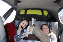
Although not something I bought for this trip, this is the first trip that I've been able to go on where the kids got to try out the Bluetooth Audio Entertainment System (follow that link for a write-up) for an extended period of time. Both kids thought it was kind of cheesy that this year for Christmas they got almost nothing, but that we got the new headsets and did all the work to wire in the music system. All that "Dad is a geek" stuff went away though once they got a long flight under them. They were so very happy not to be bothered by the other kid's music, or game sounds, and they LOVED being able to listen to their music via bluetooth, or watch movies without any wires. It was very handy for them, and after the trip, they admitted that indeed, it was a pretty cool Christmas present and they didn't realize how much they'd like it. Touche'!
iPad 2 (3G) and Verizon iPhone 4
We had such a great time with our original iPad, using it with Foreflight, and WingX starting last fall, and using it for videos for the kids in the plane. Interesting it was, that the day the iPad 2 came out, I was in line at Best Buy, waiting my turn for the iPad 2, but more interesting was the fact that a huge percentage of people in the line with me were also iPad 1 owners. Apparently, those who touch them, fall in love, and want to share them with their families.
(Click image for more photos and future write-up)
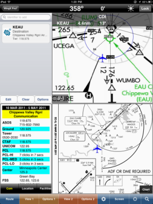
Well, this was the first trip I've taken where I got to use WingX Pro 7, release 5, in the cockpit and on flights in IMC. At the time of writing this trip write-up, I haven't yet had time to do my WingX write-up, but I'll just tell you now that Hilton Software did a spectacular job with Wing X, and on this trip we got to use it a lot. Foreflight HD Pro is also very good...I purchased the Pro ugrade, which gives Geo-Referenced approach charts, in February, just so I could compare the 2. What I found was basically EXACTLY what a recent 'IFR Magazine' article found....WingX is about the best thing you can use on iPad in cockpit, Foreflight is the absolute best preflight, flight planning, and weather tool you can use before you fly, and Skycharts Pro is a much less feature-filled option for those who just want cheap charts or more basic functionality. When we flew into Lubbock Intl at night, we used the WingX georeferenced taxi diagrams to easily see the right taxi turnoff well before we got there. Later you'll see that this trip concluded with an IMC approach, and we used WingX in flight for the approach plate. It's simply fantastic software. There was only ONE thing I found where in-flight I prefer Foreflight....on WingX's current version, if you zoom in on a Sectional, you get the sectional, even over big class B airspace like Phoenix. On Foreflight, if you zoom past a certain point, you get a TAC chart. This proved valuable for us overflying Phoenix, as there's a VFR corridor over Phoenix that can save time and fuel, but it helps, or is really necessary, to have a TAC chart that shows the corridor. Foreflight did that, WingX didn't.
The iPad 2 version we got was the Verizon 3G version, for it's GPS. Recently I dug up some infor for a post online about the chipset differences over the original iPad.
iPad 2 3G teardown proves ties to iPhone 4 design, upgradeshttp://www.electronista.com/articles/11/03/30/ipad.2.3g.torn.down.by.ifixit/
** The EVDO-based 3G version is near identical to the Verizon iPhone 4 and
has the same dual-mode Qualcomm MDM6600 chipset. The MDM6600 is a
GSM/UMTS/HSPA+/EV-DO multi-mode processor.
** The HSPA-based 3G version for AT&T and the world is using an Infineon
337S3833 baseband chip to get online but has upgraded to a newer Broadcom
BCM4751 for the GPS chipset
http://wirelesse2e.wordpress.com/2011/03/15/iphone-cdma-and-ipad-2-no-obvious-path-for-lte/

The GPS in the iPad is part of the 3G chipset. That does not mean it isn't
a true GPS. Assisted GPS means that you have a 'real' GPS that has other
services associated.
http://en.wikipedia.org/wiki/Assisted_GPS

iPhone 5 will be a world-phone using Qualcomm MDM6600. Even though Apple
prefers not to change its proven designs frequently, MDM6600 is simply
superior to legacy Infineon baseband processor and it simplifies GPS
implementation.

So you're likely to be better off with GPS in any 3G version of iPad 2,
than you are with iPad 1, or with iPhones prior to iPhone 4.   The MDM6600
chipset may be why the Verizon ones are really pretty good with the GPS
acquisition and accuracy.  And I'm sure that Apple wouldn't have moved to
the Broadcom BCM4751 for the AT&T version unless it provided something
better too.
On this trip, over 4100nm, we found that the GPS in our Verizon 3G iPad worked very very well, and we used it in many various situations and it didn't let us down once. The iPad 2's faster processor was also really zippy, so the iPad 1 is now relegated to the kids for watching movies, playing games, drawing, typing, email, and everything else they want, but the iPad 2 is for the pilots.
We also had a great trip with our iPhone 4's. In fact, between the iPad and iPhone, my butt was saved on this trip a couple times. Once, a technical problem at work came up, and since this trip was one of the very very few that I actually left my laptop at home, I was able to use the VPN and my iphone and ipad to connect to systems at work and clean up some pretty big technical problems. Without the iPad along, they would have had some extended downtime trying to fixa problem, and I work in hospital I.T. so I don't like the consequences of systems with problems. At another point, I was unable to get the FBO phone in Mexico to dial U.S. Flight Service to file a flight plan...not wanting to get shot down as I crossed the ADIZ, I fired up my VPN on my phone and connected to work, where I have "iSip", and "Cisco Mobile 8", 2 VOIP apps (I also have Skype), and I was able to use my desk phone number back in Wisconsin to dial from work, to flight service, and file my plan via the FBO's wifi. Truly amazing how you can improvise like that. When we were in the Bahamas, before I had an iPhone, another guy with one was able to use it to Skype call his family back in Oregon, over the hotel wifi...and international roaming to use his cellphone would have been a mighty heft bill. So these smart phones and devices can be awesome travel companions. When driving rental cars in the U.S., I use Navigon for road navigation, so the uses are endless!
Prop Lock
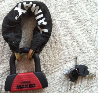
I did this Prop Lock Write-Up a couple weeks ago. Going to Mexico, I wanted to lock the prop on the plane, so I chopped up a normal prop lock and made it lighter for travel. I used a piece cut from my old tire inner tube to protect the prop, and it ended up working great while in Mexico.
So enough about the gadgets!!
I don't get paid for those reviews, just to set the record straight...but I run into many pilots who find that stuff intriguing, so I try to pass it on when able.
...Back to the story
So one of the very cool things about planning the stop at KGCN, Grand Canyon, is that for Scott, KGCN is nearly directly under his flight path to KCHD, Chandler airport in Phoenix, so it would be an ideal place to meet up and fly together to Phoenix. Additonally, we'd be flying right past beautiful Sedona on the way!
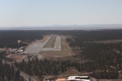
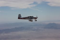
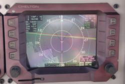
It worked out better than I could have thought. Scott texted me his ETA to overfly KGCN, and when I knew the ETA, we timed it right to get a cab to the airport, load up, and take off, with a goal of climbing to 10,500' just in time to meet him as he overflew. It worked nearly perfectly, as I was climbing out and switched off KGCN tower, Scott had heard me taking off, and I hit 10,500' with him about 4 miles in trail...and since I have NavWorx ADS-B on my Chelton's, I saw his target and told him I was in front of him, and I turned back into his flight path so he'd see my wings and I could circle around and get behind him. It worked like clockwork and soon we were sailing towards Phoenix for the night.
I'll repeat something I said above in the WingX info...
"There was only ONE thing I found where in-flight I prefer Foreflight....on WingX's current version, if you zoom in on a Sectional, you get the sectional, even over big class B airspace like Phoenix. On Foreflight, if you zoom past a certain point, you get a TAC chart. This proved valuable for us overflying Phoenix, as there's a VFR corridor over Phoenix that can save time and fuel, but it helps, or is really necessary, to have a TAC chart that shows the corridor. Foreflight did that, WingX didn't."
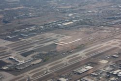
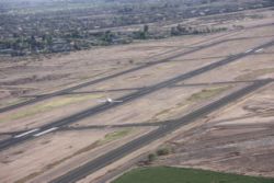
See below, we flew the VFR corridor directly over Phoenix Intl, at 4500'....one side of the corridor takes you directly over one end of the East/West runways, and one takes you directly over the other end of the East/West runways....and it really was nice using Foreflight to keep us on the corridor.
We arrived at KCHD, got our car, drove around a little while finding a good hotel rate, and then we enjoyed some dinner at the "spaghetti factory" restaurant.....really good stuff!
 |
 |
 |
 |
 |
 |
 |
Heading to Mexico!
The next day we were up with our iPads, using them for looking up our customs decal numbers and using the info to file our eAPIS stuff for US customs before we flew over the border. It didn't take long and we had our passenger manifests transmitted, accepted, confirmations emailed back to our iPads, and we also saved screenshots of our confirmation, to prove we had filed our eAPIS.
 |
 |
 |
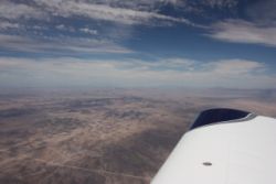 |
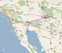
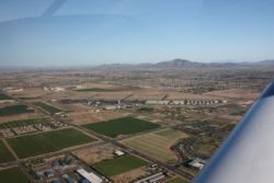
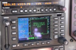
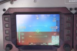
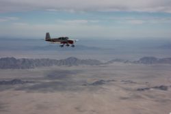
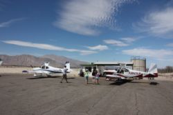
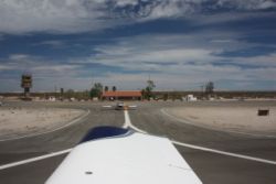
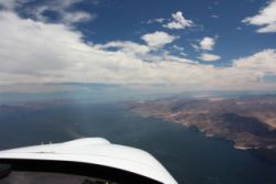
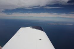
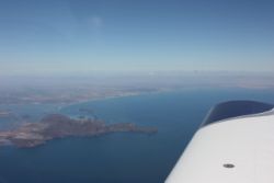
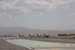
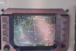
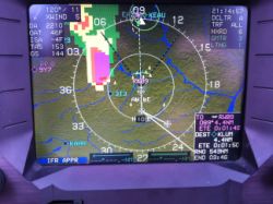
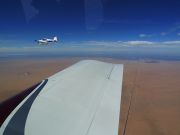
You can actually see the border in front of Scott's plane...it's a big line across the desert and it shows up on my Chelton screen too. We headed to Yuma from Phoenix, and as we got closer to Yuma, ATC cleared us direct to San Filipe, Mexico, (MMSF) straight through a restricted area, to save us some time. It was spooky to fly across a known restricted area that was indeed hot at the time, but we had permission. |
|||
 |
 |
 |
 |
 |
 |
 |
 |
 |
 |
 |
 |
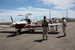
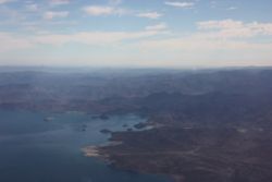
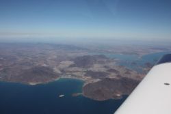
It wasn't long and we were over the sea, in the Gulf of California, or Sea of Cortez, whatever you want to call it, approaching San Filipe. We were greeted by a friendly voice on the tower, who had us reporting positions and set us up for landing, but never cleared us to land. When I radioed to ask if I was cleared to land, he explained "Well I said there was no other reported traffic"....so no, not nearly as stringent as landing at a towered airport in the U.S. Mexican ATC also apparently doesn't truly understand what "A flight of 2 RV-10's" means, because nearly every controller we encountered was surprised that 2 airplanes showed up when only one had a flight plan...despite everything we filed indicating we were a flight of 2, and we stated that on every radio communication. When we landed we were met by friendly yet machine-gun toting men on the tarmac as well. They loo. We got fueled up, and went inside. One thing about Mexican customs that is FAR different than Bahamas customs that I experienced is that Mexican customs is all about providing you everything they can, and charging you for it. You get bounced back and forth about 6 times in Mexican customs, paying fees to each of 3 or so various places for various things. They know that if they provide you something, they can charge you for it, so they diligently type away typing out flight plans, entering your information, and doing all sorts of paperwork to make it all look official and worthy of being paid. It's quite comical, but it's Mexico. You are also required to be on a flight plan any time you fly in Mexico, and THEY type your flight plan for you at the dispatch office. It took maybe an hour for every last thing to be done. Bahamian customs is very quick, costs something like $10 on the way in, and once you're in, you get a cruising permit that allows you to fly and land at any airport in the bahamas, and you don't pay any landing fees in any area I've been, and no tiedown fees either. They even have a $300 fuel credit for flying your own plane, in 2011, up from $200 the past 2 years...so the Bahamas is very welcoming of pilots and desperately wants you to come there and visit. |
|||
 |
 |
 |
 |
 |
 |
 |
 |
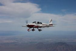
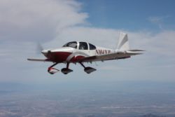
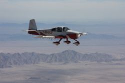
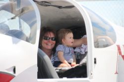
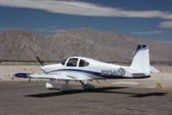
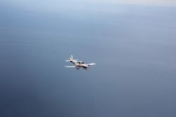
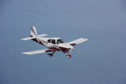
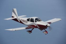
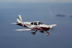
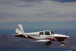
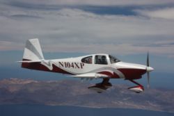
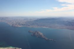
After clearing customs and topping off, we hit the skies once again for our trip down the Baja peninsula...getting lots of good photos of Scott's plane, and his beautiful daughter in the window, all with that nice zoom lens. |
|||
 |
 |
 |
 |
 |
 |
 |
 |
 |
 |
 |
 |
 |
 |
 |
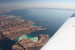 |
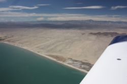
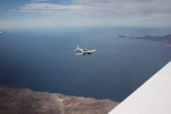
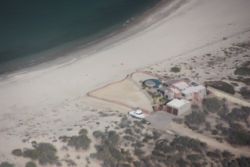
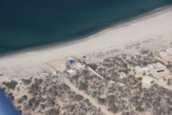
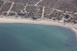
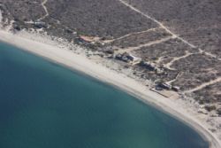
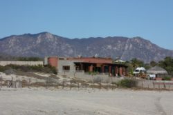
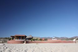
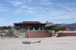
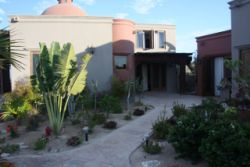
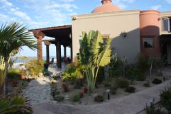
Thanks to Scott pointing it out on Google Earth, we were easily able to find the house that they rented, and do a circle around it on the way down. It was right on the beach, with a red concrete wave wall around it. |
|||
 |
 |
 |
 |
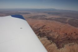
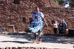
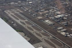
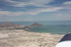
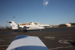
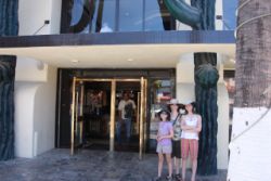
As we approached San Jose Del Cabo airport, near Cabo San Lucas, we were handed off from LaPaz approach to San Jose Approach and then San Jose tower. Interestingly, the tower zone is 10nm rather than 5nm as in the U.S. We tried contacting the tower and got no reply. Continuing inbound we attempted to contact them again. Then it started to turn crazy....we switched back to our prior approach controller, and he said he'd check in with them and get back to us. He then told us to call them again. Nope, no answer again. So we called him back and once again he said he'd check. He tells us they have us on radar, and we can call them again. No answer a second time, for a while. In the meantime, we were very near their 10nm ring, and had to start turning around it so we wouldn't penetrate their airspace. I was beginning to think it was siesta time in the tower, just like it would be at Reagan National in the U.S. apparently. HA! There was a Frontier airlines flight inbound right behind us, but finally after getting a hold of the tower, we were cleared to continue inbound and land, and within a minute or two the Frontier jet landed behind us. Taxiing to parking, we passed a cool Piaggio Avanti...something you don't get to see that often...but we saw another I think in Tucson on the way home. Pretty cool! The arrival was fine...we got to National rental car, got our cars, and soon were headed North for about an hour and a half to get to the house. Mexican road speeds are pretty slow, but some of their roads aren't quite up to what we're used to here. Interestingly, in the first hour of driving, I'd bet we passed 50 roadside grave markers....those crosses, or in some cases pretty good sized monuments, indicating automobile accidents....so it's probably a good thing their speeds are where they are. In some areas there would be 4 or more of them all on one turn in the road...very interesting. The house was just north of Los Barilles, and as we entered Los Barilles, we stopped and I had some of the finest thin crust pizza of my entire life! I mean, this pizza was inspirational! I asked their secret and they showed me to their kitchen. The oven was a hole in the wall....all brick/concrete/slate lined or something....just a flat floor, and no door on the hole, but inside was a regular small log fire going. Very very interesting and cool indeed! The brick helps dry the moisture out of the crust and gives it those awesome bubbles and crispy cracker crust. It was so awesome I went back later that week and had pizza for supper, and ordered another one for lunch the next day! |
|||
 |
 |
 |
|
 |
 |
 |
 |
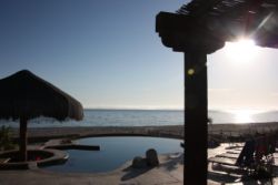
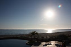
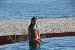
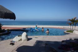
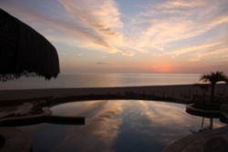
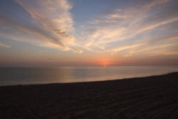
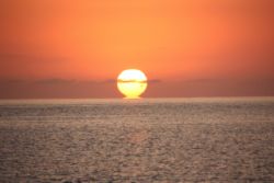
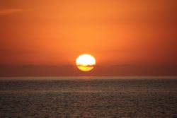
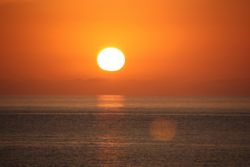
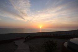
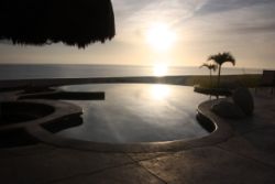
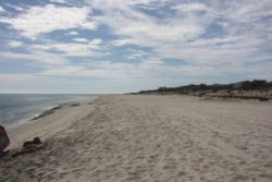
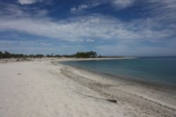
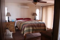
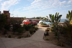
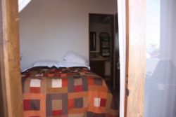
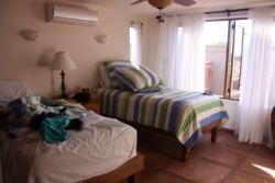
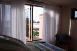
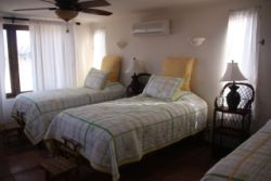
The house they rented was a fantastic and very large house. It was like having a buddy who was a millionaire with a seaside mansion, and they tell you that you can use their beach house for the week. Truly amazing. There were bedrooms in greater quantity than there were people to use them. Each bedroom had it's own bathroom and shower. Every morning we were greeted with a beautiful sunrise over the waters of the East Cape of the Sea of Cortez. Being on the East facing and bay side of the peninsula, the waves never got very large, the winds were never very strong, and the weather was nearly always perfect. The air was dry, and warm, 24 hours a day, never changing very drastically from morning to night. You could get hot standing in the sun, but with the steady sea breeze, you were never sweaty. At night, you could leave the windows and doors open, with no screens, and fall asleep with the sounds of waves on the shore. There were NO flying insects found crawling around the room, and with the dry air, your wet swimsuit would dry out overnight. In short, at this time of year at least, the climate in this particular place, is about 100% ideal! It was amazing that it was like that constantly for us. |
|||
 |
 |
 |
 |
 |
 |
 |
 |
 |
 |
 |
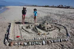 |
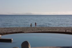
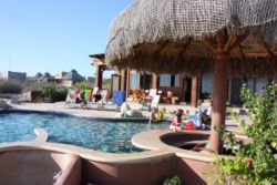
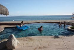
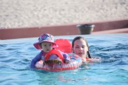
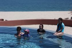
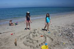
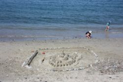
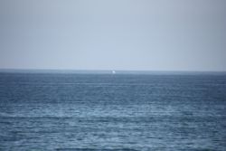
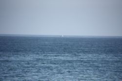
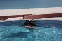
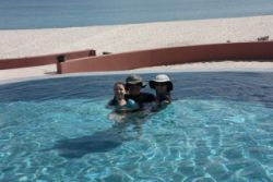
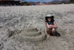
The kids all loved playing together on the beach, nearly every day was a different sand castle...this one even had a full North/South runway! The house had a nice pool too, that provided tons of entertainment. One of the big surprises we had, is visible in the photos below. There is video somewhere of this too, so maybe I can find a better screen shot of it, but nearly every day we had periods where groups of whales would swim by just offshore, jumping and breaching, and showing their tail flukes. It was quite a show to watch them cruise southbound down the coast, on their way migrating back North for the summer. |
|||
 |
 |
 |
 |
 |
 |
 |
 |
 |
 |
 |
 |
 |
 |
 |
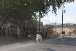 |
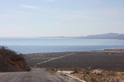
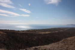
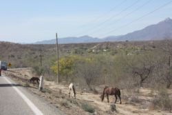
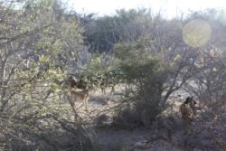
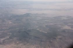
The roads in the area as I said, weren't the best, but in some areas they weren't all that bad. It looks like the roads do wash out quite badly in some areas, with huge potholes showing up and no sign of maintenance. Other areas they'd be fine for a mile or so at a time. There were often bulls, horses, or goats roaming around seemingly freely...the bulls had bells tied to their necks. |
|||
 |
|||
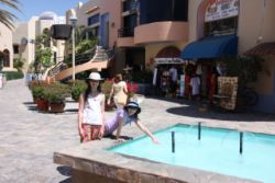
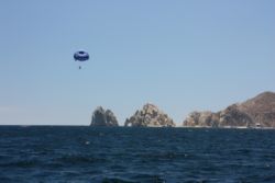
While it was nice relaxing around the house, we're a pretty active family when we travel, so we took a day and headed down to Cabo San Lucas. Here we had a complete 180 degree difference in the type of Mexico we were visiting. Up at the house it was isolated, with few stores, and if you needed something it could be hard to find as there weren't many choices. There was a caretaker that could set you up with Kayaks (we did that one day), fishing charters (some of the people did that a couple days), boat trips, and things like that, but if you wanted to do some of the more vacation'y type activities, you needed to go where the action is, and Cabo is definitely that place! As we drove into town we could see the cruise ships in the harbor, and the scenery turned from a more rustic mountains and sand to lush green gardens and palm trees, all man-planted and cared for of course. There was actually a WalMart where we could buy just about anything we needed, in multiple brands, just like in the US. We had a great lunch at the Hard Rock Cafe in Cabo, and then walked across the street to the tourist info booth.
 |
 |
 |
 |
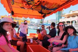
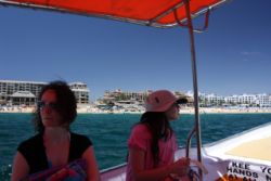
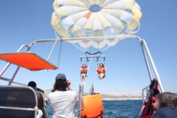
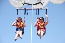
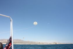
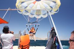
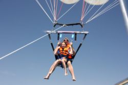
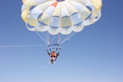
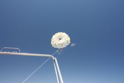
Minutes later we were being whisked away by a man who had us hooked up with one of the nicer local parasailing outfits. We were parked by the marina, and the parasailing tent is over on the public beach a mile or two away, but that gave us more opportunity for adventure. As part of our parasailing fee, they included transportation by water taxi...a boat for maybe a dozen people, where we were taken out of the harbor. Once out by the cruise ships, we jumped from boat-to-boat onto the Parasailing company's transport boat, and then we headed to the beach by their tent where we picked up a few more people. From there we had a quick trip out to meet the parasailing boat. They haul you out there in groups, just in time so that when one group finishes their parasailing, they can board the transport boat and you board the parasail boat, switching loads of passengers out in the sea. It's a pretty cool and efficient operation. |
|||
 |
 |
 |
 |
 |
 |
 |
 |
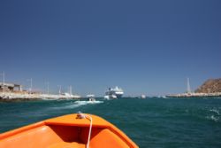
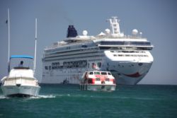
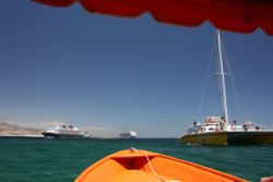
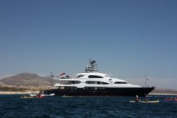
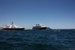
With the transportation around the harbor, we got to see some pretty cool yachts too....this one was particularly stunning, having it's own helicopter on the back deck. I decided that some day if the lottery comes my way, I'll just live on a boat like the one above. :) Parasailing turned out to be the favorite thing about the trip for the kids. They could take up 3 people at a time as long as you were balanced out properly. You are winched up in the air, to a height of about 600ft, and then after a tour of the harbor and the Cabo arch, they cranck you back down to the deck...you don't even have to get wet to go up on the parasail. After parasailing, we caught the water taxi back to the marina and then had frozen yogurt and went shopping in the mexican market where we bargained away for a few small items to take home with us. It was a really nice place to go. Being a family with near teens, I think I'd have to recommend that if you like to do lots of fun things like parasailing, jetskis, kiteboarding, and things of that nature, I'd recommend staying close to the Cabo area. The East Cape is very beautiful, less wavy, and very comfortable and relaxing, but it doesn't have the activity selection that you'd find down in the tourist trap area. |
|||
 |
 |
 |
 |
 |
 |
 |
 |
 |
|||
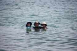
Back at the house we hung out in the ocean, going snorkeling a couple times. From shore we only saw smaller fish, and smaller rocks....nothing too fantastic. But later in the week we were on a boat trip and we gotsome pretty nice reef snorkeling where we saw thousands of fish of various types, pretty angels, parrot fish, puffers, and lots more. We did bring our dive gear but due to a few various circumstances, dive shop availability being a big huge one, we didn't get any tanks and go SCUBA diving. Too bad I hauled down a couple of weight belts worth of lead!
 |
 |
 |
 |
 |
 |
 |
 |
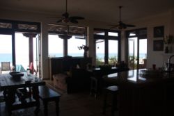
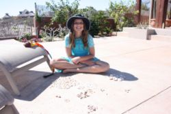
One of the girls seems to get lucky every year.....her Birthday falls right during one of our common vacation times, and this year was no exception. We had to go to town and buy cake mixes and a cake pan, but we managed to throw together a heck of a big round birthday cake and have a little celebration. Below are more pictures of the house and various rooms around it. We didn't take any exceptionally good house pictures, but it was beautiful. I especially loved that we could leave the windows and doors open 24/7. In fact, I didn't mention that although people seem to be getting murdered all over Mexico, and you hear about beheaddings, we didn't have one time where we felt we even needed to lock the doors to the house. The Baja seems to be one of the more safe zones in Mexico in some respects. |
|||
 |
 |
 |
 |
 |
 |
 |
 |
 |
 |
 |
 |
 |
 |
 |
 |
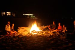
Every day I saw tracks in the sand in the morning as I walked the beach. One night everyone wanted to go to the beach and have a little bonfire. Cool, everyone thought....a beach fire. Well it was, and everyone had fun but they had a little twist when we had a scorpion show up by the fire. I had known that scorpions were in that area, and I knew the tracks were likely scorpion tracks, but they are seldom seen during the day I guess. The one we saw was just like the one in the left picture below. It was pretty cool to see, so we trapped it for a while, but then they convinced me to let it go....in the fire pit. Seems that nobody really liked the idea of walking the beach at night anymore after that. :)
 |
 |
Just a few more pictures with the new lens.
 |
 |
 |
 |
 |
Then suddenly we were at the end of our relaxing week, and it was time to go home. We had been having a very nice week, everything going really well. Despite lots of warnings from people who are too afraid from watching too much US news on violence in Mexico, we had not experienced anything like that in Mexico. We had only interacted with really nice folks, and we were never robbed.....until it was time to leave the airport.
Apparently San Jose Del Cabo doesn't really understand small single-engine aviation, or I can only assume that the folks don't know the difference between an RV-10 and a Citation jet. We dropped off our rental car, and went to start filing our plan and head out. The airport doesn't provide 100LL fuel at that airport, but a 3rd party company does. The fuel guy only accepts American Express, or pesos....and he'll argue with you that he can't take American Dollars for fuel back to the office. I had already spent our pesos though, and don't have an AmEx card, so he was stuck with dollars. I paid him a little extra for the trouble...no problem. Then he told me it was $10 more for "airspace" fees or something. No problem, senior! I was thinking things were going pretty good....then I went inside to start paying my tiedown and parking fees and filing my plans.
Inside, the FBO handed me a bill....TWO bills, actually, that had differing amounts....and they would not explain to me why these nearly identical bills didn't have the same costs on them. The bill was for $3270 pesos! Well, at 10:1, that's $327, for tiedown, parking, and landing fees. One of the more questionable charges was for about 985 pesos that they tried to explain was some tax that I have to pay for what sounded like "multi engine", and when I argued that I'm "single engine" they explained a couple times and it sounded more like "multi-landing". Apparently when you first come into the country you can get a Multi-Landing permit...and if you have that, you don't have to pay this tax at all of the airports you land at. If you don't have the permit, you pay tax every time you travel....and every time you fly you have to file a VFR plan, so they'll charge you at every stop! I was getting hotter and hotter under the collar about these high fees, when they gave me one key bit of information...
They told me that if I landed at Loretto, where I was going to top off on gas to ensure I had plenty of gas to reach the U.S. with no issues, that I would have to pay the taxes and fees again at Loretto. This threw me over the edge with them, and I told them that I was going to pay their bill, and change my flight plan so that I would NOT fly to any more Mexican airports on this trip, and I was going to get the heck out of the country straight to Tucson. I think you could have a blast flying to the smaller airports (none of which have fuel), and not pay any fees, but I'd highly recommend that before you fly to Mexico, you contact the FBO at the airports you plan to fly to, and find out exactly what the fees are for you to fly, land, park, and stay there, including any taxes. There was another airport down in Cabo that would have cost about $150/week for us, and having all of the information worked out in advanced would have at least given a heads-up on the expense. Just plan to bring plenty of pesos for fuel, and if you have an AmEx card you'll be well off.
With our new destination now being DIRECT KTUS (Tucson), we re-filed our plan and hit the skies. This time, in order to save fuel and ensure plenty of reserve fuel, we flew up the coast a ways and then direct over the Sea of Cortez, to mainland Mexico, over Hermosillo and straight North into Tucson.
Maybe 50-75 miles from the border Mexican ATC gave us squak 1200 and let us go, so about 50 miles out we tried to contact U.S. ATC, flying at I think 8,500' or 9,500'. No answer. We continued on, worried that although I had called FSS and filed a flight plan, that Mexican ATC, since they don't have U.S. Fight Plan Data, never activated our plan. This would mean we'd be flying towards the U.S. ADIZ with no active plan, and the "ADCUS" in the remarks (Advise Customs) would never get transmitted. And of course they advise pilots to phone customs an hour or more in advance to make sure they know you're coming. We had none of this.
SPECIAL INTL Flight Plan Info: Despite everything you read telling you that you MUST be on an IFR or DVFR flight plan to cross into the U.S. ADIZ, when I called FSS on my trip down, the FSS Briefer told us that in fact for Mexico and Canada, you do NOT need to be on a DVFR flight plan. IFR or VFR is fine. So, we only filed standard VFR plans. We wanted to file via Foreflight on our iPhones, but DVFR isn't an option. This is because DUATS transmits their plans and DUATS doesn't accept DVFR anymore...but no worry, VFR is fine.
(...continuing along) We kept heading North towards the border, trying 2 different ARTCC frequencies, and 1 FSS frequency, getting no replies, but when we were maybe 10-15nm out, we finally could hear other airplanes talking to ARTCC on one of the channels. I contacted an airliner who relayed my message to the U.S. Controllers that I would like a squawk and permission to enter the U.S. airspace. I could hear him talk to the controller but not hear their part for a while. When I finally did talk to them I was only 2 minutes from hitting the border. They did not give me a squawk but told me I could talk to Tucson Approach as that was their airspace. Nobody seemed to excited that we were flying into the U.S. with no squawk...so I just continued on.
I crossed the border, and finally after a few more miles I was able to talk to Tucson Approach, get a squawk, and I told them I'd really appreciate it if they could contact Customs for me and make sure Customs got notified. I didn't want to break any rules and I wanted to at least have some good ATC tapes that would verify I was trying to do things properly. No matter, soon I was cleared to fly Left Base to runway whatever at KTUS, and they had us expedite so they could put us in front of a citation Jet.
As soon as we landed, we taxiid to Customs, where a man came out with his radiation scanner and gave us a quick look, and then told us to come in. No bags unloaded and no hassles. We were in and out in 5 minutes, but spent a couple extra minutes chit chatting with the guys. Turns out Tucson customs was rated in some review as in the top 10 friendliest customs folks in the U.S. I certainly didn't expect it to be so nice coming in from the Mexican border, but it was. No big hassles, no problems, and we were handled really well.
After that we taxiid over to Premiere Aviation for the lower priced self-serve 100LL on field. The winds on the ground were blowing something like 180@31, and the last 20-30 minutes of our flight were REALLY bumpy, so we topped off and debated what to do next....it was 2 or 2:30pm so we had plenty of daylight to fly further, but the entire SoutWest was covered with high winds and an Airmet for turbulence that affected us, and we had just experienced how bad it would be. To make matters worse, a storm was coming to Tucson in the morning, and the next day was supposed to be real windy, turbulent for the first 1/2 of the trip, IFR for the 2nd half, and stormy by home, getting even WORSE the next day. I really wanted to keep going, but I hate bumps and so does the wife, so we got a car and hotel and stayed the night.
Premiere Aviation took GREAT care of us. We had a car before we were ready for it, from Enterprise, for about $35/day. We had a hotel for $62, that turned out to be maybe 1/2 mile from the FBO! We drove to Olive Garden and had a huge meal of ANYTHING non-mexican, and headed back to the hotel. I would have thought that Tucson Intl would be an expensive and inconvenient place for a small RV-10 to park and stay overnight, but this was a pretty cheap place for a layover!
 |
 |
 |
 |
 |
 |
 |
 |
Heading Home
 |
So far we'd saved a LOT of time getting from Cabo to Tucson by going on a more direct route, and had tailwinds to boot....but today was going to be an experience you rarely get!
Winds aloft were really cranking. The turbulence charts looked awful, along with the pireps and airmets I checked out. I thought for sure we'd never get home, due to conditions we'd hate to fly in. I wasn't sure if I could even make it in at home because there were storms with tornados that were forecast. Spooky stuff. In reality, we took off with an overcast sky, early in the a.m. in Tucson....plenty of visibility, but only 2500' ceilings in the mountains, and it was icing in the clouds, so we went VFR with flight following and stayed low, scooting around a couple mountains trying to head North East towards Albuquerque. I had no idea how far I'd get. We planned a flight to KGBD, Great Bend, Kansas, because their fuel was $3.95 or $3.98, and nothing attracts me more than cheap fuel! It was a long leg though, so I needed to go LOP to make sure it would work well. The further we flew on, we always had tailwinds, and the ceiling kept rising. After a half hour it was more broken, and then thining out to scattered ceilings, but still ice in the clouds. All the airliners were getting rougher rides, asking ATC what altitudes were the most reportedly comfortable. We were doing great zipping along down low, finally getting up to 9,500'.
As we flew on and approached Albuquerque we started to get kicked around pretty good. We were still looking at about a 40kt tailwind though, so I wasn't too motivated to change what we were doing. I decided to try 11,500'. At 11,500' we still had the tailwinds, and the ride improved a little. I asked for 13,500' and the ride improved a bit more, with great tailwinds. But, there was a problem....at 13,500' we couldn't get fully above the scattered clouds and I was only on a VFR plan. I knew that unless I actually TOPPED the clouds, we'd be prone to more bumps, too....so I told them I'm heading to 15,500' and we climbed on up. A fully loaded RV-10 doesn't love the climb at anything over 15,000' or so. I don't think most people will take it over 18,000' anyway, but you won't want to pass 16k if you're heavy. But, at 15,500' we were finally in almost perfectly smooth air, soaring over the ground at speeds up in the mid-230kts!!!! Yes, our tailwinds were averaging in the 60's and even hit the low 70kts range for a while! In fact, I looked at our range and we were actually +/- 10 minutes from being able to make it NON-STOP from Tucson to home (we're maybe 25 minutes East of Minneapolis) !!! Yes, we were doing awesome on fuel, running LOP at 15,500' at around 8gph!!!
 |
 |
 |
 |
 |
 |
 |
 |
As the flight went on, the clouds dispersed and soon we were widely scattered and then clear skies....zipping along with an average of maybe 62-65kts of tailwind! We debated passing KGBD, and heading to airports more North, because there was a small patch of rain showing around Omaha again. The surface winds were lighter up North too, being more in the area of 15kts, whereas KGBD was in an area where it was in the 30's, but eventually the low fuel price got the best of me and we decided to go to KGBD.
I'd have to say, KGBD ended up being a great fuel stop. They have a couple of abandoned runways where dragracing was going on, the winds were in the 30's right down the runway, and they ended up having one of the nicest fuel systems I'd been able to use in a LONG time! In fact, as I write this today, almost a week later, I received in the mail a flyer, and a letter, from KGBD, thanking me for our visit and asking for any feedback on their services. This place TRULY seems to like general aviation, with low fuel prices, a nice airport, and great service.
After a quick turn, I filed IFR to home, via my iPhone running Foreflight...the absolute quickest and simplest way to file, and received my email briefing right away. I filed for 9,000', IFR, and took off and immediately called and got on my plan and got my clearance and squawk. Lickety split! We zipped along with our tailwind still intact, averaging maybe in the 40's again, at 9,000'. We were in basically clear skies all the way into Minnesota, but there was something looming on our screen that wasn't making me so excited.
 |
 |
 |
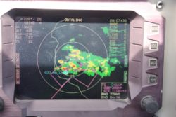 |
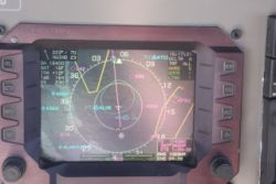
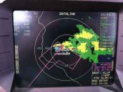
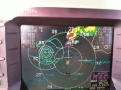
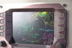
In the 1st and 4th picture above, you can see a zoomed and panned display of our destination airport, KLUM and the weather they were being hammered by. 45,000' tops, with 35+kt winds, and the terror of all terrors...HAIL! Over my years of flying the RV-10 with WSI, I've learned a lot about what types of weather are conducive to a good day of flying, and I knew that this could be good, as long as we didn't have to get in anything with colors. If it's widely greens and yellows, you may have a good smooth flight, but it'll be rainy. Probably smooth. But, if you have very isolated cells, you'll maybe have a bumpy day, or maybe not...but you CANNOT penetrate anything with color at all, if it's widely scattered or isolated. It was in the 70's that day at home, and I knew that anything with color would mean build-ups, bumps, and nothing but bad. Of course, if you can do it without flying into any of the colors, you will probably be fine. It's nice to give thunderstorms 20 miles of distance, but I've often found that depending on the storm, if you're VFR, you can find an easy way by even if you're closer...and the trailing side of the storm isn't always too bad. We continued on, fixated on this storm, hoping to see that all the colored heart of the storm would move North and East and blow past our airport. I had plenty of doubts, but as we got closer and closer, the storm moved little by little...not very quickly, but just enough. Almost into Wisconsin, I queried the controllers twice about what they saw on the Wx display. They said that the intense and extreme stuff was passing the airport. I told them I may shoot an approach at nearby KRGK. They asked if I was going to land there then....I said "No...just an approach to get under it all so I'm not in IMC". I forgot to mention that as I got closer, I was above the tops and had a solid undercast.....and, experience again told me that if it's solid undercast and I'm only at 9,000', it's likely going to be a pretty smooth descent through the clouds. There were no puffies, only smooth solid layers of clouds. I queried them on the cell status and as I was 10 minutes from home, he said it had all moved about 5 miles or so North and East. I decided I'd give the approach a try, knowing that I was coming in from the South, and the approach was flying East for Rwy 9. As I descended into the grey clouds, we watched our path, and in the 2nd picture above you can see that the we could see that the approach path was definitely clear of the cells. Keeping in mind that there's a couple minutes of delay to the satellite weather, I knew that the cell would have moved further, not closer, to the airport. So we continued on, ready to break it off and go to KRGK if there were bumps or any signs of anything negative. As we turned inbound for the approach, there was a solid gap of nothingness between the approach path and the cell, and I knew it would be fine. We were in stable stratus clouds, and as we got lower and lower on the approach, we could even see the occasional thin glimpse of ground passing by. After passing the FAF and beginning our descent, we popped out with maybe 2200-2500' ceilings, and could see the city in front of us. I called airport in site, cancelled IFR, and we had a perfectly smooth approach, and one of those landings where you don't feel the touchdown...only hear the wheels being rolling on the wet runway below. It was warm but overcast and comfortable, and we placed the plane back in it's hangar for a well deserved rest. |
|||
 |
 |
 |
 |
 |
|||
So that ended our adventure...some really great flying. I had 40.8 gallons used at KGBD, and used only 27 or so more gallons including the climb on the remainder of the flight....nearly able to fly direct from Tucson to Minneapolis! It was a great trip, with great friends and folks, and it took us about 4,200nm. It was also our furthest distance from home (maybe not the furthest overall trip flight) that we've ever had N104CD. Surprisingly though, it was only about 50nm further direct to Cabo than it was to MYLS, Long Island, Bahamas. Long Island thought is fairly far down the Bahamas, so many destinations there are a bit closer.
If I get any more good trip pictures, I'll stick them in below...
 |
 |
Site Home | N104CD Home